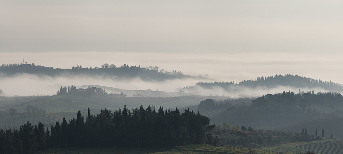
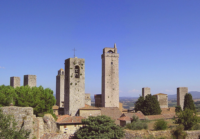
Morning, San Gimignano, Siena [1]
|
|
||||||||||
|
Southern Tuscany is an undiscovered jewel. The territory known as the Montagnola Senese is an area of hills to the west of Siena, and corresponds to the area that borders on the Maremma. The Montagnola, extending in the districts of Siena, Monteriggioni, Sovicille and Casole d'Elsa, is largely covered by forests and has conserved its native beauty.
|
|||||||||
Walking through the rolling hills of the Montagnola Senese | Selection of the best itineraries in the Montagnola Senese [gpx]
|
||||||||||
|
||||||||||
The best paths in the Montagnola Senese
|
||||||||||
Montereggioni |
||||||||||
| From San Gimignano to Monteriggioni - 29,8 km | ||||||||||
|
||||||||||
| This 29.8 km leg begins in San Gimignano and takes in about 7 hours to complete. It is one of the most beautiful legs of the Via Francigena, and after the frst section of the path, you begin to walk up and down in the valley of the Foci river, near Molino d'Aiano. A path leads upward to the Romanesque church of Santa Maria a Coneo. Then you cross the bridge on the hilltop to reach the Romanesque church of San Martino di Strove. Then you go to the Abbey of Island, before catching a sight of Monteriggioni, with its unmistakable ring of walls and towers that dominate the surrounding hills.
|
 Pieve di Santa Maria Assunta in Chianni |
|||||||||
| From Gambassi Terme to San Gimignano - 13,4 km |
||||||||||
A short stage, however an interesting one for the beauty of the landscape along the Via Francigena. Exiting from the centre of Gambassi Termi, one goes towards the Luiano farm, passing through terrain cultivated with vineyards. Once past the farm, we encounter the bridge of the Madonna, on the Torrente dei Casciani which marks the confine between the provinces of Florence and Siena and the entrance to the municipality of San Gimignano. From here the route goes uphill past cultivated fields and beautiful cypresses until reaching Pancole, the site of a Marian sanctuary and a place for refilling water. The route involves going through the underground passage of the large religious structure. Shortly after, one can already glimpse the multi-towered profile of San Gimignano. But before reaching the town we encounter the charming Romanesque parish church of S. Maria a Cellole, completed in 1238, as recorded in an inscription to the side of the portal. From the church, passing the houses of Sferracavalli, one can take a brief detour to visit an Etruscan necropolis with well-preserved hypogeous room tombs that date between the 4th and 1st century BC. There is no rest point along the route.
|
 |
|||||||||
| From Monteriggioni to Siena - 20,5 km |
||||||||||
|
||||||||||
| This 20.5 km leg begins in Monteriggioni and takes in about 6 hours to complete. Leave Monteriggioni and walk along the road in the Sienese hills to the medieval village of Cerbaia. It runs through the woods up to the Castle of Chiocciola and the Castle of Villa, before descending down toward Pian del Lago. Then cross the Renai woods before arriving at Porta Camollia, the traditional Via Francigena entrance to Siena. In the city, walk down Banchi di Sopra and then up to the end of this leg in Piazza del Campo, the Duomo and then the hospital of Santa Maria della Scala.
|
 |
|||||||||
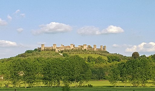
| Monteriggioni circular walk | Trekking nella Montagnola senese tra Monteriggioni e Badia a Isola | Anello Monteriggioni | Monteriggioni - Badia a Isola - Castel Petraia - Monte Maggio (Italian) Mentioned by Dante in his Divine Comedy, Monteriggioni was for a long time the object of a struggle between Florence and Siena, like many other towns in this corner of Tuscany. It was only in 1554 that Florence definitively conquered it. As you approach Monteriggioni you feel like you are travelling back in time. The small town, whose distinctive feature is its elliptical city walls soared by 14 towers, is set atop a hillock. Only two access gates (Porta Romea and Porta San Giovanni) open into the walls, one opposite the other. The town has also a “pieve” (a kind of church) and a small museum with a great masterpieces of Renaissance Florentine painting: the Maria Maddalena by Pollaiolo, realized in the second half of XV century, when he was admitted in the hospital of the town, after getting sick in San Gimignano.
|
 |
|||||||||
| Val di Merse | The Hermitage of Montesiepi |
||||||||||
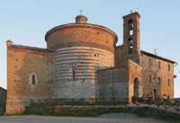
| The abandoned Cistercian Abbey of San Galgano with the Montesiepi hermitage rise in the valley of the river Merse, between the medieval villages of Chiusdino and Monticiano. The site is made up of two major attractions: the Gothic roofless cathedral and the unusually shaped monastery of Montesiepi, and ancient hermitage, which hosts the tomb of San Galgano and the sword in the stone. According to the tradition, in 1180 on Christmas Day San Galgano fixed his sword into the stone in order to realize a cross. Now in Montesiepi's Hermitage a plexiglass shrine with the sword into the stone is still preserved. The Round or Montesiepi’s Hermitage was built right after the death of the saint, over the ancient hut where St. Galgano spent his last year of life. The church is based on a circular plan, only broken off by the little apse. The small chapel is posthumous if compared with the rest of the Round. It was built and badly connected to the Round only in 1340, by will of Vanni of the Salimbeni. The chapel interior is famous for its hemispheric vaulted ceiling in concentric two-tone rings created with brick and travertine and for the sword of San Galgano thrust into a rock. There’s a very nice and reasonably level walk from San Galgano to Monticiano that takes about an hour. During the itinerary you can stop at the sculptures park by Roberto Ciulli in Monticiano.
|
|
|||||||||
 |
||||||||||
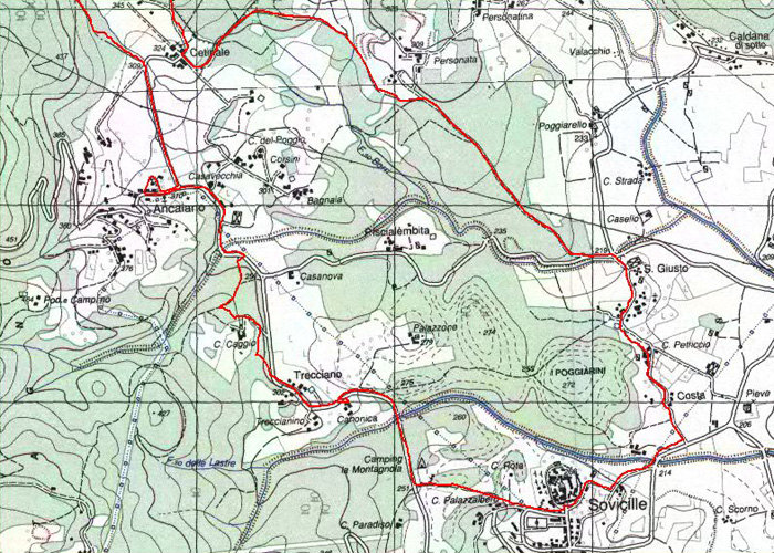
Palazzaccio di Toiano, Sovicille [3]
|
||||||||||
Val di Merse | Sovicille | Itinerarys in the surrounding hills of Sovicille |
||||||||||
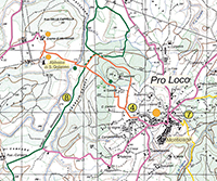
| Sovicille’s territory stretches from La Montagnola Senese to the valley of the river Merse. The historic-artistic heritage of the territory is of extreme importance. It can boast a large presence of abbeys and Romanesque parish churches such as San Giusto a Balli, Pernina, Molli, Ponte allo Spino, Torri with the notable polychromatic cloister in the Santa Mustiola abbey, and San Lorenzo a Sovicille. Villas worth mentioning are the 17th century Cetinale designed by the architect Carlo Fontana; Celsa with its formal garden and the 18th century Villa Linari. Most of the itineraries around Sovicille are covered by the “Carta Turistica” (Turistic Maps) and by the “Sentieri della Montagnola Senese 1:25000” (The Sienese Montagnola Paths) Club Alpino Italiano (CAI: Italian Alpine Club) Sezione di Siena (Multigraphic Edizioni, Firenze). Anello Sovicille | Sovicille – San Giusto – Villa Cetinale – Il romitorio di Cetinale - Pieve di Pernina – Ancaiano – Villa Celsa - 16 km | Details (Italian)
|
|
|||||||||
| The Val d'Elsa | The Val d'Elsa |
|||||||||
Val d'Elsa, borrowing its name from the river Elsa, is located in the heart of Tuscany close to the cities of Siena, San Gimignano and Volterra.
|
||||||||||
 |
||||||||||
Colle Val d'Elsa
|
||||||||||
|
||||||||||
| San Gimignano | The municipality and the entire province of Siena offer an infinite variety of trekking and cycling itineraries. Paths and tracks which, in the case of the San Gimignano area, wind through valleys and hills, woodland and open country. On foot from San Gimignano you can reach Castelvecchio, the village of Lariano and the Romanesque parish church of Cèllole, the sanctuary of the Madonna di Pancole. There are many routes, on foot or by bicycle. Attempting a walk out of San Gimignano can be daunting, but the nearby countryside holds enough sites of interest to make it worth your while. Most trails depart from San Donato (downhill from the San Giovanni Gate) with routes taking you into the Castelvecchio Nature Reserve and the four kilometers to Pieve di Céllole, a pretty Romanesque parish church with a beautiful and quite surprising view back to San Gimignano. |
|||||||||
 |
||||||||||
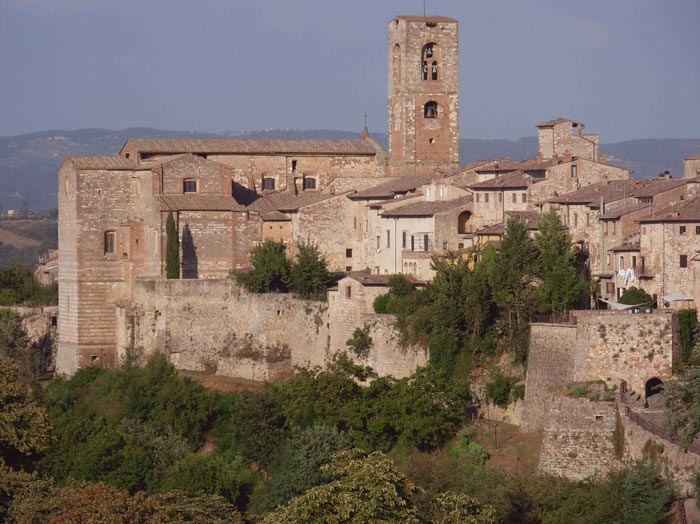
San Gimignano
|
||||||||||
|
|
Album Val d'Elsa | Album San Gimignano | ||||||||
 |
 |
 |
||||||||
| Siena | Monteriggioni
|
San Gimignano, città delle torri | ||||||||
 |
 |
 |
||||||||
Colle Val d'Elsa, Le Caldane
|
Colle Val d'Elsa, Le Caldane | Colle Val d'Elsa, itinerario per la sorgente de Le Caldane | ||||||||
|
||||||||||
|
||||||||||
|
||||||||||
Trekking in the Crete Senesi, stunning landscape between Siena and Asciano |
||||||||||
|
||||||||||
|
||||||||||
 L'eremo di Montesiepi (the Hermitage of Montesiepi)