| |
|
The Via Francigena is a historical itinerary leading to Rome from Canterbury, a major route which in the past was used by thousands of pilgrims on their way to Rome. In mediaeval times it was an important road and pilgrimage route. To pilgrims headed south, it was the Via Romea; to those headed north, the Via Francigena.
The pilgrimage to Rome
The Via Francigena was the major medieval pilgrimage route to Rome from the north; even today pilgrims travel this route, but in far fewer numbers than the Way of St. James (Camino de Santiago). The route was first documented as the "Lombard Way", and was first called the "Frankish Route", the Iter Francorum, in the Itinerarium sancti Willibaldi of 725, recording the travels of Willibald, bishop of Eichstätt in Bavaria. The Via Francigena is first mentioned in the Actum Clusio, a parchment of 876 in the Abbey of San Salvatore al Monte Amiata (Tuscany).[1] At the end of the 10th century Sigeric the Serious, the Archbishop of Canterbury, used the Via Francigena to and from Rome to be consecrated by the Pope;[2] he recorded his route and his stops on the return journey,[3] but nothing in the document suggests that the route was then new. Other itineraries include the Leiðarvísir og borgarskipan of the Icelandic traveller Nikolás Bergsson (in 1154) and the one from Philip Augustus of France (in 1191).[4] Two somewhat differing maps of the route appear in manuscripts of Matthew Paris, Historia Anglorum, from the 13th century.
In 1985 the Italian archaeologist of roads, Giovanni Caselli, retraced the itinerary as described by Archbishop Sigeric. The Welshman Rhodri Mawr in AD 880 and his grandson Howell the Good in 945 are both known to have visited Rome towards the end of their lives, but it is not known whether they went by land or by the dangerous and pirate-infested sea route via Gibraltar. Reports of journeys before Sigeric can only be apocryphal. We may be quite certain that the Benedictine St Thierry, known as William of St Thierry, used the roads towards Rome on several occasions at the end of the 11th century. The return journey by sea was likely to be easier, thanks to the prevailing south-westerly winds, but tacking down to the Mediterranean would have made a very long journey indeed. A statement that a historical figure "died in Rome" may have been a historical falsity, but a metaphorical truth.
The Via Francigena was not a single road, like a Roman road, paved with stone blocks and provided at intervals with a change of horses for official travellers. Rather, it comprised several possible routes that changed over the centuries as trade and pilgrimage developed and waned. Depending on the time of year, political situation, and relative popularity of the shrines of saints along the route, travellers may have used any of three or four crossings of the Alps and the Apennines. The Lombards financed the maintenance and defence of the section of road through their territories as a trading route to the north from Rome, avoiding enemy-held cities such as Florence. Unlike Roman roads, the Via Francigena did not connect cities, but relied more on abbeys.
Today the Via Francigena enters Tuscany at the Cisa Pass in the area called Lunigiana north of Pontremoli and heads south toward Acquapendente in Latium passing through Lucca and Sienna. It is still possible to follow approximately the ancient road and to find refuge in most of the same villages mentioned by Sigeric. The route passes through four distinct geographical areas where the landscape, the building materials and the gastronomic traditions follow their own local traditions, occasionally still reflecting mediaeval influences.
In the third sector, the Francigena and runs from Altopascio, down to Fucecchio, and on to Sienna passing through Castelfiorentino, Certaldo, Poggibonsi, San Gimignano and Monteriggioni before it arrives in Sienna. Near Fucecchio, the road goes through very open and flat land that used to be swamp and which is still the crossing point of the Arno river, and there are rolling hills beginning near Castelfiorentino. All the cities were walled and the mediaeval atmosphere is still evoked by the narrow streets, gates and the buildings made from the local sandstone.
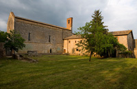
Monteriggioni was originally built by the Republic of Siena for a defensive purpose since the position dominated and watched over the Via Francigena in the direction of Florence, historic rival of Siena. The Via Francigena, ancient road between Rome and Canterbury, was very important during the Middle Ages for merchant and travellers, as well as being the major pilgrimage route. In the stretch between San Gimignano and Siena, the Via Francigena crosses the territory of Monteriggioni, where one of the oldest stopping stations still exists today: the abbey of Abbadia Isola.
Walking in Tuscany | The Via Francigena in the Siena Region
Tuscany | Monterriggioni
|
 |
Siena, Duomo
|
The Via Francigena in provincia di Siena
Although it is difficult to identify a precise route of the Via Francigena, the stretch that crosses the province of Siena is one of the most fascinating sights of artistic and cultural as well as pristine natural areas.
In particular, the stretch of the Val d'Elsa, the town of San Gimignano, Poggibonsi, Monteriggioni and Siena were in communication through the Franchigena Street that runs alongside the hills of Chianti then immersed himself in the Crete Senesi.
|
| 11 |
Monteriggioni - Siena - 20,5 km
|
| |
Departure: Monteriggioni, Piazza Roma
Arrival: Siena, Piazza del Campo
Getting to the starting point: FS Empoli-Siena Line, Castellina Scalo station
|
| |
Descrizione
|
| |
This 20.5 km leg begins in Monteriggioni and takes in about 6 hours to complete. Leave Monteriggioni and walk along the road in the Sienese hills to the medieval village of Cerbaia. It runs through the woods up to the Castle of Chiocciola and the Castle of Villa, before descending down toward Pian del Lago.
Then cross the Renai woods before arriving at Porta Camollia, the traditional Via Francigena entrance to Siena. In the city, walk down Banchi di Sopra and then up to the end of this leg in Piazza del Campo, the Duomo and then the hospital of Santa Maria della Scala. |
| |
|
Map| La Via Francigena | From Monteriggioni to Siena
|
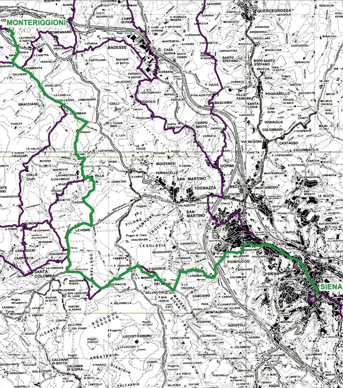 |
Download in pdf the maps 1:10.000 of trail 11 | www.francigena.provincia.siena.it/percorsi/tappa-11
Roadbook | www.viafrancigena.eu.
|
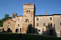
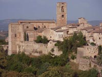
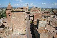
Monteriggioni
|
|
|
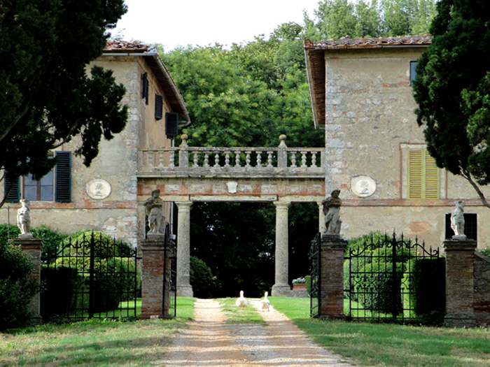
Inhabited since the 8th century B.C, as proven by the settlements discovered at Campassini and the vast Etruscan necropolis of Casone, the communal region of Monteriggioni preserves numerous testimonies of the past. The main points of interest are the Castle of Monteriggioni and the nearby Abbadia Isola, but the entire area is punctuated by castles, parish churches, villas and small villages.
Situated at the northern end of the region, Monteriggioni occupies the peak of a small, rolling hill covered with cultivated slopes, vineyards and olives.
The castle was founded in the second decade of the thirteenth century by the Republic of Siena, with the purpose of creating a defence outpost against its rival Florence. For centuries the settlement carried out the function for which it was created, repelling a multitude of sieges and attacks. Inhabited by soldiers and many civilian families, from the middle of the sixteenth century its military function ceased when the entire Sienese state, to which our village belonged, was annexed to the Florentine state.
Much of the XIII century structure remains which makes Monteriggioni utterly unique in the panorama of medieval Tuscan villages. Its more or less circular walls, which embrace the peak of the hill, are constructed over roughly 570 metres and crowned with fourteen towers that rise up from the external surface. Their majesty must have been so impressive in the Middle Ages that Dante used the turrets as the famous simile for the giants encircling the infernal abyss in his Divine Comedy.
The village sheltered within the walls can be accessed through two gates (a third has been constructed) and centres around a large rectangular square looked over by the parish of S. Maria Assunta. This building is the best example of the preservation of medieval features, even if in the entire area with its characteristic alley ways, there are many houses that exhibit their ancient origin.
|
 |
| |
|
Monteriggioni
|
“[...] Because as on its circular parapets
Monteriggioni crowns itself with towers,
E’en thus the margin which surrounds the well
With one half of their bodies turreted/ The horrible giants [...]”.
Dante,, Inferno, XXXI, 40-44) |
|
|
|
In the heart of Tuscany, in the southwest corner of the Chianti region, Monteriggioni castle was built in the second decade of the thirteenth century by the Republic of Siena. Its original purpose was as a defensive outpost against Siena’s rival, Florence. Home to garrisons of soldiers, but also a large number of civilian families, its military use declined in the middle of the sixteenth century, when the Sienese State, to which the castle belonged, was annexed by Florence.
Today, Monteriggioni still retains most of its thirteenth-century structure, beginning with the circular exterior wall. Completely realised in stone, it supports fourteen rectangular towers jutting into the sky, immortalised by Dante in the Divine Comedy. In the main square, which is reached by two doors (a third has been walled up), sits the church of Santa Maria Assunta. This is certainly the structure that bestretains its medieval character; although, throughout the grounds, down the alleyways, there
are still many houses which display their ancient origins.
The Church of Santa Maria Assunta
The late Romanesque church of Santa Maria Assunta faces the piazza Roma. It was consecrated sometime between the building of the defensive walls (1213) and 1235, when the peace treaty between Siena, Florence, and Poggibonsi was signed here. Santa Maria Assunta's association with pilgrims tracing the Via Francigena route continues to this day. A notice on the door offers lodging assistance to pilgrims. To the left of the church as you face it is the tourist information office, where you can obtain lodging and other information on Monteriggioni.
Ufficio Turistico di Monteriggioni
Piazza Roma, 23
53035 Monteriggioni (Siena-Italy)
tel. +39 0577 304834 / +39 0577 573213
|
|
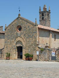 Chiesa di Santa Maria Assunta Chiesa di Santa Maria Assunta
|
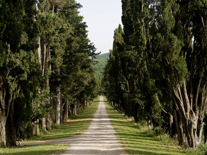 |
Stomennano. The entrance to Stomennano is preceded by a cypress tree-lined drive almost a half kilometer long
|
| |
|
|
|
Stomennano
|
|
|
The tiny village (borgo) of Stomennano was built on ancient Etruscan and Roman ruins that are visible to this day, and it is indeed as a Roman outpost that it first appears in written records dating back to 1059. The name Stomennano may be of Etruscan origin, but it most probably derives from the latin "strumentum" of "pacis" after peace treaties stipulated between the local population and the Romans invasors.
Around 1100 the Sienese made agreements to acquire the control of Strove, Castiglion Ghinibaldi, Stomennano and Staggia, and in 1164 Ubaldino and Ugolino Soarzi gave their lands between Poggibonsi and Siena to Siena itself. This transfer of property included Stomennano and its farmlands then crossed by the Via Francigena, an important road connecting the pilgrims from Paris to the Pope in Rome.
The church on the hilltop of Stomennano - Santa Maria al Poggiolo - is mentioned as early as 1100, and its remains are still visible in the cellars of the villa.
Documentation of this church may also be found in the Vatican Archives that record parish incomes of the region, all elements that make it possbile to establish that Santa Maria al Poggiolo predates th church built inside the castle of Monterggioni.
On the 11th of June 1254 in front of the church of Stomennano a peace treaty was signed between the warring towns of Siena and Florence, which resulted in Siena surendering possession of Montepulciano and Montalcino to Florence. One of the Florentine delegates was Maestro Brunetto Latini, tutor of Dante Alighieri, and when the two visited Stomennano together years later Dante was so struck by the sight of the powerfull towers of Monteriggioni emerging from the mist that he decided to mention them in the "Divine Comedy" in the XIII canto of Hell, describing them as giants emerging from the mud.
In 1555 The Republic of Siena was incorporated into the Granducate of Tuscany, bringing Stomennano and Monteriggioni into the Medici family. Successive ownership of Monteriggioni and Stomennano passed to the nobel family of Golia, then to that of the Accarigi and finally - in 1700 - to the Griccioli family of which the curent owners are direct discendents.
|
|
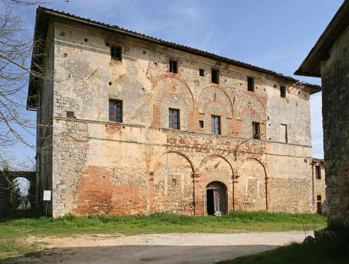
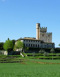
 The villa Stomennano
An arc connecting the two identical buildings of the villa, each with a specific purpose: the first, with its spacious rooms, is the residence, the second contains the wine cellars. |
Ripa
|
|
|
|
|
|
Caminata
|
|
|
|
|
|
Bracciano
|
|
|
|
|
|
Cerbaia
|
|
|
|
|
|
Casa Bucci
|
|
|
|
|
|
Castagnoli
|
|
|
|
|
|
| La Chiocciola |
|
|
The Chiocciola Castle was one of the many medieval fortresses that rose, and in large part still rise, in the district of Monteriggioni, outpost of the Senese power. The castle is famous for the spiral staircase that is located inside the circular tower of the castle, and that takes up to the top of the tower. In italian that type of staicase is called scala a chiocciola.
|
|
 La Chiocciola
|
| Villa |
|
La Villa his is an imposing fort of the medieval era, characterised by a massive rectangular stone tower with curtain walls and crenulated battlements. The building occupies the side of a quadrangular wall, also with its own crenulated walls, inside which are other partly original buildings.
Fungaia
Fungaia, currently under restoration, is a rural habitat with stone houses enriched by brick loggias. The medieval origins of the hamlet, recorded in the 12th century, are made evident by the brickwork elements and the stone arches which appear in some buildings. Slightly to the west of the hamlet stands the church of S. Michele Arcangelo, with a nineteenth century facade and internal layout, mainly of the 17th century. Once again there are elements which testify to the medieval origins of the building, beginning with a Madonna with child which dates back to the mid fourteenth century in a fresco on one of the inside walls. The remnants of the medieval structure can be seen in the right-hand side and the end wall of the building, with a small wall belfry which was probably from the same period.
|
|
Mugnano
|
|
|
|
|
|
Santa Colomba
|
|
|
Santa Colomba has medieval origins but suffered serious damage in 1364 during the passage of the company of Giovanni Acuto (John Hawkwood). Of this period, the church, containing valuable frescos from the 14th century, and a defence tower which was later used as a bell tower for the religious building remain. Other remains of medieval walls can be seen in the base of the grandiose Renaissance villa which stands at the centre of the small hamlet and was built between the end of the 15th and the beginning of the 16th century by the Lord of Siena, Pandolfo Petrucci. Attributed to the Sienese architect Baldassarre Peruzzi, it was originally equipped with a majestic garden which was destroyed to make place for the subsequent extensions to the villa itself.
The local unit of CAI maintains a network of trails departing from Santa Colomba (CAI lO2 to Monteriggioni, Cal l06 to Abbadia lsola, and CA1114 through Tegoia to Molino d'Elsa.
A specific map was produced for the occasion (“Hiking the Montagnola”) and special signposting installed).
Colle Ciupi
The originally medieval village is now a small rural area with recently restored peasant cottages. In its centre the Romanesque church of S. Lorenzo still stands with a single nave and simple architectural lines. The value of the building lies in the cycle of frescos on the interior walls which, for the main part, go back to the fourteenth century and are attributed to the school of Duccio di Buoninsegna.
|
|
Artist in the style of Duccio, Crucifixion
|
San Leonardo al Lago
|
|
|
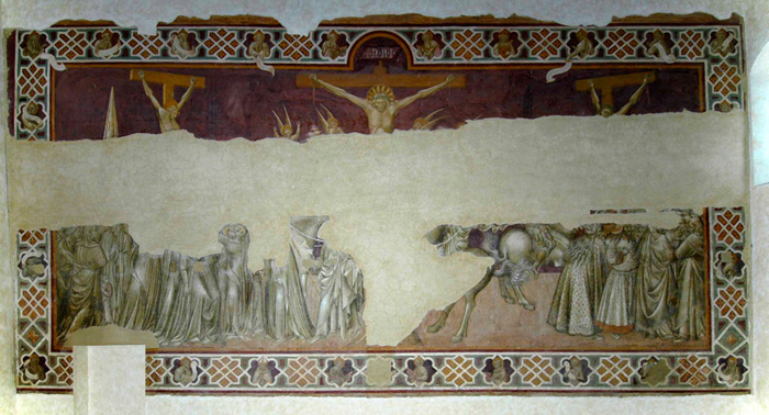
Recorded at the end of the 13th century, the hermitage stands on the margins of what was called, in the medieval period, the lake of Verano. The lake was situated south of Monteriggioni but is no longer in existence. When it became part of the congregation of the Hermit Brothers of St. Augustine in 1243, S. Leonardo it was aggregated to the nearby hermitage of Lecceto a few years later where it remained until 1516. At the start of the fourteenth century, the Blessed Agostino Novello, an important religious figure who had taken up residence during the last years of his life, died here.
A noteworthy element of the architectural complex is the beautiful church with a single nave built entirely in stone, excellently conserving the simplicity of its medieval lines. Inside, the small square apse is decorated by a cycle of 14th century frescos by the Siena born painter Lippo Vanni. To the side of the church, as well as the remains of a defensive wall with turrets, there are cloisters and a part of the monks' dwellings, amongst which should be highlighted the refectory frescoed by Giovanni di Paolo in the 15th century.
The painting, although somewhat damaged by a partition wall built in the room in 1810 after the hermitage was suppressed, is an important milestone in early fifteenth-century Sienese painting. The scene, whose intensity is heightened by the contrast of the monochrome figures against the reddish background, is characterized by a tight, spare painting style distinguished by a strong linear quality and a compositional tension, particularly strong in the expressions on the faces.
Not far from the hermitage of S. Leonardo stands the so-called Pyramid, an obelisk to the memory of the eighteenth century draining of the area below, which is still known today as the Pian del Lago (the Lake Plain). The Pyramid also signals the start of the Grand Duke's canal, a tunnel of around two kilometres long which served to permit the running off of the waters and which is perfectly preserved and still usable today.
Eremo di San Leonardo al Lago
Località Santa Colomba
Orario di apertura:
chiuso il lunedì.
Aperto (gratuitamente) dal
martedì alla domenica
dalle ore 9.30 alle ore 15.30
|
|
Erermo di San Leonardo al Lago

Giovanni di Paolo, Crocifissione
|
Convento Vecchio
|
|
|
The Certosa di Belriguardo or Belriguardo Charterhouse stands high on the hills sur-rounding Siena, some 7 kilometres (4½ miles) from city centre. The site ideally fits into the breath-taking Tuscan landscape, where vines and olive trees joyfully take turns in an array of colours and sceneries sharply marking out this land ideally suited for vine-growing.
The winery, stretching over some 75 (160 acres) hectares, of which only 8 hectares (17 acres) are planted with vineyards.
The charterhouse’s historical building (its construction got under way in 1340 and was completed in 1347) is graced with a double cypress row and stands at the very entrance to the farm on a slope overlooking Siena. The first twelve monks settled in at Bel-riguardo (Italian for “beautiful view”) as early as 1348, as can be ascertained from a papal bull dispatched that year to the Bishop of Siena by Pope Clement the Sixth from his exile in Avignon, France. The recordings in the cellar’s registers instead date back to the beginning of the Sixteenth century and vouch for the existence of a “bangle bower” with a plentiful and much valued production of wine sold on the Sienese market.
|
|
|
La chiesa di Casciano
|
|
|
|
|
|
Santa Petronilla
|
|
|
|
|
|
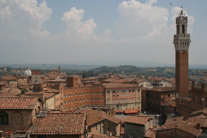
Siena
|
|
|
Although it is difficult to identify a precise route of the Via Francigena, the stretch that crosses the province of Siena is one of the most fascinating sights of artistic and cultural as well as pristine natural areas.
The historic centre of Siena has been declared by UNESCO a World Heritage Site. It is one of the nation's most visited tourist attractions, with over 163,000 international arrivals in 2008. Siena is famous for its cuisine, art, museums, medieval cityscape and the Palio, a horse race held twice a year.
And it is thanks to this important road that Siena flourished in the first centuries of second millennium. Not only the Via Francigena does runs through the province of Siena from north to south; it also penetrates into the town of the Palio, in particular in the districts called Città and San Martino.
The history of Siena has been made on the Piazza del Campo, or better, 'il Campo', as the Sienese call it. Here the Sienese organised their spectacular and terrible 'games', later replaced by the Palio, where they celebrated and played games of risk (il Campo was the only place where the games were allowed). The market also used to take place here. Il Campo has witnessed the passage of memorable characters in the history of Siena: Santa Caterina, the mystic saint deeply linked to the image of Siena, and also artists such as Simone Martini or Jacopo della Quercia.
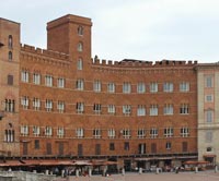
Piazza del Campo is a unique place in the whole of the world, starting with the very particular conformation of the ground, which turns the square into a big concave shell. The paving is made of red bricks arranged in fishbone style, divided into a sunburst pattern by nine strips of travertine (in memory of the Government of the Nine, who ruled over the city from 1292 to 1355). The white marble of the Fonte Gaia stands out on the paving, it is the masterpiece of 1419 by Jacopo della Quercia, later replaced by a copy. There is also the Palazzo Comunale (town hall), unusually built on the lowest part of the square, and also the tall, slender Torre del Mangia that stands out against the sky (it reaches 102 metres including the lightning conductor). At the base of the Palazzo is the Chapel of the Virgin, or Chapel of the Square, constructed and voted for by the Sienese, after the end of the terrible plague of 1348. And surrounding the chapel are the elegant façades of the Palazzi Signorili, belonging to the wealthiest of families: the Sansedoni, the Piccolomini, and the Saracini.
The piazza took shape at the end of the 1200s, on a space that was for a long time used for fairs and markets and was situated at a crossroad of important streets. When it was built (the flooring dates back to the 1300s, it managed to hold the entire population of Siena, who gathered here to attend events, tournaments, and buffalo and bull races. Piazza del Campo has hosted almost all the important events in the history of the city, from the time of the Republic up until the Medici period, during which Siena come under the control of Firenze di Cosimo I de'Medici.[2]
Il Duomo or Cattedrale dell'Assunta is a splendid example of the Italian Gothic.The building, begun in 1230, replaced a previous cathedral of the IX century, entitled Santa Maria. The cupola (or Dome) was added in 1264, but in the 1300s the church was completely transformed: the central nave was raised and illuminated by trifora (three-arched) windows, the façade was worked on by, amongst others, Giovanni Pisano, the chorus was changed, and above all, the transept was widened, in the ambitious attempt to transform the cathedral into the biggest temple of Christianity. Of this last insane widening, begun in the first half of the 1300s and interrupted by the terrible plague of 1348 (as well as by the collapse of some of the structures), there remain traces of the structures effectively built on the left side of the current Duomo: the so-called 'facciatona', the columns of the three naves and a part of the left side, where you can see what is certainly the most brilliant door of the Sienese Gothic. The door opens onto the staircase that leads to the lower Baptistry of San Giovanni.
After the failure of the plan for the New Duomo, work, from then on, concerned the old building. The façade was finished in a gothic style at the end of the 1300s, integrating the part by Giovanni Pisano. The originals of the marble statues (some of which are the work of Pisano), that enrich the façade with depictions of Saints, Prophets, and allegorical Sybils and Animals, are assembled on the ground floor of the Museo dell'Opera.
The dominant theme on the inside of the Cathedral, apart from the wideness of the naves and of the transept (in imitation of the Romanesque Duomo di Pisa), is the colour: the two colour print of the covering, in horizontal strips (the recurring theme of the Sienese 'Balzana') covers the whole of the structure, including the pillars, unifying the richness of the architecture into a homogenous togetherness. The space seems to have been built entirely from colour and light, more than from the solidity of the mass masonry.
The huge masterpiece, not only of Sienese art, on which worked the greatest Sienese artists of the 1400s and 1500s, is the spectacular multi-coloured marble flooring, that covers the whole of the inside of the Duomo like an enormous carpet. Divided into 52 squares, there are depictions of biblical scenes in prevalence, the most famous of which is the Massacre of the Innocents, carried out according to the design by Matteo di Giovanni, in 1482.
Siena | Palazzo Pubblico
Siena | Duomo
|
|
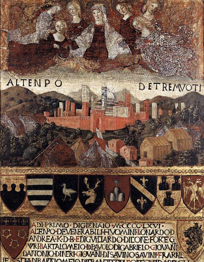
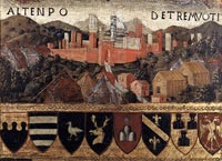 Francesco di Giorgio Martini, Madonna del Terremoto, detail, 1467, Archivo di Stato, Siena Francesco di Giorgio Martini, Madonna del Terremoto, detail, 1467, Archivo di Stato, Siena
 Palazzo Sansedoni on the Piazza del Campo Palazzo Sansedoni on the Piazza del Campo
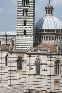
Duomo
|
 |
Siena, Piazza Il Campo
|
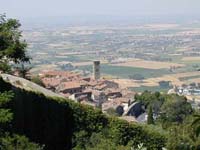
The Via Francigena in the province of Siena
Via Francigena | From Gambassi Terme to San Gimignano
Via Francigena | From San Gimignano to Monteriggioni
Percorsi trekking | Trekking nella Montagnola senese tra Monteriggioni e Badia a Isola | Anello Monteriggioni | Monteriggioni – Badia a Isola – Castel Petraia – Monte Maggio
|
|
|
|
| |
|

Photo Gallery Abbadia a Isola
|
|
|
| |
|
|
|
|
 |
|
 |
|

|
| Abbadia a Isola, Facciata |
|
Abbadia a Isola, tribuna
|
|
Interno della chiesa di Abbadia Isola |
 |
|
|
|
|
c
|
|
|
|
|
| |
Ospedale Santa Maria della Scala
|
 |
Ospedale Santa Maria della Scala
|
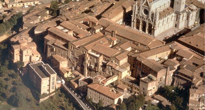
Santa Maria della Scala is a former hospital, now turned into a museum complex, in Siena, Tuscany, Italy. Located next to the city's cathedral, it is one of the most ancient European hospitals.
The hospital was founded by the Cathedral's priests across the Via Francigena to house the pilgrims coming from France and northern Europe to Rome. It also performed charitable work for the poor, including an orphanage for abandoned children. In the 15th century it became under the responsibility of the city's commune, receiving numerous donations from the local wealthiest families. It also received important artistic works: these include a famous fresco cycle (now lost) with Histories of the Virgin, on the façade, by Simone Martini, Ambrogio and Pietro Lorenzetti (1335); the series of frescoes with the Stories of the Hospital in the Pellegrinaio Hall, by Domenico di Bartolo, Lorenzo Vecchietta and Priamo della Quercia; the old sacristy, also decorated by Vecchietta; the Manto Chapel, with a lunette by Domenico Beccafumi; the 15th Fonta Gaia by Jacopo della Quercia; and the decoration of the large apse by Sebastiano Conca (late 18th century).
The nucleus of the hospital is the pre-existing church of Santa Maria Annunziata, dating to the 13th century, and renovated in the current appearance in the late 15th century. It now houses an archaeological museum and other rooms for exhibitions.
Italo Calvino died in the Ospedale Santa Maria della Scala in Siena on September 19th 1985. Santa Maria della Scala served as a hospital from the 10th Century until 1996.
Siena | Santa Maria della Scala
Complesso Museale di Santa Maria della Scala
Piazza Duomo, 2
Orario: tutti i giorni ore 10.30 - 18.30
(chiusura della biglietteria ore 18.00)
|
|

Santa Maria della Scala served as a hospital
from the 10th Century until 1996.
|
|
|
|
|
|
Podere Santa Pia, garden |
|
Podere Santa Pia |
|
Abbadia d’Ombrone and Monastero d’Ombrone near Castelnuovo Berardenga. |

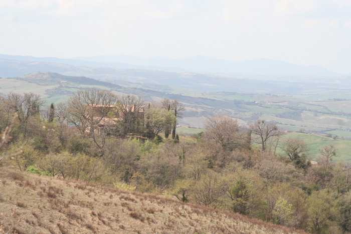
Situated in the midst of the Maremma nature, in the heart of Monte Amiata region, between the provinces of Siena and Grosseto, Podere Santa Pia boasts such an enviable position that it's hard to just figure it out. This is the land where the DOC wines Montecucco and Brunello are produced. The towns of Montalcino, Pienza and Montepulciano are all important provincial capitals in the area and within easy driving distance.
Tuscan holiday houses | Podere Santa Pia, a hidden treasure the heart of the Valle d'Ombrone
|
| |
|
|
|
|
|
|
|
Podere Santa Pia |
|
Podere Santa Pia, garden (April) |
|
Montalcino |
| |
|
|
|
|
|
|
|
|
|
Badia di Sicille, Trequanda
|
|
Colle di Val d'Elsa |
|
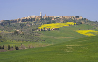
Pienza |
| Siena History |
|
|
Legend says that Siena was founded by Senio and Ascanio, sons of Remus, of the famous duo Romulus and Remus who founded Rome. Statues of the wolf feeding the twins are spotted throughout Siena, but without historical foundation! Instead, the Romans established a military outpost in 30AD called Siena, and it developed into a busy little trading post in the following years.
The Lombards arrived in 6th century AD, and the Franks also had an input in the governing of the city. Great works were carried out, the most important being the Via Francigena, the road which linked Rome to France, used by pilgrims and travellers; this greatly increased Siena's importance. During this time the Church was actively involved in governing the city, especially between the 9th and 11th centuries, after which the Sienese people claimed their right to govern and administer the city.
Economic and military power grew enormously and inevitably friction grew between Siena and Florence, as both cities tried to enlarge their territory. There were many battles between the two cities between the 13th and 15th centuries, some won by Siena, but eventually Florence had the upper hand and Siena was incorporated into Florentine territory and administration.
Despite both external disputes with neighbours and internal disputes over government, in the years 1150-1300 great artists were discovered and the city was adorned with beautiful monuments such as the Duomo, the Palazzo Pubblico and the Torre del Mangia. The Council of Nine, a benificient governing body in the mid-13th century, were behind a lot of these improvements, which you can still see today. However a devastating plague hit Siena in 1348, while the citizens were planning the extension of the Duomo, and killed 3/5 of the population, after which the city was slow to recover.
With a diverse group of rulers from the 14th -19th centuries, including Emperor Charles V and Cosimo I de' Medici, Siena grew in economic power, with the famous bank Monte dei Paschi di Siena giving employment and security to the citizens throughout the ages. When Italy formed a republic, Siena became part of the region of Tuscany and prospers today from a combination of finance and tourism, thanks to its beautiful artistic heritage.
The Museo dell'Archivio di Stato, Siena, has the major collection of the di Biccherna covers, and the view of the Torre del Mangia and of Piazza del Mercato is fabulous from this peaceful spot.
The collection is housed just beside the Campo (Archivio), and houses all of the double city's tax, hospital, birth, baptism and death records dating back into the 13th century.
In the 13th century the city started commissioning some of its great artists to paint the covers with themes of important events in the city's history the year of each bound accounting record.
Biccherna is the Italian term used to describe small painted panels, named after the chief financial office of Siena, were initially created as covers for the state ledgers or administrative balance sheets between the 13th and 17th centuries. The biccherne provide a fascinating window into the daily life of an Italian city-state and evolving republic at the dawn of modern economic thinking. These remarkable works of art derive their name, biccherne, from the government agency that originally commissioned them, La Biccherna.
One of the most popular boards is that made by Ambrogio Lorenzetti in 1344 which represents the Buon Governo - Good Government.
Museo delle Biccherne dell’Archivio di Stato di Siena
Via Banchi di Sotto, 52
You can visit the Archivio di Stato and see the Biccherne display Monday through Saturday at 9:30, 10:30 or 11:30 am only. From the Campo, exit on Via Rinaldini (from the San Martino corner, to your left as you face the Torre di Mangia) and turn right on Via di Citta. The first large doorway on you right is no.52, and the entrance to the Archivio di Stato is marked. The offices are on the third floor, accessible by stairs or elevator.
Art in Tuscany
| Sienese Biccherna Covers | Biccherne Senesi
|
|
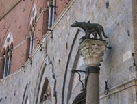
The emblem of Siena: a she-wolf suckling the infants Romulus and Remus.
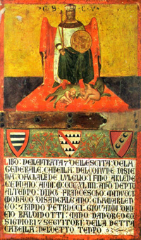
Ambrogio Lorenzetti, biccherne, the Buon Governo - Good Government |
 |
|
|
|
 |
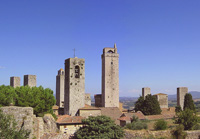
San Gimignano |
|
Cortona |
|
Certaldo |
| |
|
|
|
|
The Palio
|
|
|
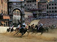
Tra le maggiori manifestazioni che si svolgono a Siena segnaliamo: la corsa del Palio che si disputa il 2 luglio e il 16 agosto di ogni anno e ha sede in Piazza del Campo.
The Palio di Siena (known locally simply as Il Palio) is a horse race that is held twice each year, on July 2 and August 16, in Siena, Italy. Ten horses and riders, bareback and dressed in the appropriate colours, represent ten of the seventeen contrade, or city wards. The Palio held on July 2 is named Palio di Provenzano, in honour of the Madonna of Provenzano, who has a church in Siena. The Palio held on August 16 is named Palio dell'Assunta, in honour of the Assumption of Mary.
A magnificent pageant, the Corteo Storico, precedes the race, which attracts visitors and spectators from around the world.
The race itself, in which the jockeys ride bareback, circles the Piazza del Campo, on which a thick layer of dirt has been laid, three times and usually lasts no more than 90 seconds. It is not uncommon for a few of the jockeys to be thrown off their horses while making the treacherous turns in the piazza, and indeed, it is not unusual to see unmounted horses finishing the race without their jockeys.
Siena | Il Palio
|
|
Il Palio
|
 |
Podere Santa Pia, Aprile |
|
|