| |
|
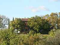
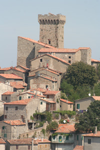
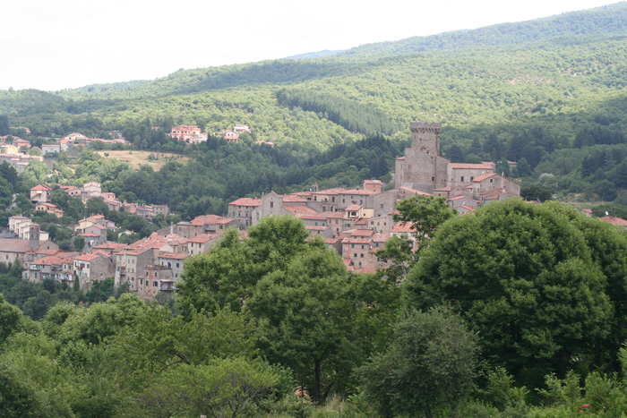
Situated up high, overlooking the beautiful territory below, Arcidosso definitely has an austere and magical atmosphere.
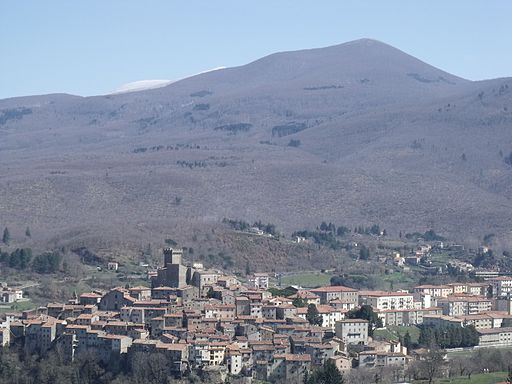
Rising at the feet of Monte Amiata, in the province of Grosseto, the town is famous for the extraordinary beauty of its zone, characteristic for ancient structures and for the great fascination of its panorama and scenery, which offer views of the mountains, the hills and the countryside. Much like all of the Maremma, the origins of this town are very ancient and their streets act like custodians of profoundly magical and exceptional architecture.
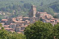
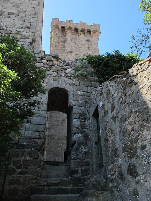
Arcidosso rises at 679 meters above sea level on the western slopes of Monte Amiata between Siena and Grosseto. The historic center of Arcidosso, one of the most striking of Amiata, develops in a long pyramid shape along the plateau dominated by the Aldobrandesca Fortress. Only three gates of the original medieval walls remain, of which two are original – the Porta di Castello and the Porta Talassese towards the sea. From here, going down towards Codaccio, one finds the Porta dell’Orologio, built in 1851 to replace the Porta di Mezzo.
Among the most important monuments to see in Arcidosso we point out here the Chiesa di San Leonardo (Saint Leonard Church), the Chiesa della Madonna dell'Incoronata (Our Lady Crowned Church), the Porta dell'Orologio (Gate of the Watch) and the Rocca Aldobrandesca (Aldobrandeschi's Fortress).
Church of St. Niccoló: the principal building, it is the oldest of the town and was established by the Abbey of St. Salvatore and named after the patron saint of the town. Inside there is a precious wooden crucifix and a stoup.
Church of St. Andrea: a splendid Romanesque construction which is custodian of many splendid frescoes, including “La Vergine in Trono” (The Virgin on the Throne).
Church of St. Leonardo: built in the 12th century, it is home to many stunning frescoes and has some architectonics elements which were added in the 16th century.
|
|
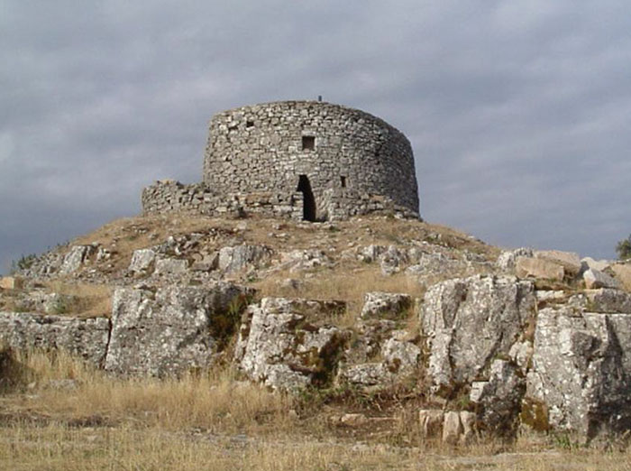
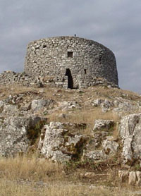
 La Rocca aldobrandesca di Arcidosso La Rocca aldobrandesca di Arcidosso |
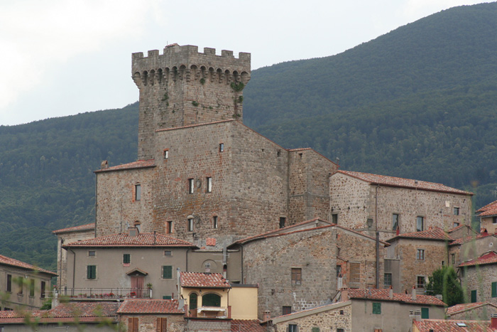 |
Arcidosso, the Aldobrandesca fortress which is an imposing
Medieval complex completed with a crenellated tower
|
Pieve di Santa Maria ad Lamulas (Parish Church of St. Maria ad Lamulas): a medieval structure, built in the countryside which surrounds Arcidosso. Legend implies that the name of the church is derived from a mythical event, suggesting that one of the walls kneeled down to venerate the Madonna and that it left the imprint of its knee.
Chiesa dell’ Incoronata (Church of the Crowned): built in the second half of the 14th century, it commemorates the end of the pestilence and is custodian of some frescoes which depict “La Madonna con il Bambino” (The Madonna with the baby) and “La Gloria della Santissima Trinità”(The Glory of the Sacred Trinity).
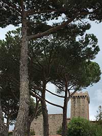
Rocca Aldobrandesca (Aldobrandesca Fortress): a fortress which was constructed in the highest part of the town. Today the building is home to interesting cultural events, shows, conventions and displays.
Fonte del Poggiolo (Fount of the Poggiolo): a splendid fountain made out of marble and resembling a small neo-Gothic temple.
The ancient doors used to access the fortified city: Porta dell’Orologio (Door of the Watch), Porta del Castello (Door of the Castle) and Porta Talassese.
|
|
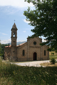
Santa Pieve ad Lamulas, Montelaterone
|
 |
|
 |
|
 |
Arcidosso, panorama
|
|
Arcidosso, panorama
|
|
Rocca Aldobrandesca di Arcidosso |
 |
|
 |
|
 |
Rocca Aldobrandesca, visto da Via Risorgimento
|
|
Vicolo verso Rocca Aldobrandesca
|
|
Rocca Aldobrandesca, vicolo verso Via dei Olmi |

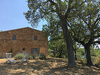
Podere Santa Pia, situated in a breathtaking setting in the south of Tuscany, is an authentic holiday house particularly suitable for a family or group of friends. The Maremma in southern Tuscany incorporates the perfect harmony for man and nature.
Situated in a charming position on the top of a smooth hillside, surrounded by the wilderness of mediterranean woods and shrubland, Podere Santa Pia offers an extensive view of a breathtaking panorama all the way to the sea.
The house, with a habitable area of 300 square meters, has 4 bedrooms and 2 terraces and has a fully equipped kitchen and a big living room. A huge fireplace in the kitchen cheers our autumn visitors.
The main house sleeps 11 plus a child in a small child’s bed.
A generous garden sweeps down the hill with fig, and olive and downy oak trees offering shade from the heat of the summer sun and offers various areas for a dinner al fresco.
Secluded hammocks and picnic places are dotted around the property.
Podere Santa Pia is located 3 km from Castigliocello Bandini, 15 km from Arcidosso, Abazziia San 't Antimo, Montalcino, and 1 hour away from the seaside and close to art cities like Siena, Pienza, Montepulciano and San Quirico d'Orcia.
Holiday homes in the Tuscan Maremma | Holiday home Podere Santa Pia

|
 |
|
|
|
|
| |
|
|
|
|
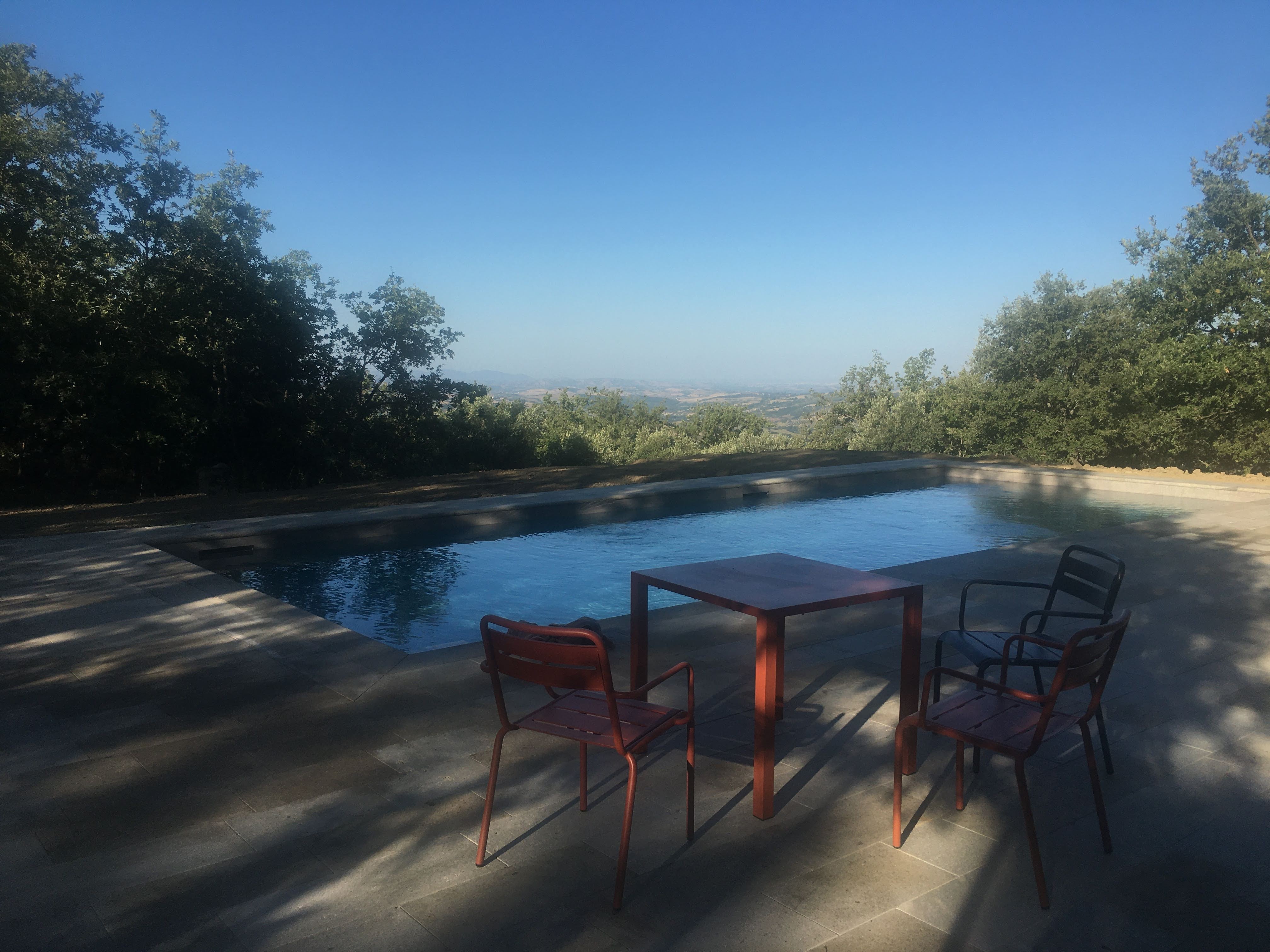
Close to the house is a unique private swimming pool (12 x 5 m). On the spacious terrace around the pool are sun loungers, tables, chairs... This is also an ideal place for outdoor dining, to enjoy an apero or dinner al fresco. And here also, the views are truly stunning.
The pool is open from the first Saturday of May until the last Saturday of October.
The pool is surrounded with spacious sun terraces and shadow spots, which offer our guests boyant relaxation.
|
 |
|
 |
|
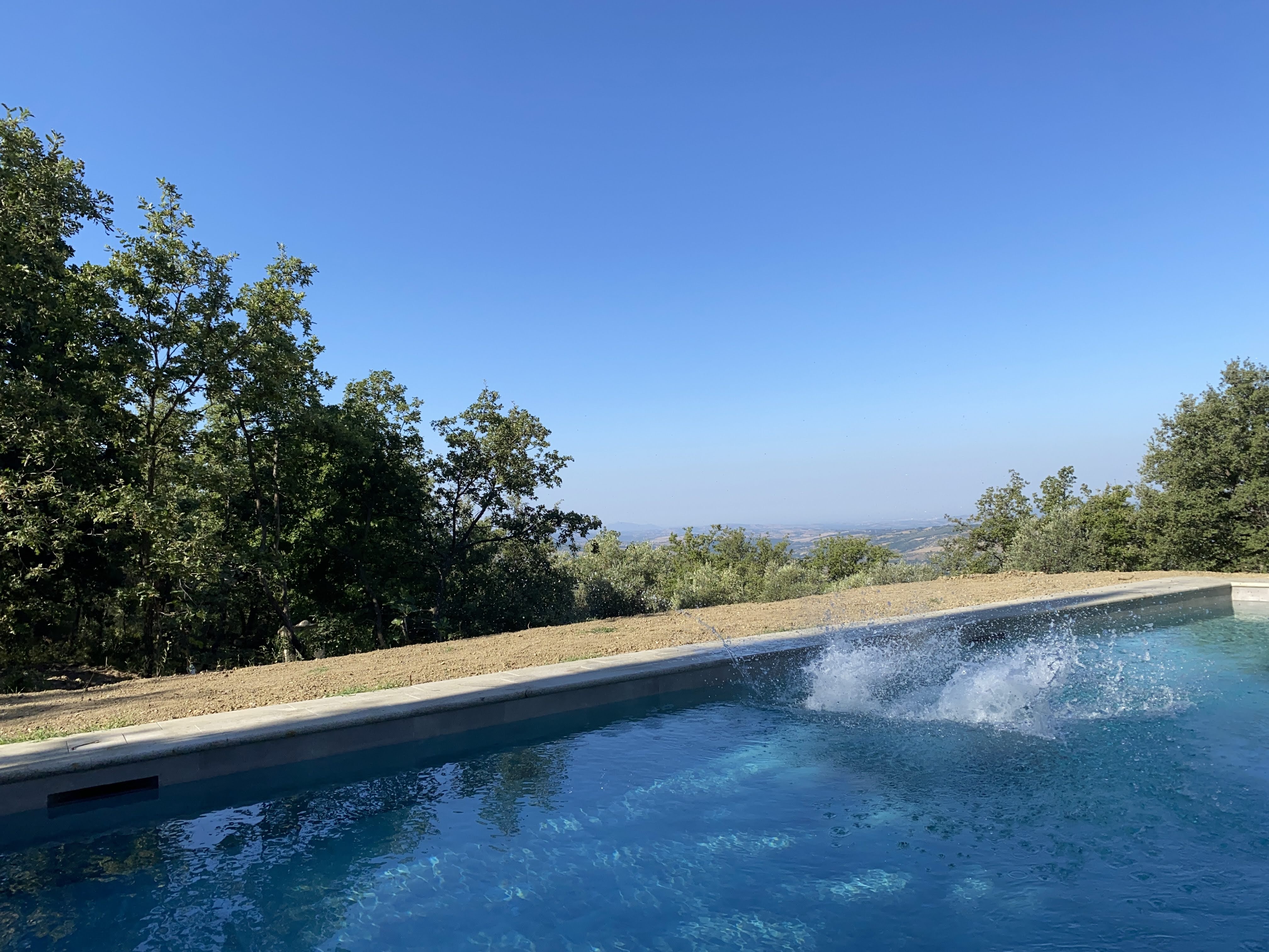 |
Early morning light at the private swimming pool at Podere Santa Pia
|
|
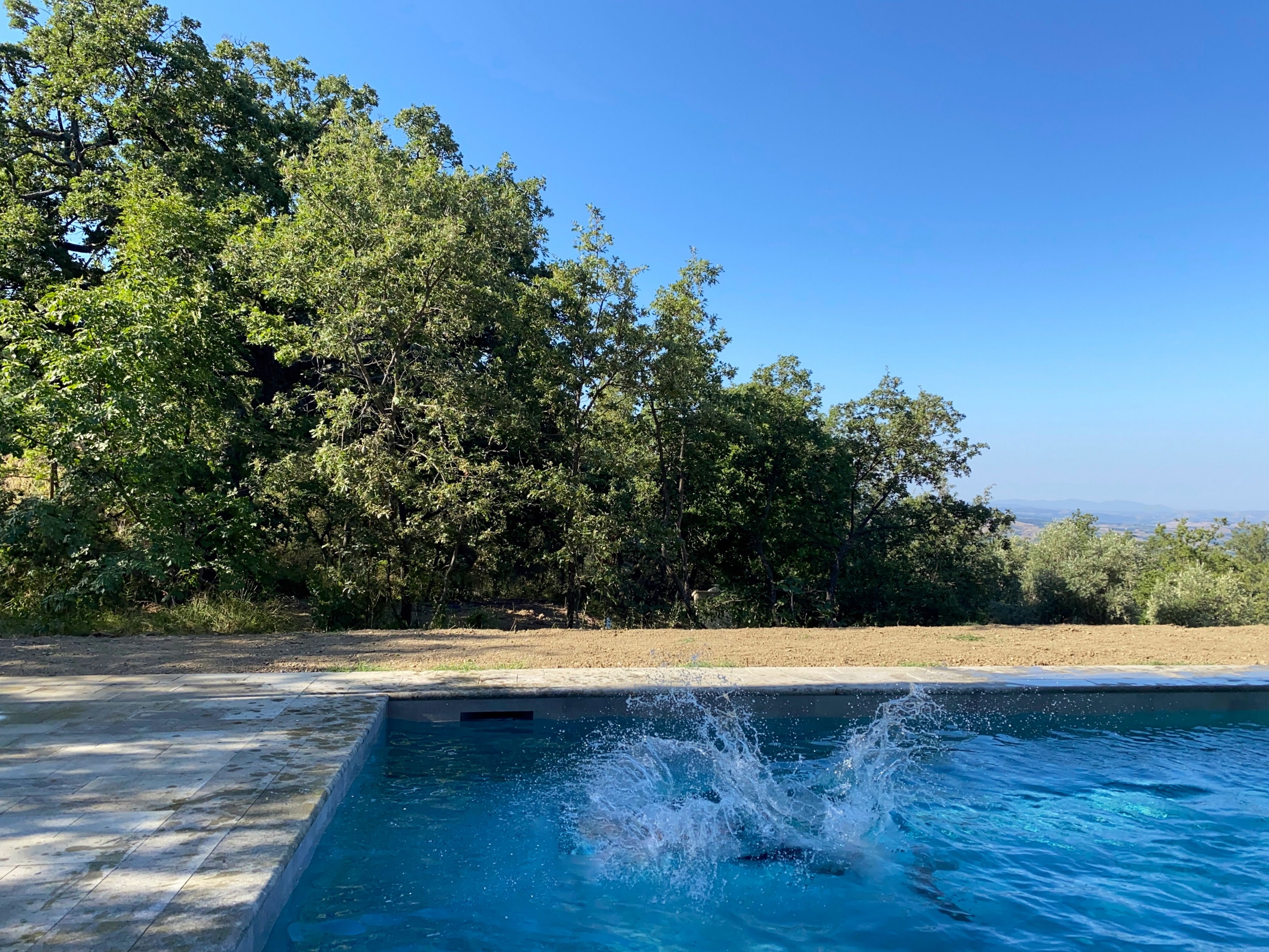
A bigger splash in swimming pool at Podere Santa Pia, southern Tuscany |
|
A bigger splash in the pool, Podere Santa Pia, Castiglioncello Bandini, Cinigiano, Tuscany |
The owners live on the property in a separate unit and can provide you with any kind of information you could ever imagine about Tuscan history, landscape, art, food, wine, or local festivals.
September and October are the months for the Tuscan vendemmia (Italian for grape harvest). It’s a wonderful way to learn a lot about the local wine traditions and also the local culture.
September and October are the months for the Tuscan ‘vendemmia’ (Italian for grape harvest). It’s a wonderful way to learn a lot about the local wine traditions and the local culture. There is a wide selection of events and manifestations dedicated to some of the most traditional products in Tuscany, from olive oil to sangiovese grapes, from chestnuts to mushrooms to truffles.
We are happy to let you stay for the annual 'Festa dell’Uva the first weekend of October, a traditional wine festival held in Cinigiano, when the harvest is finished.
And Montalcino is nearby. If you love Montalcino wine it is a must for your journey and your experience, especially during the harvest period in September and October, the best time to discover and taste Brunello di Montalcino and Montecucco wines. The last weekend of October, Montalcino celebrates the Sagra del Tordo, the “Song Thrush Festival”. Other local festivals include the Festa della castagna in Monticello and La Castagna in Festa Arcidosso.
|
The David Lazzaretti Study Centre
|
|
|
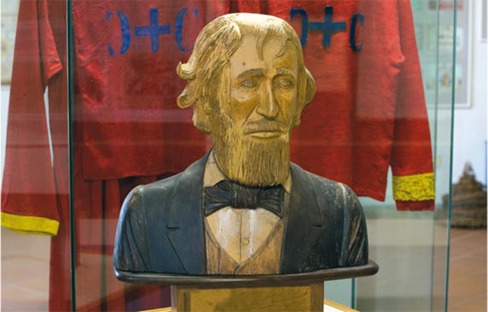 |
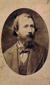
David Lazzaretti
|
The Torre di David (Tower of David) is a stone monument constructed in the wonderful landscape of Monte Labbro. It was built for David Lazzeretti, known as “Il Profeta” (The Prophet) in the second half of the 19th century. Today there also exists a small church which still receives a great number of pilgrims each year.
David Lazzaretti, a mystic and revolutionary and the prophet of Amiata, must be remembered in this story. He sacrificed himself in 1878 for religious reasons, and he was opposed to injustice in the world and the decline of the roman clerical order.
The David Lazzereti Study Centre: inside there are manuscripts, texts and testimonies which tell of the life and the work of the “Prophet”.
The David Lazzaretti Study Centre
Trekking in Tuscany | Arcidosso - Monte Labbro | 10 km | 2 hours | Download gpx
Visitor Centre of the Faunistic Park of Monte Amiata: with numerous exhibitions, panels and descriptions of the Maremman mountain territory, it contains photos and reproductions which describe the morphological characteristics of the area, its geographic position and its evolutionary history. You can also admire and observe the life of the flora and fauna of the park, thanks to the presence of video cameras spread throughout the centre.
Mount Amiata Fauna Park Visitors' Centre
Among the numerous celebrations periodically taking place in Arcidosso we remind here the "Oil Festival of the Amiata mount" held yearly on November in Montelaterone, a district of Arcidosso.
Arcidosso is a convenient shopping area (13 kms from Casa Santa Pia). Here you find everything you need on a daily basis. Post Office, banks, small shops, fresh take-away pasta, fresh fruits and vegetables, butcher, bakery, car repair center, etc. Just before you enter the village, next to the the first roundabout when you come from Castiglioncello Bandini and Monticello Amiata, you have the Coop and Conad supermarkets with again: fresh pasta, shoe store, pizza place, car wash, etc.
Coop Supermarket (Via Donatori Del Sangue, 58031 Arcidosso), and Conad Supermarket (CO.RI.M. SRL, via risorgimento 75).
Then there are the spring festivals: the Pina festival of the Lamulas parish church (the first Sunday after Easter), in the Santa Pieve ad Lamulas. This festival has ancient origins, and is related to the engagement ceremony, in which pine and ivy branches and candies were exchanged.
Visitor Centre of the Faunistic Park of Monte Amiata: with numerous exhibitions, panels and descriptions of the Maremman mountain territory, it contains photos and reproductions which describe the morphological characteristics of the area, its geographic position and its evolutionary history. You can also admire and observe the life of the flora and fauna of the park, thanks to the presence of video cameras spread throughout the centre.
Nature Reserves in Southern Tuscany | Parco Faunistico del Monte Amiata (it)
CENTRO VISITE DEL PARCO FAUNISTICO DEL MONTE AMIATA

Comune Arcidosso
|
|

David Lazzaretti |
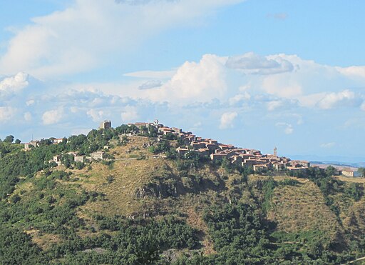
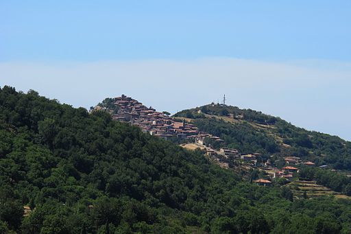
Montelaterone
Also Montelaterone has kept its medieval structure almost intact. It is dominated by the remains of a Sienese castle (1369) in the upper part, has been built on the preexisting fortress, and reveals a solid hexagonal structure. It lies in a strategic position and dominates the valleys of the Lente and Zancona streams and the rich soil produces olive groves, vine-yards and other cultivations. It is amongst the first castles to be documented (1004). The village which can be accessed through Porta senese and Porta di mezzo is covered with portals, inscriptions and coats of arms of incredible value. At the beginnung of the toom there is the church of San Clemente, with ogival portal and sealed round opening and inside there is just one nave with trachytic pavement: inside there are works of art like a seventeenth century Crucifix, a seventeenth century painting of the Sienese school and a Sienese marble tabernacle (XV-XVI century). Outside the walls of Montelaterone, the Chiesa della Madonna della Misericordia houses frescoes by Francesco Nasini (XVII century). Next to the entrance junction there is the chapel of the Schiacciaie, decorated with precious fifteenth century frescoes.
|
 |
|
 |
|
 |
Montelaterone
|
|
Montelaterone, Arcidosso
|
|
Chiesa della Madonna delle Grazie (Madonna della Misericordia), Montelaterone
|
|
|
|
| |
|
 |
|
|
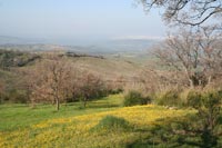
| There are a lot of hiking and mountain-biking trails around Arcidosso. Walking the undulating hilltops overlooking medieval villagers, past vineyards and olive groves to the magnificent open vistas and sun splashed landscapes of southern Tuscany. We recommend the Kompass hiking map Kompass 653 Pienza - Montalcino - Monte Amiata (1:50.000) to accompany the guides that are present in Podere Santa Pia. Also Il portale di Amiata Turismo (it), provides exellent information and good hiking and MBT tracks.
The brochures Amiata without haste... By foot (Itineraries) and Amiata by bike (Itineraries) provide useful information.
Both guides and maps are present in Podere Santa Pia.
We selected the most beautiful gpx trails around Arcidosso and Monte Labbro:
Arcidosso - Monte Labbro | 10 km | 2 hours | Download gpx
Anello Monticello Amiata - Poggio all'Olmo | 7.96 km | 1h 35m | download gpx
Arcidosso - Monte Labbro - Roccalbegna | 17,83 km | 3,5 hours | Download gpx
Anello Arcidosso - Parco Faunistico - Monte Labbro | 15.27 km | 3h 3m | Download gpx
Anello Parco Faunistico - Monte Labbro | 5,68 km | 1h 8m| gpx
Anello Monticello Amiata - Monte Labbro | 30.41 km | round trip | 6h 4m | Download gpx
|
Itineraries Amiata Park
Arcidosso-Anello Amiata Itinerary 10
Starting form the center of Arcidosso, the pedestrian pathway represents a short cut on the way to Casteldelpiano, going towards Case Grappolini and then to the localities of Le Cannucce and the Poggio alla Pescina, from which the Ring of the Amiata is reached.
The pathway climbs from about 600 m to 1200m on a length of almost 5 km. It can be covered on foot in about 2 hours.
The pathway can be entirely ridden on horseback and by mountain bike.
Anello Amiata (Amiata's Ring) (AA, 10 and 11 on the map)
The ring surrounds the mountain essentially along the level curve of the 1200 m altitude and can be reached through many roads coming from Vivo d'Orcia, Seggiano, Casteldelpiano, Arcidosso, Santa Fiora, Piancastagniaio and Abbadia San Salvatore.
Through the pathways it is possible to reach the ring from many different directions: following the pathway number 10, starting form Arcidosso, with the pathway 11 from Vivo D’Orcia, with the pathway number 12 from Santa Fiora, with the pathway number 14 from Piancastagnaio and the pathway 15 from Radicofani.
The road winds up, except for some stretches of asphalt road, in a wide pathway, about 27 km long, which allows the wanderer to reach the ring in about 7 hours and without difficulty.
Starting from Abbadia San Salvatore, which is the nearest village to the Ring, and walking anti-clockwise from the seat of the Mine Museum, one meets the church of the Ermeta, then the Spring of the Acquapassante, the Refuge of Capo Vetra, a central crossroads on the Siena’s slope of the Mount Amiata, the hillock Sasso dei Falchi, the Locality Madonna del Camicione, the hillock Pescina, the Capanna di Mecopapa, the Spring of the Monache, the Podere Cipriana (farm house) and then once again the villas of Abbadia.
The pathway can be walked down on foot, but also on horseback, by bike (mountain bike) and, in winter, it turns into a cross-country ski slope.
The pathway offers the possibility of enjoying enchanting panoramas of the peak and of the valleys of the Orcia, Paglia and Fiora rivers and crosses wonderful beech forests, intermingled with chestnut trees, oaks and pine and fir tree reforestations. In the areas between the chestnut trees and the beech trees there are many native maples, hazels and hawthorns.
The excursionist crosses therefore many different landscapes and can enjoy the majesty of the maples, almost creating a boulevard in locality Poggio Lombardo or he ort she can pass under the magic vaults created by the beech trees in locality Aia dei Venti or enjoy, in winter, the sight of fairy snowed landscapes in locality Madonna del Camicione among the fir tree forests.
|
|
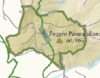
Map The Monte Amiata Loop | Anello Monte Amiata
|
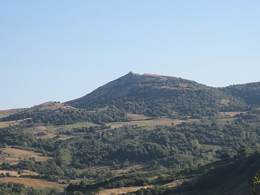
Mount Labbro Nature Reserve
|
|
|
Similarly solitary parishes, churches and natural spots evoke a large number of saints and hermits who lived in Maremma. The tower, hermitage and church on Monte Labro, for instance, evoke the extraordinary life lived by David Lazzaretti, the so-called Mount Amiata’s Prophet.
Mount Labbro, also known as Labro (1,194 m above sea level), rises on the South-Western side of the Mount Amiata massif. Its Nature Reserve spreads over some 600 hectares between torrent Zancona and river Albegna.
The Reserve hosts 193 species of vertebrates including 117 birds, 53 mammals, 13 reptiles and 10 amphibians. Many are threatened with extinction. Among the most interesting species in the park it’s worth mentioning short-toed eagles, lanner falcons, spotted salamanders, yellow-bellied toads, barn owls, noctules, wolfs and badgers.
How to get there: from Arcidosso follow the directions to Roccalbegna and after about 8 km turn right taking the road to Mount Labbro
Opening hours: Open every day (except on Monday) from 07.15 to sunset. The reserve can be visited following the available foot tracks.
The David Lazzaretti Study Centre was established by the Commune of Arcidosso at the beginning of the 1980s and is housedin the Town Hall. The Centre holds objects,manuscripts and testimonies of the"prophet of Amiata"and of the jurisda-vidic movement.
|
|
 Eremo di David Lazzaretti or Torre Giurisdavidica
|

Photo gallery Monte Amiata and Arcidosso
Merigar West
|
|
|
 |
|
 |
|
 |
| Merigar West |
|
|
|
|
 |
|
|
|
 |
Targa sulla casa di Lazzaretti ad Arcidosso
|
|
Bagnore, La casa dove morì Davide Lazzaretti |
|
Monte Labbro |
| |
|
|
Monte Labbro (1193 metres above sea level) is a limestone ridge with little forest vegetation, rising to the
south-east of the Amiata region. The Gar is spread over an area of about fifty hectares and is bordered by Monte Amiata to the Northeast
and Monte Labbro to the Southwest. The walk to the Monte Labbro top is well worth the effort as you enjoy spectacular views
over the valley. The area of the park covers about 200 ha and spreads over the Monte Labbro slopes and is
part of the natural reserve which is dedicated to protecting several animal species.
The Buddhist Temple Merigar which was founded in 1981 as the first centre of the Dzogchen Community in Italy.
Merigar West, the European Gar, is located on the slopes of Monte Amiata. It was founded by Chögyal Namkhai Norbu in 1981 and was the first centre of the Dzogchen Community. Merigar means “place of the fire mountain”. [1]
|
Arcidosso and the Parco Faunistico
Mount Amiata Faunal Park is part of Mount Labbro Nature Reserve. It spreads over some 200 hectares and is dedicated to the study, protection and safeguard of a number of animal species semi-wildly living within large areas. It’s currently a landmark for investigations on environmental issues and also hosts many cultural events on various topics, from botany to contemporary arts. The park fauna includes Apennine wolfs (which can be spotted from the loggias along the footpaths provided), saltire mousy donkeys, Egyptian vultures, wild boars and ungulates such as fallow and roe-deers, chamois and mouflons. A large number of footpaths and natural tracks are provided for didactic and educational itineraries. Expert environmental guides are also available to accompany visitors within the park. [www.parcodeglietruschi.it]
|
The Pigelleto Nature Reserve
|
|
|
The Pigelleto Nature Reserve extends over a territory of 862 hectars between Siena and Grosseto. It is located in Piancastagnaio, a small town South-East from Monte Amiata in Tuscany.
It used to host one of the most important quicksilver mines of Monte Amiata, today completely abandoned. The Environmental Education Centre 'La Direzione' is inside the Reserve itself and includes the Visitors Centre, the Environmental Education Labs and facilities for visitors who wish to spend some time in peace and tranquillity.
The Pigelleto Nature Reserve takes its name from the ancient term 'Pigello', with which the locals of Monte Amianta used to call the silver fir, the most common tree of this part of Tuscany. The silver fir or Abies Alba is a tree that can be up to 50 mt. tall, with a long clear bole surmounted by a pyramidal crown.
Monte Amiata Chestnut Trail
|
|
 |
The Monte Amiata region is characterized by areas that are very different to one another from the top of the mountain (1600 meters) to the valleys that gradually descend towards the Maremma. The territory of Arcidosso is mostly covered by forests of beech and chestnut trees, the latter in particular play an important role in the economy and the country’s gastronomy.
The chestnuts grown on Mount Amiata (particulary in its western flank wichh includes the municipalities of Castel del Piano, Arcidosso, Santa Fiora e Seggiano) belong to one of the three hundred varieties in Italy.
In these woods grow three types of chestnuts that have received the I.G.P. brand recognition for their higt quality : “Marrone”, “Bastarda Rossa”, and “Cecio”.
The chestnut tree (Castanea sativa - the Latin sativa means cultivated by humans) has accompanied mankind since ancient times. Just as much as the vine and the olive tree, the chestnut has fed and sustained the ancient and modern populations of central-southern Europe and Asia Minor, a region from which it probably originated. The chestnut is mentioned in the Bible, Theophrastus, Pliny the Elder, Varrone and Virgil. In 400 BC the writer and historian Xenophon of Athens called the chestnut “the tree of bread”.
The European Chestnut Trail
In the landscape of the European Chestnut Trail, the great ancient chestnut trees are not only witnesses to our memory but also the sustaining force behind a rich and irreplaceable natural inheritance. The Monumental Chestnut tree, for whose growth many centuries have been necessary, is in fact a complex ecosystem of fundamental importance for the conservation of the habitats of many species, both plant and animal.
It appears evident that one of the main functions of the European Chestnut Trail consists in evaluating the chestnut not just as a tree grown for its fruit or wood, i.e. from an exclusively productive point of view, but as a tree which possesses other equally important values: biological, in the general balance of the ecosystem of the chestnut tree landscape, symbolic, for its intimate connection with human activity and, aesthetic, for its shape, strength and imposing presence.
The European Chestnut Trail currently includes five territories within four regions in Italy, Portugal and Spain. Monte Amiata and Mugello in Tuscany, Valle Camonica in Lombardy, Alto Torneqc in the Trâs os Montes and Comarca di Monterrei in Galicia. They all adhere to the Transnational Cooperation project Castanea, created and run by seven GALs (Local Action Groups) in their respective countries.[2]
In the SIENA GAL the territories of the towns of Piancastagnaio, Abbadia San Salvatore and Castiglione d'Orcia are included. Participating in the European Chestnut Trail are the towns of Arcidosso, Castel del Piano, Cinigiano, Santa Fiora and Seggiano which are part of the AMIATA and MAREMMA GALS. The landscape of the chestnut grown for the nut is well looked after: chestnut farming has ancient origins (VIIIth century) and plays an important role in the mountain economy. The chestnut woods occupy almost without interruption a good part of the mountain from 500 to 1000 metres (beyond this the band of the 'Fagetum' extends to the summit at 1738m.)
In December 1999 the I.G.P. marque was extended to include the whole territory of Amiata which produces the Marrone, the Bastarda rossa and the Cecio. The surface area of chestnuts cultivated for the nut is about 1.900 hectares, and about 2.200 hectares for wood. Giant chestnuts have been surveyed and may be seen as part of the itineraries proposed in the Monte Amiata Chestnut Trail, set up in 2001. Examples of artefacts, uses and customs of chestnut farming are preserved in the Casa Museo di Monticello Amiata (Cinigiano). There are many festivals and fairs in these towns dedicated to the chestnut between October and November among which are the "Sagra della Castagna" in Monticello Amiata and the "Castagna in Festa" in Arcidosso.
|
|
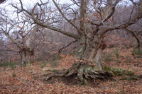
Chestnut tree in Poggio all'Olmo, Cinigiano
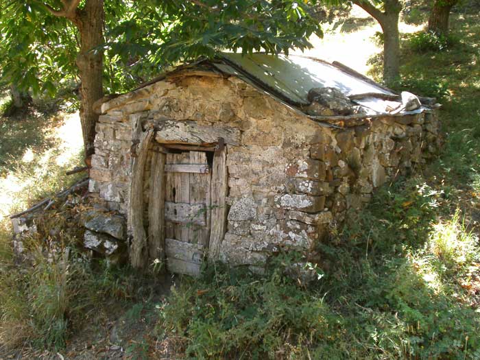
Drying house in chestnut grove, Monticello Amiata
|
 |
|
|
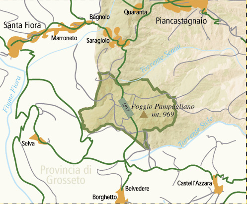
| Walking in the Riserva Naturale del Pigoletto | Between Saragiolo, Miniera del Siele, Castell'Azzara, Podere La Roccaccia and Castell'Azzara
There are many excurursion paths that run through the Nature Reserve of Pigelleto. Some paths are part of the marked trail n° 16 (Saragiolo - Miniera del Siele - Castell'Azzara) and n° 17 (Pod. La Roccaccia - Castell'Azzara) created by the Town of Monte Amiata.
How to get there: from Piancastagnaio - take the road to Castell'Azzara. The Nature Reserve is only 6 Km away.
Siele mine
Riserve Naturali Senesi | www.parks.it
In 1996, the Provincial Administration of Siena established 11 Nature Reserves covering about 8 thousand hectares of territory with a high environmental, naturalistic, historical, and cultural value, whose different protected environments house rare animal and vegetal species of great scientific and conservation interest. The 11 Nature Reserves form a System of Protected Areas whose aim is to ensure and promote, in a coordinated manner, the conservation and enhancement of the environment, the landscape, the historical-cultural and naturalistic heritage.
Chestnut recipes | www.chestnutsonline.com
Monte Amiata is famous for its beech and chestnut tree woods AND for its chestnut recipes. These recipes come from Stefano Marchi, host and owner of La Palazzina, an Agriturismo accommodation in Castelnuovo di Garfagnana. The recipes represent dishes from the kitchens of Garfagnana and in particular from those that are a part of the chestnut industry in Tuscany. 
[1] Originally, the only habitable structure on the land was a farmhouse. It has been renovated and remodelled over the years. Now called the Serkhang (the golden house), it contains the office, the refectory, a shop and accommodation for the custodian (Gekö). A new building was constructed to house a library with an important collection of Tibetan texts as well as the Mandala hall where the Vajra Dance is practiced. Cabins where members can do personal retreats were built in the centre of a forest grove.
The Gonpa, or Temple of the Great Contemplation, was completed in 1990 and inaugurated by the Dalai Lama. In 1998 Chögyal Namkhai Norbu inaugurated the Great Stupa. The Stupa is a reliquary monument representing the Buddha’s illumination. It is meant to promote the well-being and prosperity of the place where it stands. All the buildings have been harmoniously set into Merigar’s wonderful natural surroundings.
Over the years Merigar West has played host to the teachings of some of the most important Masters of the Tibetan spiritual tradition, including His Holiness the Dalai Lama, Penor Rinpoche, Sakya Trizin, Jetsun Chimed Luding, the Twelfth Tai Situpa, the Twelfth Gyalwang Drugpa, Sögyal Rinpoche, Lopön Tenzin Namdak Rinpoche, Drugu Chögyal Rinpoche, Dorzong Rinpoche, Ontul Rinpoche, Ayang Rinpoche, Trogawa Rinpoche and Sey Rinpoche.
Source: www.dzogchen.it
[2] The GALs are the operational arm of the Community Initiative LEADER 11 (Liaisons entre actions developpement de l'economie rurale instituted by the European Commission (DG Agriculture) with the aim of protecting and sustaining the European rural and mountain environment and the human activities taking place within it.
The Castanea project has as its main aim the promotion of the cultivation and production of the chestnut tree in the interested areas via the coordination of actions which involve three complementary aspects: a technical-agricultural area, a promotional area and a transversal area. The latter is being realised via the creation of the European Chestnut Trail which, recognising the importance of the chestnut landscape, favours the constitution of a link and a common identity among the participating territories with consequent positive effects on local economic activities. The other two aspects of the project, technical-agricultural and promotional, propose technical solutions for the maintenance, cultivation and production of the chestnut and for its promotion and diffusion (control of the management of the European marques of quality certification I.G.P. and D.O.P.).
[Source: The European Chestnut Trail, funded by the Leader 11 European Community Initiative, Livorno, 2001 | www.castanea.it]
|
|
|

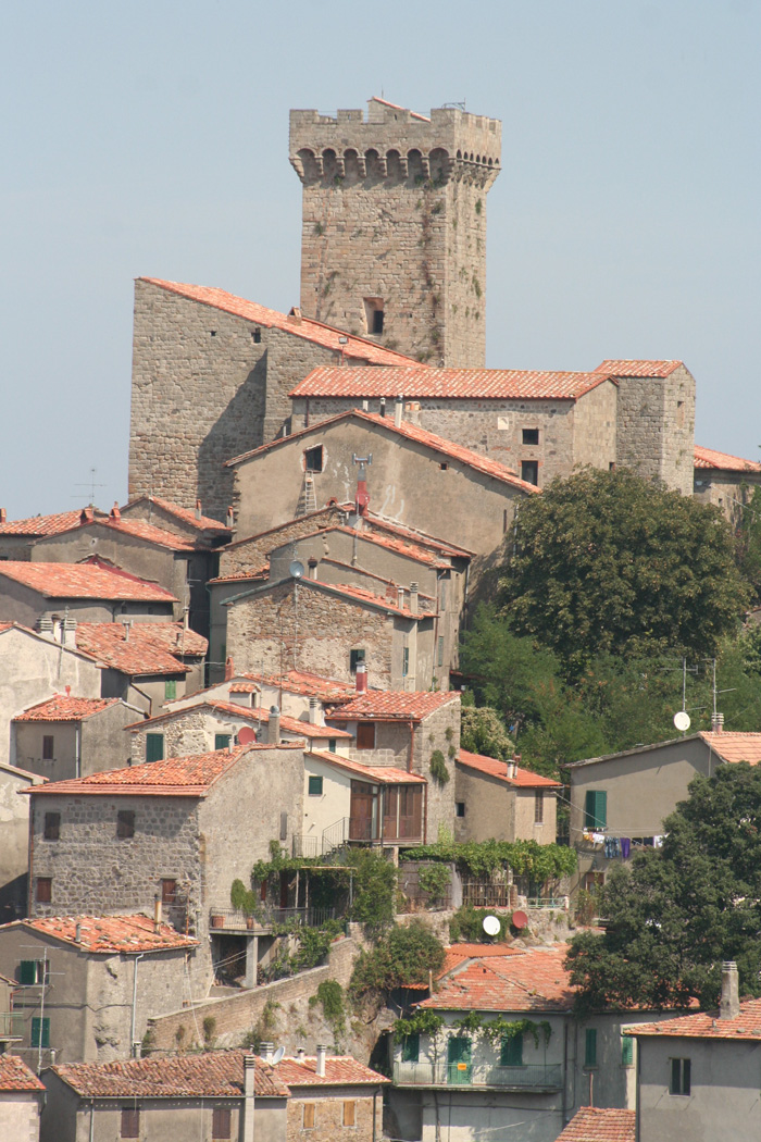 La Rocca aldobrandesca di Arcidosso