 |
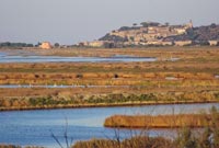
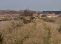
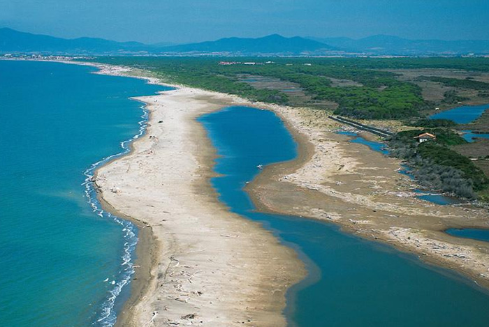
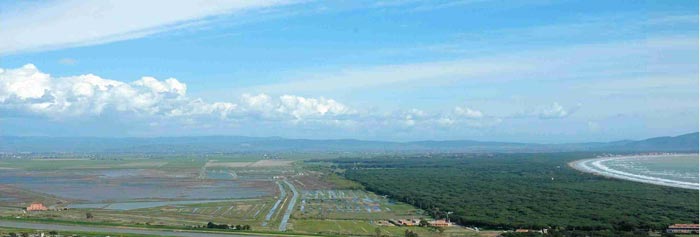
The Ombrone River Delta located along the coast of Maremma Grossetana, where it flows into the Tyrrhenian Sea . |
The most beautiful beaches in Tuscany |
| Tuscany is a splendid region, rich in history and culture, and graced with beautiful landscapes. The Tuscan coast and its immediate hinterland, consisting of the provinces of Massa-Carrara, Lucca, Pisa, Livorno and Grosseto, together with the islands of the Tuscan Archipelago, is a unique and fascinating area. The sea and beaches, cliffs and pinewoods, parks and protected areas, and historic cities and ancient villages are the salient features of this part of Tuscany. The wine. routes crossing it, its varied and delicious cuisine, and the traditions and folklore that are also evident in the festi vals taking place here, make it even more attractive. Despite the apparent homogeneity of the Tuscan coast, it is, in fact, very diversified and, thanks to its mild climate, may be visited at all times of the year, making it an outstanding area for tourism. The Maremma There are places that allow themselves to be discovered little by little, almost as if they were reluctant to reveal their hidden treasures to the hasty tourist. This is not the case with the Maremma, a well-known land that immediately dazzles the visitor with its colours, landscape, art, history and traditions. The Maremma and its inhabitants are much more demanding on their guests: they want to be accepted and liked for what they are. This area has a long history, beginning with the Etruscans and then continuing over the centuries with invasions, conquests and the building of fortifications. The variegated forms of the coastal landscape and the gently roI ling hills of the interior have been modelled by the ingenuity and toil of generations of peasants, labourers, cowherds, wood men, quarrymen and miners. The towns, like Marina di Grosseto, villages and isolated hamlets dotting the area have a rich heritage of works of art and handicrafts. Even the hearty local cuisine seems to be immune from fashions and easy compromise. But, above all, it's the character of the people that marks the Maremma off from the rest of Tuscany: it's an area that in the past had a reputation for being rough yet courteous, difficult but not hostile. Then as now, it's a land of sharp contrasts where, for the visitor, everything is fascinating. The natural environment Few areas in Italy have such a large number of protected areas as does the province of Grosseto. They include the old-established Parco naturale della Maremma, the recent Parco naturale dell'Arcipelago Toscano, thir teen nature reserves and eight others concerned with, for example, repopulation and biogenesis, as well as the WWF nature sanctuaries. Altogether they cover 40,000 hectares, constituting a vast nature reserve contai ning all the typical habitats of the coastal strip and the interior, right up to the top of Monte Amiata. Men, animals, plants: the balance between these elements indicates that by and large, in the wide coastal strip between the promontory of Piombino and the Colline Metallifere to the north and the promontory of the Argentario and the hills of Orbetello to the south, nature still reigns supreme. A clear sea washes a long, varied coastline comprising sun-drenched sandy beaches, isolated coves and sand bars alternating with high, rocky stretches from which there are magnificent views of the islands of the Tuscan Archipelago. The bay of Cala Violina, rightly considered to be one of the finest and cleanest expanses of sea in Italy, the long beach of Punta Ala and Castiglione della Pescaia, Marina di Grosseto and Marina of Alberese, Talamone, the sand dunes of Orbetello and the Argentario, Ansedonia and the coast near Capalbio: these are names of places familiar to those seeking a coast that, with the variety of its landscape, is never dull or predictable, Long stretches of this varied coast are mantled with the bright green of the dense pinewoods screening off the sun-baked countryside of the interior. The trees growing almost at the water's edge at Punta Ala are followed by the extensive pinewoods between Castiglione della Pescaia, Marina di Grosseto and Principina a Mare. Finally, in this part of the coast, which is one of the most intact in Italy, there are still vast areas of wetlands, now protected for the numerous species of migrant birds and plant associations that still form part of a unique, unspoilt natural environment. [1] |
|||
| Tuscany Beaches in Maremma | [2] From Principina a Mare to Ansedonia |
|||
| Tuscany Beaches in Maremma | [1] From Principina a Mare to Piombino |
|||
The Maremma is bordered by a transparent sea along its long and multicolored coastline of sunny beaches and rocky cliffs. The clear water of the Maremma coast holds first place as the cleanest in Italy. The 160 km of splendid coastline offer endless possibilities for enjoyment. High cliffs alternate with small isolated coves. Long stretches of sandy beaches providing all comforts are protected by lush pine forests.
|
 Cala Violina |
||
| There are a number of charming beaches along the Maremma coastline: one, a long sandy stretch from Castiglione della Pescaia to Marina di Grossetto, can be virtually deserted in the middle of August. A short way south of Marina di Grosseto, the Marina di Alberese beach, at the end of a long track which virtually drops you in the Mediterranean, is busier but good for families, and has shade in an extensive area of woodland behind the beach – also a fun place to mountain bike. |
|||
| Principina a Mare | 58 km |
|||
| Principina a Mare is a place mainly bathing fraction of the town of Grosseto. Principina a Mare is quite popular thanks to its proximity to the mouth of the River Ombrone and the Natural Park of Maremma. Principina a Mare is a nice seaside resort which enjoys a peaceful setting between the evergreen pine forest and the sandy beaches at the very heart of the Maremma. Near the northern the border of the Natural Reserve of the Maremma in the Uccellina hills, Principina a Mare is less than one hour by car away from Casa Santa Pia. At Principina a Mare, we arrive there in less than 50 minutes, going on the Trappola road, which takes the name from a thirteenth century tower, from which top we can enjoy wonderful views of the sea and Uccellina Mountains. The road, on one side runs along three loops of the river Ombrone and on the other one runs along fertile fields hardly pulled up from the marsh some time ago. So soon we come to a thick wood: it's the pine-wood of Principina, a wonderful forest of wild and domesticated pine-trees, now centenarian, with a thick underwood. After having reached the holding La Trappola, if we turn left through a cart-road, we can reach the mounth of the Ombrone river, where the lack of vegetation, the action of the sea and that of the river, suitably joint, build a land in continuous evolution. Farther on, northwards, spreads out the built-up area of Principina. |
 |
||
| Marina di Grosseto | 57 km |
|||
| Marina di Grosseto is a frazione of Grosseto, and is renowned for the Mediterranean maquis shrubland of the Maremma and for its wide beaches on the Tyrrhenian Sea. It houses a fort, known as Forte di San Rocco, built by the Grand Dukes of Tuscany in the 18th century. The San Felice Oasis consists essentially of four different habitats (five, if you include the public beach), in part completely natural, in part shaped by centuries of labour, especially with the reclamation works initiated in the 19th century by the Lorraine grand dukes of Tuscany. To begin with, the pinewood, dating back almost two centuries when the trees were planted, now the impressive green enclosure of the Oasis; the luxuriant underbrush of Mediterranean shrubs that proliferate thanks to the protection afforded by the dense pinewood; then the dunes, whose characteristic expanses of grasses and bushes create an intriguingly wild atmosphere; finally, the Fiumara canal, another manmade environment, whose lake habitat is much favoured by the aquatic bird species. |
 |
||
 |
|||
The Nature Reserve of Diaccia Botrona |
|||
| Riserva Naturale Provinciale Diaccia Botrona | 64 km |
|||
| Diaccia Botrona Marshland is the last relic of a once large Etruscan and Roman lake - lago Prile - that lay between Grosseto and Castiglione della Pescaia. Long coastal dunes, the tombolo separate the marshland from the Tyrrhenian Sea. Diaccia Botrona is of great environmental importance, both for the variety of plant species, both for the role it plays in supporting the migration and wintering birds. Represent what remains of a wider area marshy, affected by an artificial water system, carried out at different times, for the remediation of a good part of the plain between Castiglione and Grosseto. Of interest is the geological formation of Macigno in outcropping along the road is the second Panoramica. The Emblem of padule and its bonifica is the Casa rossa, was built in the eighteenth century by Leonardo Ximenes, head of the works for the remediation from Grand Leopoldo, to flow water through a complex system of cataracts, and marginally was also used for catching eels. The marshland is a site of great environmental importance. Inside the Park one can admire admire white herons, red herons, ducks, the falcon of the marshes and the Cavaliere d’Italia. There is a visitors centre within the Riserva Naturale Provinciale Diaccia Botrona and guided boat tours are available through the marshes. Entrance is free. The Nature Reserve of Diaccia Botrona |
|||
| Castiglione della Pescaia | 70 km |
|||
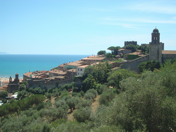
| Castiglione della Pescaia is a famous and popular seaside resort town known for its sandy beaches and Tombolo pine forest. Castiglione della Pescaia, a delightful village of Roman origin, has developed on the summit of Mount Petriccio within mighty walls with 11 towers and 3 portals and the Castle XV, that keep intact their charm, such as small streets of stone, the ancient portals and arches that susseguono. The country is an ancient fishing village (hence the name) and the port-channel every night pull up boats fishing with their cargo. On Saturday morning there is a market in Castiglione della Pescaia. |
|||
 |
|||
| Castiglione della Pescaia |
|||
The large and accessible sandy shore of the Gulf of Follonica includes coves such as Cala Martina and Cala Violina as well as the furnished beaches of Castiglione della Pescaia and Marina di Grosseto.
|
|||
| Capanna Civinini |
|||
South of Punta Ala there is the beautiful and long sandy beach Spiaggia di Capanna Civinini. Capanna Civinini lies within the territory of the Comune of Castiglione della Pescaia, south of the mouth of the River Alma. |
|||
| Rochette |
|||
| Rocchette is a small seaside resort that takes its name from the rocky peninsula where a beautifully preserved 11th century castle stands. This fortified castle, set on a dramatic cliff-top, 100 metres above the sea, was build to defend the Etruscan coast from the raids of the Moors. The castle is now hunting lodge and summer residence of the Marchesi Lucifero. The hill of Le Rocchette is extremely fascinating because it has remained unspoilt surrounded as it is by scrub and pine trees.
The beaches of Roccamare and Le Rocchette merge into one another along the coast between Castiglione della Pescaia and Punta Ala. Le Rocchette |  Forte delle Rocchette |
||
| Punta Ala |
|||
| Punta Ala (formerly Punta Troia) is a fraction of the town of Castiglione della Pescaia. Modern and well equipped residential village with a rational tourist port, Punta Ala rises on a promontory surrounded by the sea in a wonderful position. One o the main attractions is Golf Club Punta Ala. Another attraction in the area is Abbazia di San Pancrazio al Fango. |
|||
Cala Violina and Cala Martina |
|||
 |
|||
Cala Violina |
|||
| Cala Violina |
|||
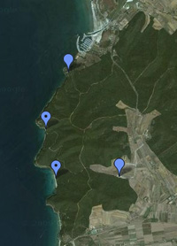
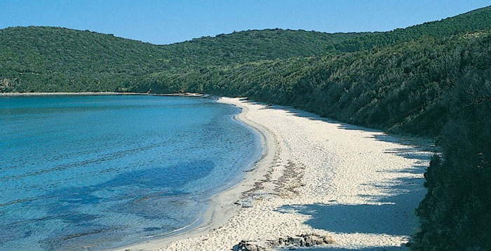
| Cala Violina is situated within the Golfo di Follonica (Gulf of Follonica), the heart of the Riserva Naturale delle Bandite di Scarlino (Bandite di Scarlino Nature Reserve). It is completely unspoilt. Along with Cala di Forno in the commune of Magliano in Toscana, Cala Violina won a Legambiente national award as one of Italy’s 11 most beautiful beaches. The beach is only accessible by foot, bike or horse. Cala Violina is reached by the route to Cala Martina or by a dirt road indicated 400 meters before the gas station beyond Portiglione on the road to Castigione della Pescaia (between Marina di Scarlino and Pian d'Alma). A path of approximately 1 km leads from the parking area to the cove. Follow the Sentiero Cala Violina sign. A second option, and substantially longer route (3,8 km), is to take the private access road to the rocky cove of Cala Martina and then continue a further 1.8 km to Cala Violina. Map |
|||
| Cala Martina |
|||
Cala Martina is a small caletta (cove) with two rocky shore bays, also situated within the Golfo di Follonica and the heart of the Riserva Naturale delle Bandite di Scarlino, a protected area of natural interest. |
|||
| Cala Civette |
|||
Cala Civette is a delicious four-mile stretch of beach that unites the rocky promontories of Scarlino with Punta Ala. Cala Civette has a a fine and light sand. The beach is 20 metres wide and it is encircled by pinewood. It can be reached through the road that leads to Punta Ala just after having passed Torre Civette and walked through the pine trees. |
|||
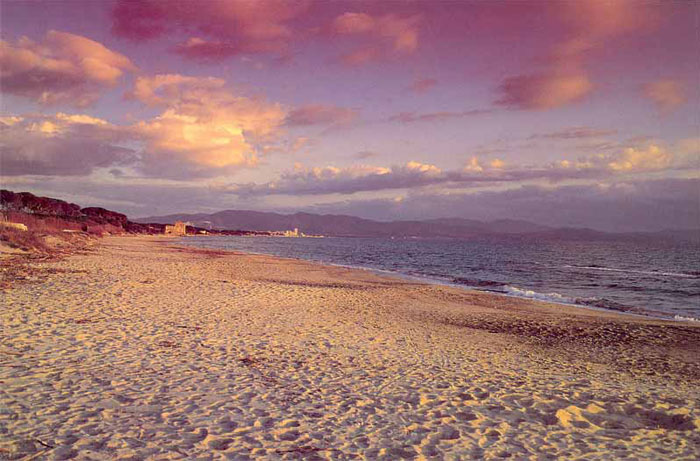 |
Beach in the Coastal Park of Sterpaia (with Torre Mozza) |
Situated on the Gulf of Follonica (Golfo di Follonica), Follonica offers wonderful landscapes from Punta Ala in the south-east to Piombino in the Northwest and towards the sea, until Elba island. Follonica is a popular tourist site during the summer, mostly visited by the Italians themselves. The city has been awarded the Bandiera Blu (Blue Flag) every year from 2000-2007 for the cleanliness of its beaches and seawater. The imposing Chiesa di S. Leopoldo di Follonica was built in the third decade of the 19th century after a project by the well-known Florentine architect Carlo Reishammer (1806-1883). The church includes abundant elements in cast iron, like the big rose window in the façade, the apse, several pieces of the indoors furnishing, as well as the summit of the pretty bell-tower. |
||||
|
||||
| The village of Torre Mozza belongs to the municipality of Piombino. Torre Mozza beach takes its name from the medieval tower that sits on the waters edge. It is situated within a natural park, the Parco Costiero Della Sterpaia, a short distance from either Follonica or Riotorto. Torre Mozza beach is a public beach with a great wide stretch of sand and a great view of the whole of the Gulf sweeping from the ancient port of Piombino, past Torre di Sale, Torre Mozza, the seaside resort town of Follonica, the white tower of Torre Civette, and lastly to the promontory and southern-most point of the Gulf at the millionaire sailing port of Punta Ala.
|
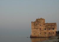 Torre Mozza |
|||
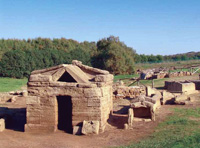
| The Gulf of Baratti, Buca delle Fate, Spiaggia Lunga and the Cala Moresca beach, Perelli and Torre Mozza are just some of the places famous for their unspoilt beauty along this stretch of coast. A very interesting itinerary along the coast is dedicated to archaeology. Here you can find important findings such as the graves and the Etruscan buildings in Populonia and the Archaeological Park of about 80 ha, directly in front of the sea within the beautiful Gulf of Baratti. The Archaeological Museum of Populonia is located in Piombino.
Populonia was one of the most powerful Etruscan villages and one of the major iron centre for the processing of the iron extracted in the Island of Elba, thanks also to the strategic geographical position, near the harbour of Baratti.
|
|
|||
 |
||||
View on the Gulf of Baratti from Populonia Tower (2)
|
||||
Piombino, a modern and active town, has always been an important strategic place thanks to its particular geographic position which allowed both the control of the Tuscan Sea and the access to the peninsula. Piombino is situated on a promontory jutting out into the sea. It was the capital of an ancient Italian state and is heir to classical and medieval, as well as Etruscan metalworking traditions. Piombino, which was governed for a time by Napoleon's sister, Elisa Bonaparte, was an important centre in medieval and renaissance tirnes, and old traditions survive side by side with today's dynamic, efficient town. |
||||
| The Coastal Park of Rimigliano | 112 km |
||||
The park extends over beaches and dunes where the bush has been shaped by sea breezes, and on to the shady forest dominated by holm oak and by maritime pine with their characteristic parasol-shaped tops. The Coastal Park of Rimigliano occupies the most southerly part of the Livorno Municipality territory of San Vincenzo, on the border with the Municipalities of Piombino and Campiglia Marittima. It covers around 650 hectares. |
||||
I Parchi della Val di Cornia The half-wild and barely populated hills of the Val di Cornia extend alongside the river between Campiglia Marittima and Piombino. The umbrella organization I Parchi della Val di Cornia is made up of six parks in the region: the Mediterranean scrub vegetation of the Parco Naturale di Rimigliano and the Parco Naturale di Sterpaia, the green wooded hills of the Parco Naturale di Montioni and the Parco Naturale di Poggio Neri, and the archeological parks of Populonia and San Silvestro. The Parks are very near one to the other, and consequently visitors are given the opportunity to follow an itinerary beginning in the Parchi costieri della Sterpaia e di Rimigliano, where the sea joins the woods. |
||||
The Island of Elba
|
||||
|
View Le Spiagge dell'Isola d'Elba | The beaches of Elba Island in a larger map |
||||
|
|
||||
| The Parco Naturale della Sterpaia stretches along the Livornese Tyrrhenian coast, in the wide gulf between Piombino and Follonica, and occupies an area of about 296 hectares. Here we have a rare and highly-prized humid forest, which was typical of the landscape of the ancient coast of the Maremma. Miraculously surviving deforestation, it was reclaimed by the municipal authority after the unauthorised lotting of the 1970s. Magical scenery through which to wander among ancient oak trees and woodland fauna, over the sandy dunes and down to the sea.
Walking in Tuscany | Itinerary in the Coastal Park of Sterpaia | ||||
|
|
||||
Piombino is a town and commune in the province of Livorno (Tuscany), Italy, on the border between the Ligurian Sea and the Tyrrhenian Sea, in front of Elba Island and at the northern side of Maremma. www.parchivaldicornia.it | Piombino, Castle and city Museum How to get to the Museum: the museum is in the centre of Pombino facing the sea. On entering Piombino follow signs to the town centre (centro storico). If arriving by train: Campiglia Marittima station, FFSS bus substituting train connection for Piombino Comune Piombino |
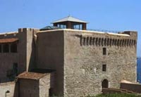 Piombino Castle |
|||
MARINA DI GROSSETO | Location Marina di Grosseto | Town Marina di Grosseto PRINCIPINA A MARE | Assistance YES | Location Principina a Mare | Town Marina di Grosseto FOLLONICA | Location Golfo di Follonica | Town Follonica LA POLVERIERA | Location Zona Sud | Town Follonica LE MARZE | Location Le Marze | Town Marina di Grosseto LE ROCCHETTE | Location Le Rocchette | Town Castiglione della Pescaia MARINA DI ALBERESE | Location Marina di Alberese | Town Alberese
|
||||
Naturist beaches in Tuscany
|
||||
Tuscany has a host of incredible beaches that have become the major attraction to both local and international Naturist tourists. Tuscany has some of his most beautiful beaches reserved for nudists and Naturists. The beaches are sometimes marked at the entrance with a sign. Here you find more information about the three main nude beaches in Tuscany, in Capalbio, Alberese, and Marina di Bibbona.
|
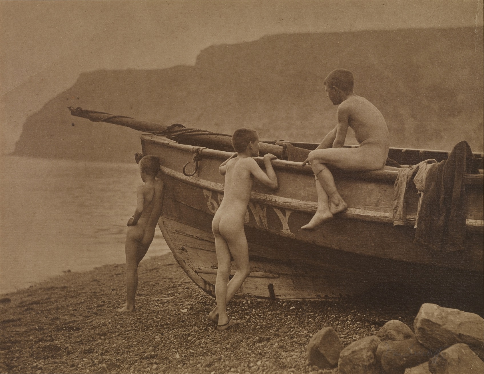 |
|||
|
[1] The theme of the Tuscan coast has now become a publishing project, realized by the Touring Club Italiano and promoted by the provinces, their chief communes and the tourist organizations of the areas involved, with the aim of bringing the outstanding features and most fascinating tours to the attention of the public at large. One of the most interesting aspects of this project is this general guide to the Tuscan coast and its highlights, with the enclosed road map and outline guide. Together they are a brief but complete source of information for visitors to the area. [Source : Toscanamare Progetto Costa di Toscana | www.touringclub.it] [2] Foto di Przemek P, licenziato in base ai termini della licenza Creative Commons CC0 1.0 Universal Public Domain Dedication
|
||||

