 |
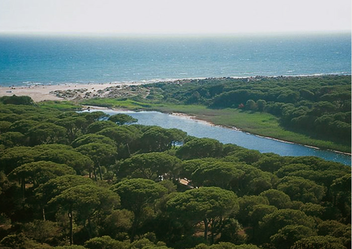
The Ombrone River located along the coast of Maremma Grossetana, where it flows into the Tyrrhenian Sea in Principina a Mare. |
Beaches in Tuscany |
| Tuscany Beaches in Maremma | [1] From Principina a Mare to Piombino |
|||
| Tuscany Beaches in Maremma | [2] From Principina a Mare to Ansedonia |
|||
| The coast of the Maremma is awarded the Blue Flag recognizing the quality and the cleanness of the waters along its shoreline. The stretches of sandy and rocky coastline allow all sea lovers to find the perfect place for them. Moreover, the vast pine tree forests which border the beaches of the Maremma are a real naturalistic treasure. The clear water of the Maremma coast holds first place as the cleanest in Italy. The 160 km of splendid coastline offer endless possibilities for enjoyment. High cliffs alternate with small isolated coves. Long stretches of sandy beaches providing all comforts are protected by lush pine forests. The Maremma seashore, overlooking the Tirrenian Sea, features some of the most beautiful sand beaches of Tuscany. Some of these beaches are quite isolated and wonderful, from a natural viewpoint. They are very often embellished by sand dunes, behind which evergreen bushes lead the way to a flourishing and thick pine forest. This type of wood is very closely tied to the history of this land with its past of drainages. The Maremma boasts several other areas of great beauty and worldwide fame farther away from Grosseto, such as the Argentario peninsula, Talamone, and the Tuscan Archipelago with its beautiful little islands which can be reached by boat from many of the ports and smaller harbours of the Maremma. |
 Argentario |
||
| 2 | From Principina a Mare to Ansedonia | |||
| Principina a Mare | 58 km |
|||
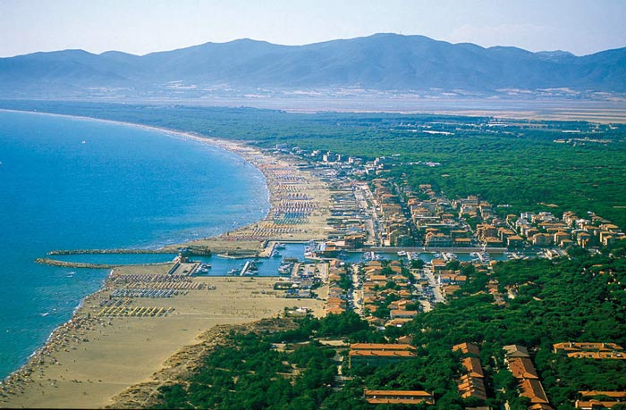
| Principina a Mare is a place mainly bathing fraction of the town of Grosseto. Principina a Mare is quite popular thanks to its proximity to the mouth of the River Ombrone and the Natural Park of Maremma. |
 |
||
| Marina di Grosseto | 57 km |
|||
| Marina di Grosseto is a frazione of Grosseto, and is renowned for the Mediterranean maquis shrubland of the Maremma and for its wide beaches on the Tyrrhenian Sea. It houses a fort, known as Forte di San Rocco, built by the Grand Dukes of Tuscany in the 18th century. |
|||
|
|||
| Marina di Grosseto |
|||
| The natural environment Few areas in Italy have such a large number of protected areas as does the province of Grosseto. They include the old-established Parco naturale della Maremma, the recent Parco naturale dell'Arcipelago Toscano, thirteen nature reserves and eight others concerned with, for example, repopulation and biogenesis, as well as the WWF nature sanctuaries. Altogether they cover 40,000 hectares, constituting a vast nature reserve contai ning all the typical habitats of the coastal strip and the interior, right up to the top of Monte Amiata. Extending from Principina a Mare to Talamone, the park comprises an area to the north of the mouth of the Ombrone with its marshes, ponds and sand dunes, and one to the south dominated by the Monti dell'Uccellina. The Palude della Trappola, near the mouth of the Ombrone, is par ticularly interesting. The sand bar delimits bracki sh pools known as chio ri, where numerous spe cies of birds find refuge in the thick reed-beds. Dry in the summer, the chiari come to life in the autumn, when the mar shes are once again under water. Passage migrants at the Trappola include, above all, various families of palmipedes, while species such as the grey heron, mallard, little egret, black-winged stilt and sandpiper are resident in this marsh. |
|||
 |
|||
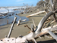
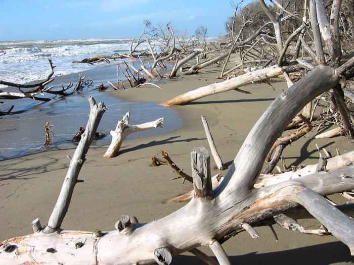
Beach in the Parco Naturale della Maremma |
|||
| Parco Naturale della Maremma |
|||
| For those who love nature you should not miss the Natural Park of Maremma, which runs from Principina a Mare to Talamone. The most famous part of the Maremma is the Parco Naturale della Maremma, otherwise known as the Parco dell'Uccellina after the name of the hills that comprise a large part of the park area. The entrances to the park are at Talamone and Alberese. Coastal Maremma is one of the least populated areas of Italy, with large stretches of land left undisturbed for the flora and fauna, which seem, even beyond its boundaries, to be a natural extension of the Parco dell'Uccellina, even though the area has undergone massive reclamation, transforming what was once putrid and unhealthy marshland into habitable terrain. Few places in this world can boast the blessings of land, water and air together in the eternal construction of its beauty. Maremma is one such place carved with artistic hands of all three forces of nature - the land, water and air. The resulting park is a huge area of lush vegetation, exhibiting the various species of animal kingdom and the gentle touch of glorious beaches of aquatic ecological importance. The Maremma Nature Park has well-maintained hiking trails and biking tours and horseback rides in the park are also possible. Moreover the beach of Marina di Alberese is one of the most beautiful places of the Maremma littoral. A curiosity: part of this beach is for nudists. [read more]
|
|||
|
|||
| |
|||
Spiaggia Marina di Alberese
|
|||
| Alberese |
|||
| Although located within the Parco Naturale della Maremma, entry restrictions do not apply to Marina di Alberese, whose beach - though not as superb as that in the park, rates as one of the best in Tuscany. |  Marina di Alberese |
||
| Talamone |
|||
| A short drive away, going south, you can go to the port of Talamone, a picturesque and solitary fishing village. Talamone stands on a little promontory, dominated by an ancient Sienese fortress, to the extreme south of the Monti dell'Uccellina. In antiquity Talamone was an Etruscan port. At the top of the rocky hill you can see a wonderful view, following the coast line of Osa, you see right up until the promontory of Argentario,with its jagged coast, its coves with crystal clear sea. A zone that will leave a lasting charm and certainly unforgettable, also appart from it being interesting, this a very popular destination for skin diving as in the depths of the sea there are beauliful sealife views (for more information: The Argentario Coast Diving Centre). Near to Talamone is the spa of Osa. Here, a spring of suphureous water with a temperature of 32°C is exploited for the therapeutic purposes. The virtues of the waters of Osa have been renowned since time beyond recall. They were in use in Roman times and remains of buildings equipped for thermal cures have been excaved in the zone known as Bagno dell'Osa as well as in the Le Tombe district. |
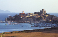 Talamone |
||
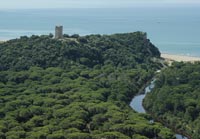
| La Torre di Talamonaccio, an historic Spanish tower, perched on top of a cliff which overlooks the sea, was erected to protect against the Saracen invasions. is located along the via Aurelia, the closest village is Talamone at 4 km distance. La Torre di Talamonaccio is soon to feature in the upcoming James Bond film Quantum of Solace. According to a legend handed down from classical literature the eponym of this town was Telamone, the son of Eaco, who landed here with the Argonauts by coming back from Colchide. The Grecian hero died here and was buried under the promontory. An important archaeological discovery made on the Talamonaccio hill concerns some fragments of Etruscan sculpture, which dates back roughly to 150 b. C. and in which is represented the final act of the Edipo’s curse during the war of Seven years against Thebes. [Special Branch agent, James Bond takes a boat trip back to Italy to visit his friend Mathis (Giancarlo Giannini) at Talamone in southern Tuscany. Mathis’ home is Torre di Talamonaccio, a restored Medieval tower on the coast, a couple of miles east of Talamone itself...] Quantum of Solace film locations |
 Fonteblanda beach and La Torre di Talamonaccio |
||
| Fonteblanda |
|||
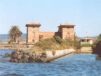
| From the folk tradition, the name of the country should come from a source of fresh water, bland, in the vicinity of the old path. The beach is 20 metres wide and can be reached from the campingsites south of Talamone. The mouths of the Osa and the Albegna come together at this sandy shore, skirted by a green pine grove. Lit. Ciampoltrini, Giulio and Firmati, Marco (2002) "The Blacksmith of Fonteblanda. Artisan and Trading Activity in the Northern Tyrrhenian in the Sixth Century BC," Etruscan Studies: Vol. 9, Article 4. Available at: http://scholarworks.umass.edu/etruscan_studies/vol9/iss1/4 |
 |
||
| Albinia |
|||
| Albinia, a modern agricultural trade centre anda considerably tourist seaside resort, rises near the mouth of the Albenga river, from which it takes the name. The presence of the Tower of the Salines, near the mouth, shows that once salt was produced there. The Spanish Forte delle Saline, is located in the frazione of Albinia. Near the mouth of the Albegna River, on the left shore, the Forte delle Saline is a defensive architectural complex built in the second half of the 15th century. Restored several times since, it is indicated by nineteenth-century historian and naturalist Emanuele Repetti as "Torre delle Saline" with the function of Fort and Customs House. The name of the tower derives from the presence in this area of numerous salterns, which thus imposed the necessity to defend the site, as it was also the point of embarkation of grains from inland Maremma. [read more] Giannella is a long sandy beach connecting the north of the peninsula to the mainland near Albinia and Talamone. |
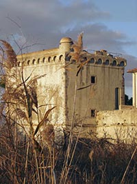 Forte delle Saline, Albinia |
||
| Orbetello |
|||
| A town rich in history, situated on a spit of land that stretches into the lagoon, Orbetello has Villanovan origins and was an important Etruscan centre, as witnessed by the imposing remains of the walls and the numerous finds discovered. Having passed from the Byzantines to the Longobards, from the Aldobrandeschi to the Orsini, from Siena to the Spanish, who in 1557 made it the capital of the Presídi State, Orbetello was largely rebuilt after the destructions of the last war and this has in part altered the old nucleus. Worth seeing in particular are the buildings of the Spanish period: the Medina Coeli gate, the fortifications, the Guzman powder magazine and the Clock Tower. An important mediaeval architectural work is the 14th-century Duomo dell'Assunta, probably built on a previous Etruscan temple, which houses a remarkable marble polyptych of the pre-Romanesque period. [read more]
| |||
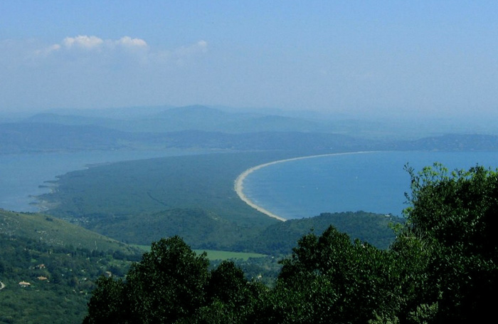
| The territory around Orbetello is extremely varied. The lagoon's wetland is divided into two pillows by the sea (il Tombolo della Feniglia and Tombolo della Giannella) characterized by long sandy beaches, pinewood forests and Mediterranean bush, while next to the Talamone and Ansedonia heights, the coastline is full of cliffs. The hinterland offers lower heights and vast plains where cultivations alternate with Mediterranean bush. Orbetello is joined to the Argentario promontory by two long, golden sand dunes, known as the Tomboli della Feniglia e della Giannella that offer the visitor kilometres of enchanting, unspoilt beaches. Spiaggia Feniglia. This impressive beach is 7 km long and it has fine white sand and is backed by a lush pine forest. It ends with the lagoon of Orbetello. It can easily be reached from Porto Ercole. |
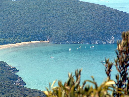
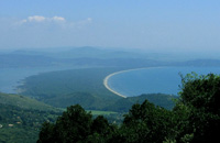 Tombola di Feniglia, view from Monte Argentario |
||
|
 |
||
| Orbetello e Tombolo di Feniglia | |||
| Floating between sea and sky
The effect is particularly fascinating at sunset, when the sun reflected on the water cancels out the delicate outline of the coast and the jagged rocky bulk of the Argentario seems to slowly emerge from the lagoon of Orbetello. Its thick, perfumed macchia, the clear sea and its rugged cliffs were already much apprecia ted by the Romans, who built numerous vil las overlooking the most beautiful bays. And still today the exclusive holiday resorts of Porto Santo Stefano and Porta Ercole attract tourists from all over the world.
|
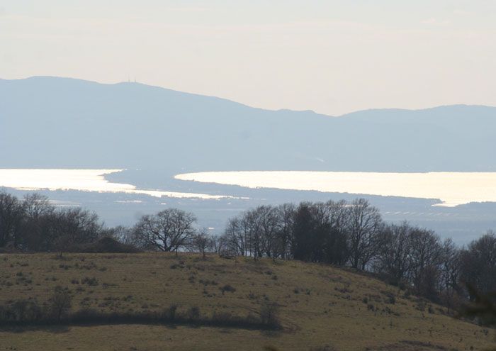 |
Monte Argentario and Tombolo di Giannella, view from Scansano |
|
|||||||||||||||||||||||||||||||||||||||||||
Monte Argentario is considered as most favorite by many scuba divers across the globe. The richness of the beaches extends to the Orbetello lagoon and the golden groomed beaches of the Feniglia and the Giannella, Capalbio coast and the island of Giglio and Giannutri that can only be called the paradise of the world with its spell bound views of nature. |
|||||||||||||||||||||||||||||||||||||||||||
The Argentario coastline is surely one of the most beautiful areas of Tuscany, with a dramatic cragginess reminiscent of parts of Sardinia. Other than the long sandy beaches of Giannella and La Feniglia, which are well-equipped with bars and other amenities, there are also several other smaller sandy beaches like, Acqua Dolce, Spiaggia Lunga and Cala del Gesso as well as rocky bathing areas like the exclusive Cala Piccola. Other gems like Cala Grande can only be reached by boat. Following the panoramic road west from Porto Santo Stefano takes you to the wilder, less developed part of the island, affording wonderful views of the dramatic coastline along the way. Here there are beautiful unspoilt beaches; some sandy, some with pebbles and others with flat rocks to jump or dive off. These less busy beaches are more difficult to reach by foot, usually down steep inclines or sets of stairs built into the hillside and some can only be reached by boat. As well as views across to Giglio Island, visitors can also admire the striking offshore islet of Argentarola with a private rocky beach in front. Cala del Gesso is a particularly panoramic beach set in a residential area made up of private villas, although it is accessible to the public. Cala Piccola is one of the most exclusive locations in Monte Argentario, where the wealthy and the famous have their holiday villas. The small beach is private to those staying in the nearby villas and is well-serviced with amenities. It has a small patch of sand and otherwise has flat rock platforms from which to swim. |
1 - Bagni di Domiziano 2 - La Soda 3 - Il Pozzarello 4 - La Bionda 5 - Punta Nera 6 - La Cantoniera 7 - Viareggio 8 - La Marinella 9 - Il Moletto 10 - La Caletta 11 - Il Siluripedio 12 - La Cacciarella 13 - Cala Grande 14 - Cala Moresca 15 - Cala del Gesso 16 - Cala del Bove 17 - Cala Piccola 18 - Capo d'Uomo 19 - L'Acqua Appesa 20 - Cala dell' Olio 21 - I Sassi Verdi 22 - Il Mar Morto 23 - Le Cannelle 24 - Il Purgatorio 25 - La Ciana 26 - Cala Piazzoni 27 - Le Ficaie 28 - L'Acqua Dolce 29 - Lo Sbarcatello 30 - La Spiaggia Lunga 31 - La Piletta 32 - Le Viste 33 - Le Pietrine 34 - Cala Galera 35 - La Feniglia 36 - La Giannella |
||||||||||||||||||||||||||||||||||||||||||
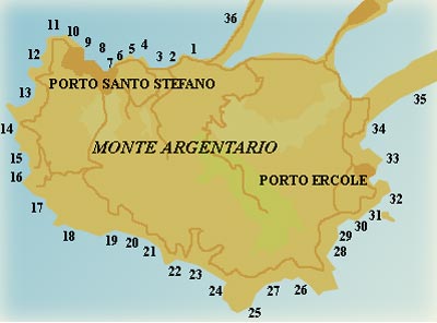 |
|||||||||||||||||||||||||||||||||||||||||||
Porto Santo Stefano |
|||||||||||||||||||||||||||||||||||||||||||
Porto Santo Stefano is the largest town on Mount Argentario, and connections leave from here for the islands of Giglio and Giannutri. Porto Santo Stefano is a famous resort with two ports, Porto Nuovo and Porto Vecchio. Dominated by the 17th-century square-plan fortress, built by the Spanish to defend the port, Porto Santo Stefano originated in the 15th century as a fishing village. Fishing continued to be the almost exclusive activity of its inhabitants until not many decades ago, when the town became a famous seaside resort, appealing to a wide range of tourists. In the summer period the fortress is the venue for a wealth of cultural activities and exhibitions. |
|||||||||||||||||||||||||||||||||||||||||||
| Porto Ercole |
|||||||||||||||||||||||||||||||||||||||||||
Porto Ercole is located on the eastern coast of the Argentario. It is a charming seaside village that overlooks a bay protected by a small promontory. |
|||||||||||||||||||||||||||||||||||||||||||
Porto Ercole, seen from the fortress
|
|||||||||||||||||||||||||||||||||||||||||||
 |
|||||||||||||||||||||||||||||||||||||||||||
Tombolo, di Feniglia, view from Monte Argentario. The Feniglia dune, for its entire length and breadth, 6 km by 1 km, is entirely covered by pine-woods. |
|||||||||||||||||||||||||||||||||||||||||||
Tombolo di Feniglia
|
|||||||||||||||||||||||||||||||||||||||||||
Not to be missed are the characteristic and famous beaches like Feniglia, Giannella and Ansedonia with its golden sand continuing with Torba and Marina di Capalbio with its dark, almost black sand. |
|||||||||||||||||||||||||||||||||||||||||||
Ansedonia
|
|||||||||||||||||||||||||||||||||||||||||||
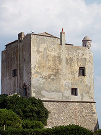
Directly across the harbor from Porto Ercole lies Ansedonia, an almost sleepy little town with some of the best beach front in Tuscany. Rather than the rocks and pebbles that greet you on so many Italian beaches, Ansedonia offers soft, velvety sand. In Ansedonia you can visit the remains of the “city of Cosa” and its museum on the promontory of the Etruscan Tagliata “Spacco della Regina” with a marvellous view on the Argentario. Next to the dark beach is the historical complex of the Tagliata Tower, also know as the Puccini tower for the famous composer who lived here. The Torre Tagliata was built in the early 13th century as a watchtower for the Spanish troops that occupied this part of Tuscany. Giacomo Puccini, an ardent hunter and fisherman (cacciatore e pescatore), loved the wild marsh land of the Maremma. In 1920 he bought the crumbling tower (torre franante) on the windblown beach and became friends with his only neighbors: the men of the local Guardia di Finanza (a branch of the police), whose caserma (barracks) were next door. Giacomo Puccini who resided here for many years and in the last days of his life began composing the opera Turandot. History of Tuscany |The Tagliata Tower, or the Puccini Tower in Ansedonia |
 |
||||||||||||||||||||||||||||||||||||||||||
Torba |
|||||||||||||||||||||||||||||||||||||||||||
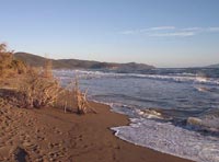
Extends east of the promontory of Ansedonia. The beach is characterized by sand ranging in color from dark gray to black. Proceeding toward the Lake of Burano and the mouth of Chiarone, the shoreline tends to soften the color and come forward tone between dark gray and gold. The entire stretch of the coastal zone is presented with wild dune vegetation, and Mediterranean retrodunal (macchia). |
 |
||||||||||||||||||||||||||||||||||||||||||
Chiarone Scalo |
|||||||||||||||||||||||||||||||||||||||||||
The beach can be reached going from the promontory of the Argentario toward Capalbio Scalo. It has an almost black sand and clear, transparent water. Thick wild scrub and broad dunes encircled the beach. |
|||||||||||||||||||||||||||||||||||||||||||
Marina di Capalbio |
|||||||||||||||||||||||||||||||||||||||||||
Capalbio Beaches are Chiarone, Macchiatonda and Capalbio Scalo The beaches have an almost black sand and clear, transparent water. Thick wild scrub and broad dunes encircled the beach. |
|||||||||||||||||||||||||||||||||||||||||||
Marina di Pescia Romana, Montalto di Castro |
|||||||||||||||||||||||||||||||||||||||||||
Montalto di Castro is a little town on a hill overlooking the coast. It is called Montalto di Castro with reference to the Duchy of Castro to which it belonged for a century. The road leading to the town is dominated by the mass of Castello Guglielmi or della Rocca, a medieval castle built by the Orsini. Pescia Romana, attracted by the beauty of the countryside, by the possibility of going on many different types of excursions, both naturalistic as well as cultural, by the 8 km of beach, all true to their natural state, and by the clarity and cleanliness of the seawater. The beaches of Marina di Pescia, Casalaccio and Costa Selvaggia are particularly well known. They are situated north from Montalto on S1, then follow signs to Marina di Pescia Romana. |
|||||||||||||||||||||||||||||||||||||||||||
Marina di Montalto |
|||||||||||||||||||||||||||||||||||||||||||
Marina di Montalto is a tourist resort situated two kilometres from Montalto. Near the mouth of the Fiora is a massive building, which probably acted as grain store, and a square tower, recently restored, probably built in the 15th century. Further south, in the locality of Punta delle Murelle, the ancient structure of Regisvilla port can be seen a short distance from the bank. |
|||||||||||||||||||||||||||||||||||||||||||
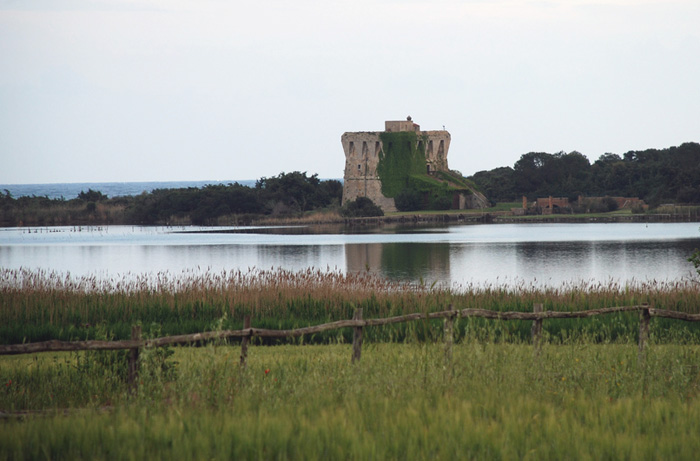 La Torre di Buranaccio, Lago di Burano, Capalbio. The Buranaccio Tower stands at the centre of the narrow sandy isthmus separating lake from sea. |
|||||||||||||||||||||||||||||||||||||||||||
| Extending parallel to the coast, Lake Burano and the immediately surrounding district make up one of the most important wetland habitats in Italy in terms of the integrity of the environment and accommodation and teaching facilities. [read more] |
|||||||||||||||||||||||||||||||||||||||||||
|
|||||||||||||||||||||||||||||||||||||||||||
The islands of the Tuscan archipelago
|
|||||||||||||||||||||||||||||||||||||||||||
When we talk about the Maremma and its coast, however, we cannot forget to mention the islands of the Tuscan archipelago, a nature sea park, and an extraordinary place for the beauty of its depths and the cleanliness of the seawater. The islands of the Tuscan archipelago, a nature sea park, and an extraordinary place for the beauty of its depths and the cleanliness of the seawater. The Isles known as Giglio and Giannutri in particular are not to be missed. [read more] |
|||||||||||||||||||||||||||||||||||||||||||
MARINA DI ALBERESE | Location Marina di Alberese | Town Alberese MARINA DI GROSSETO | Location Marina di Grosseto | Town Marina di Grosseto PRINCIPINA A MARE | Assistance YES | Location Principina a Mare | Town Marina di Grosseto |
|||||||||||||||||||||||||||||||||||||||||||
Porto Santo Stefano |
|||||||||||||||||||||||||||||||||||||||||||
BAGNI DI DOMIZIANO The beach can be reached by leaving the provincial road and walking down a short path. The bay is below the Tower of Santa Liberata where are the ruins of an antique Roman villa. |
|||||||||||||||||||||||||||||||||||||||||||
CALA DEL GESSO This beach can be reached from the provincial road 700 metres beyond Cala Moresca following the signs for a paved turning. To get to the sea we have to take a footpath. This beach is ideal in low season as it is well protected from the wind. |
|||||||||||||||||||||||||||||||||||||||||||
CALA DEL BOVE Cala del Bove is next to the exit for the beach of Cala del Gesso and it can only be reached from a path. |
|||||||||||||||||||||||||||||||||||||||||||
CALA GRANDE The beach can be reached from a footpath after the Torre della Cacciarella. It is a beautiful section of coast where vegetation grows up to the sea. Another stretch of this beach near an oakgrove can be reached by following the path of the old “Fosso del Cauto”. |
|||||||||||||||||||||||||||||||||||||||||||
CALA MORESCA | Location Cala Moresca | The pretty cove is named after the tower which dominates the beach. It is a stretch of a cliff, flat and with no sands. It is reached from the sea or from a private entrance on the provincial road. The isle of Argenatrola which faces the cove is a favorite for scuba excursions thank to a stunning submerged grotto with stalagmites and stalactites. |
|||||||||||||||||||||||||||||||||||||||||||
Cala Piccola is reached from the provincial road that leads directly to the terraced bathing establishments and the cliffs. |
|||||||||||||||||||||||||||||||||||||||||||
Naturist beaches in Tuscany
|
|||||||||||||||||||||||||||||||||||||||||||
Tuscany host some incredible beaches that have become the major attraction to both local and international Naturist tourists. Spiaggia di Marina di Alberese [42.6401N, 11.0597E], Spiaggia della Feniglia [42.4177N, 11.2384E] and Spiaggia di Capalbio [42.3973N, 11.3720E] are within reach of Podere Santa Pia. In Torre del Lago, there is the beach known as La Lecciona, the point of reference of all Italian gay beaches.
|
 |
||||||||||||||||||||||||||||||||||||||||||
|
|
|||||||||||||||||||||||||||||||||||||||||||
|
|||||||||||||||||||||||||||||||||||||||||||
[1] Source : Toscanamare | www.touringclub.it |
|||||||||||||||||||||||||||||||||||||||||||

