| |
|
Number on the map: 3 - Length: 18.5 km - Journey time: 6.5h - Difficulty: easy -Signposting: Scarse, but evident footpaths - Feasibility: by foot, by bike, on horseback- Places of interest: Merse river, Natural reserve of the Merse.
Note: This itinerary is almost all on the flat and above all offers magnificent viewsof the mouth of the Merse, here very wild and not contaminated. Although it is verylong it can be walked by everyone and is not particularly difficult. Always quite,shady, especially along the river. Very enjoyable by bike and on horseback.
Taking the Monticiano - San Lorenzo road, after around 3.5 km we reach a bridge overthe Torrente La Gonna stream. Immediately after the bridge, on the left, the footpathbegins as a shale track.
After around 400 m the road crosses the “Podere La Gonna” farm, which warrants apause to look at the magnificent stone drinking trough on the right of the road, immediatelyafter the houses. The road continues slightly downhill until we reach a plain. Onthe plain there is a picnic area. We continue on the track for another 150 m and when wereach a sign for the Parco Farma -Alto Merse, we leave the main road and make a leftturn. The road narrows and crosses a small ditch. After crossing the ditch we can admireon the right of the road numerous holly bushes (emergenza naturalistica on the map).After a short while we arrive at the river Merse, on a cement bridge which may be floodedwhen the river is full. On the left of the river is a large creek, where one can swimor use the canoe. We continue along the road and on reaching a sharp left hand bend ouritinerary veers into a footpath on the right which is marked by wooden barriers thatform as bounderies and remain with us for some kilometres. After a short while wereach the Merse river, and on the opposite bank we notice a hydrometre used in the pastto measure the mouth of the Merse (emergenza storica on the map).
We continue alongside the orographic left of the river until a landslide forces the path toveer to the left and climb for around 30 m, moving from the river bed to the top of the“Masso degli Zingari”. Here we can see some charcoal pits used in the past for the productionof vegetal carbon. After almost reaching the top of the “Masso degli Zingari”,the footpath goes downhill towards the river and follows alongside for around 500 m. Apicnic area is near by the old breakwater on the hydrographic left of the river. After thepicnic area , the footpath climbs in a NNW direction, moving away from the river.
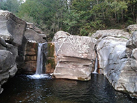
After around 100 m from the start of the incline, a post indicates a deviation on theright, where after around 500 m it is possible to reach the old breakwater on the Merse(emergenza Naturalistica on the map). This is a marvelous place for a swim. Thequartz formations make this place even lovelier. The footpath continues to climb in aNNW direction for around 400 m until we reach the ruins of an old house (300 m abovesea level). We continue for around 200 m until we reach a second ruin, at 280 m abovesea level. From here the footpath begins its decline for around 1km nearing the river.The Merse is reached near a crossroads of footpaths. From here the footpath runsalongside the river, and after 200 m reaches on the right a ford made of large rocks, buteasy crossable. If one does not want to ford the river at this point it is possible to continuealong the footpath for about 1 km, after reaching the ruins of an old iron foundary,and wade across the river where the water is less than 1 metre. On passing theriver, from either of the 2 places, we continue on the large footpath, which after runningalongside a plateau for 200 m, reaches the Calcinari farm ruins (not on the map).From here we turn right in a southerly direction, taking the large shale track which runsalongside, even if it is 30 m above, the river Merse.
We carry on along this road, leaving behind all the small roads which cross its path.After around 2 km we leave the road and take a shale track on the right, which descendsrapidly and continues on a parallel to the road we have just left behind, but 50 m underneathit. We walk along this road for around 2 km, and on reaching an open space, wemeet another road which takes us to the old breakwater, this time on the hydrographicright of the river. We continue along this road and after 1 km we reach the CasettaRossa (Red House), a beautiful abandoned red brick construction. We go past the houseand continue in a southerly direction near the Podere Mallecchi farm. Near the farmruins we take the uphill road to the left which after a couple of bends crosses the roadwe left 3 km before. At the crossroads we take a right and continue on the path whichwidens for 1.5 km until we arrive at Pian delle tende and therefore which takes us tothe bridge on the Gonna stream.
|
Il sentiero continua in salita in direzione NNW per circa 400 m fino a raggiungere i ruderi di una vecchia casa (quota 300 s.l.m.). Si continuarimanendo in quota per circa 200 m fino ad un secondo rudere, posto alla quota di 280m s.l.m.. Da qui il sentiero comincia a scendere, in direzione NNE, per circa 1 km riavvicinandosial fiume. Il Merse è raggiunto in corrispondenza di una piccola confluenzae di un crocevia di sentieri. Da qui il sentiero costeggia il fiume e, dopo circa 200 mraggiunge, sulla dx, un guado formato da grossi massi facilmente superabili. Se non sivuole guadare il fiume in questo tratto, è possibile continuare lungo il sentiero per 1 kmcirca e, dopo aver raggiunto i ruderi di una vecchia ferriera, guadare il fiume in un trattodove la profondità dell’acqua è sempre molto inferiore al metro.
Attraversando il guado si tralascia l’evidente strada che prosegue a dritto e si serra,invece, subito a dx (ometto) su una strada che, con un paio di tornanti, si allontana dalfiume e prosegue poi parallela a questo. Dopo circa 300m in piano, una strada più largaattraversa diagonalmente. Prendendo a dx si arriva ad un campo (possibili avvistamentidi animali) dove prendendo a dx salendo, con il campo che rimane alla, sn si raggiungeil podere Calcinari (fuori carta). Passato il Fiume Merse, da quello più a nord,si prosegue lungo un sentiero molto ampio, che dopo aver costeggiato un pianoro per circa 200 m porta ai ruderi del Podere Calcinari (fuori carta). Dall’ampio spiazzo difronte al podere suddetto (attualmente diroccato), da cui si apre un campo con dietroPoggio Romito, si prende a dx la larga strada proveniente da Brenna (fuori carta) chepresenta ampie tracce di un selciato a pietre. Su questa si prosegue verso sud tralasciandotutte le diramazioni secondarie. Dopo circa 500 m. si può scorgere in lontananzasulla dx l’imponente castello di Castiglion Balzetti soprannominato Castigionche Dio sol sa, data la sua ubicazione particolarmente nascosta.
A 2 km. da Calcinarisi lascia la strada per prendere un bivio in discesa a dx, facilmente riconoscibile perchèsituato subito dopo un ponte su una curva. La nuova strada dopo poche decine dimetri di discesa continua parallela alla precedente, in piano ed in direzione sud. Daqui gli scorci sulle gole del Merse sono mozzafiato e fanno apprezzare quanto remotoed incontaminato sia questo angolo di Toscana. Dopo altri 2 km. in prossimità diuno slargo un sentiero che scende a dx porta dopo 100 m alla Vecchia Diga (emergenzanaturalistica), dove è difficile rinunciare ad un bagno.
Si continua sulla strada e dopo 1 km si raggiunge la Casetta Rossa, bellissima costruzionea mattoni abbandonata. Si supera la casa e si continua in direzione sud verso ilPodere Mallecchi. In corrispondenza dei ruderi del podere, si prende verso sinistra la stradache sale e che dopo un paio di tornanti si incrocia nuovamente con la strada cheavevamo lasciato circa 3 km prima. All’incrocio si prende a dx e si continua lungo lastrada a sterro che ora si fa molto ampia per circa 1,5 km fino a ritornare al Pian dele Tende e, quindi, alla strada che porta al Ponte sul La Gonna.[1]
|
|
 |
l fiumi Merse, Farma, Gonna
|
|
|
La Val di Merse è un polmone verde tra la Maremma, le Crete senesi e la Val d'Orcia. È un ponte naturale tra l'Amiata e le Colline Metallifere, tra il mare e Siena.
l fiume Merse nasce in territorio grossetano sul Poggio Croce di Prata (848 metri) e scorre per 70 chilometri, attraversando i comuni di Chiusdino, Monticiano, Sovicille e gettandosi poi nelle acque dell’Ombrone. I suoi maggiori affluenti sono il fiume Farma e i torrenti Feccia, Rosia e Gonna.
Grazie alle sorgenti perenni (dette “vene”) di Ciciano, il fiume mantiene una notevole quantità di acqua anche nei periodi di maggiore siccità.
L’importanza dei corsi d’acqua nel territorio di Monticiano è testimoniata dalla presenza dei diversi mulini e soprattutto dalle ferriere per la lavorazione del ferro disseminate lungo le rive di questi fiumi.
Nelle acque del torrente Gonna, che scorre nei pressi di Monticiano per poi gettarsi nel Merse, si può trovare il gambero di fiume, divenuto rarissimo in Europa, e la biscia tassellata, piuttosto infrequente lungo i corsi d’acqua italiani. Le sue rive lambiscono cerreti e castagneti che ospitano una ricca fauna forestale dove di notte non è raro incontrare il grande ragno lupo Hogna radiata durante l’attività di caccia. Ogni anno i Monticianini attraversano il torrente Gonna il martedì dopo Pasqua per il tradizionale pellegrinaggio a piedi all’eremo di Camerata.[2]
|
|
 I Canaloni del Torrente Farma [foto: Mago Zichele] I Canaloni del Torrente Farma [foto: Mago Zichele]
|
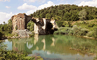
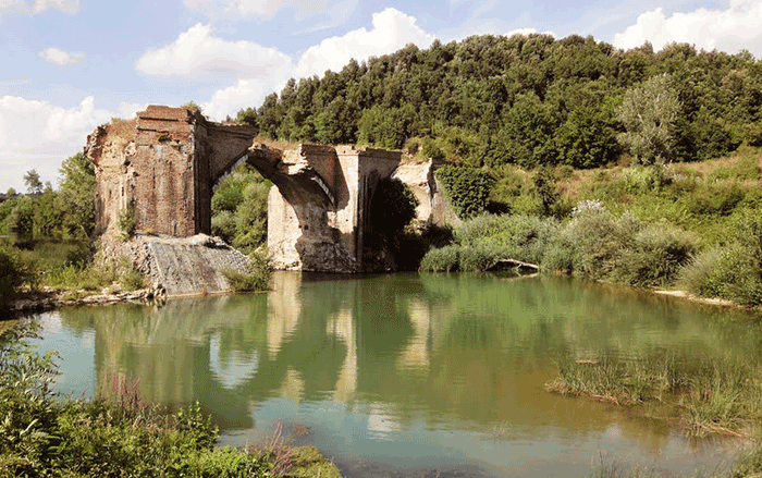
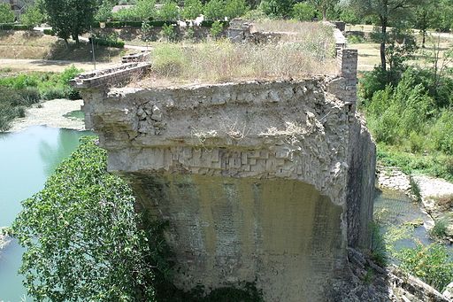
Il Ponte a Macereto è un ponte in Pietra a tre arcate edificato nel 1386 e ricostruito più grandioso nel 1827. Il ponte ha preso il nome da una piccola borgata che fino al secolo XIII ebbe chiesa parrocchiale (S. Niccolò), ora distrutta e riunita a quella di S. Lorenzo a Merse a circa 8 miglia toscane ad ovest di Sovicille, che si trova a 14 miglia toscane a settentrione del Ponte a Macereto.
Il ponte è anche detto Ponte Rotto sul fiume Merse, in quanto interrotto a circa metà della sua ampiezza e non più percorribile.[3]
Pieve di San Lorenzo a Merse
|
|
 |
| |
|
|
|
|
|
| |
|
|
|
Fonte: Edizione a cura dell’Ass. Pro Loco Monticiano - Via Senese, 6 - 53015 Monticiano (SI)
[2] Fonte: www.ecomuseovaldimerse.org
[3] Fonte: www.neogeo.unisi.it/
Bibliografia
AA.VV., Val di Merse. Casole d’Elsa, Chiusdino, Monticiano, Murlo, Radicondoli, Sovicille, Firenze, Aska edizioni, 2005, pp. 9-19.
Muscò D. (a cura di), Le mappe di comunità della biodiversità in Val di Merse, Monteriggioni, Associazione La Collina, 2009, pp. 95-117. Nonis D., I mammiferi del “Farma-Merse” e le loro tracce, Siena, Tipografia S. Giovanni, 1994.
Repetti E. Dizionario Geografico Fisico Storico della Toscana, Firenze 1833-1845 (versione on-line a cura del Dipartimento di Archeologia e Storia delle Arti dell’Università degli Studi di Siena, 2004), sub voce Mersa, Merse. |
|
|
|


