 |
|
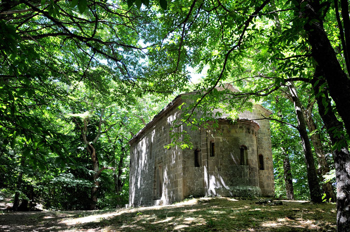
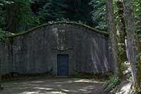
Immersed among chestnut, is the Ermicciolo of Vivo, a small church built with local volcanic rock, called trachyte. [Copyright © All rights reserved by Bruno Brunelli]
|
|
|
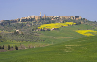
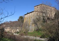
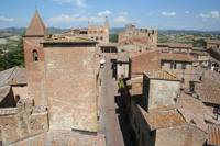
| The castle of Vivo d'Orcia boasts a long and fascinating history. The estate with the impressive castle and the romanesque church reaches back to the 11th century. In 1002 a hermitage was founded on this spot by camaldolese monks close to the source of the Vivo river.
|
Characteristics: not a particularly difficult itinerary, ideal even during the summer months, it almost completely unfolds among woodlands. |
||||
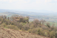
From Vivo d’Orcia we start downhill on Via dell’Eremo toward the white-fir forest of Vivo d’Orcia, one of the last remaining in Tuscany of this kind. At the end of the road we cross the bridge over the Vivo stream passing under a stone arch that leads to the Borgo dell’Eremo. Very few houses are clustered around the XVI century Palazzo Cervini and the church of San Marcello. We proceed going back to the stone arch without crossing the stream, turning left on a footpath that starts at a gate and some stone steps that climb up to the fir-woods. We carry on for about 10 minutes up to a junction where we turn right along a path that leads to the asphalted road (Vivo-Seggiano). Here turning left we carry on downhill for about 200 m to another junction where the right turn will lead us steeply uphill to the equipped area of Lo Scudellino. Carrying on the footpath, lined by a wooden fence up to some boulders and a little bridge that crosses over the Mulino stream, we reach some picnic tables in a chestnut-woods. Climbing up among the huge chestnut trees the footpath becomes wider and leads us to a T-junction at which we turn right and cross a wooden bridge to reach a dirt road next to Sasso della Lupareccia. Here, making a right turn we arrive, uphill, at the Ermicciolo. The dirt road leads, with no problems, to the asphalted road that we take uphill and on the left, up to a second dirt road that will take us to the equipped area of the Ermicciolo. Following the main road we get to a stone aqueduct and through a flight of stairs, on the right, we reach the little Romanesque church of the Ermicciolo, today private chapel of the Cervini family. Two drying kilns are at a stone’s throw away from here. Leaving the little church behind, we proceed on the footpath that going through the woods, will lead us, in few minutes, to a dirt road in the proximity of a hairpin. We carry on the right, down to the asphalted road. From here it is either possible to go back to Vivo d’Orcia on the asphalted road for about 1 km or by the dirt road on our right, previously covered, that goes up to the junction with the asphalted road which, turning right, will lead us to the centre of Vivo d’Orcia.
|
||||
 |
 |
 |
||
| Monte Amiata Album | Vivo d'Orcia, Pieve di San Marcello | L'Ermicciolo, Vivo d’Orcia
|
||
 |
 |
 |
||
| Palazzo Cervini in Eremo d'Orcia | Seccatoi, nella vicinanza dell’Ermicciolo
|
Sorgente dell'Ermicciolo, Vivo d'Orcia | ||
Mappa Eremo del Vivo, Vivo d'Orcia | Ingrandire mappa |
||||
|
||||
Eremicciolo di S. Benedetto
|
||||
|
||||
 |
||||
Podere Santa Pia |
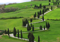
Pienza and the Val d'Orcia |
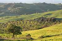
Century-old olive trees, between Podere Santa Pia and Cinigiano |
||
 |
 |
|||
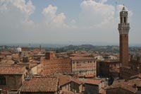
Siena, Piazza del Campo |
Lago Trasimeno |
Montalcino | ||
 |
||||
Sovicille |
Certaldo |
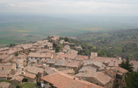
Monticchiello |
||
 |
||||
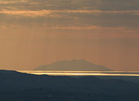
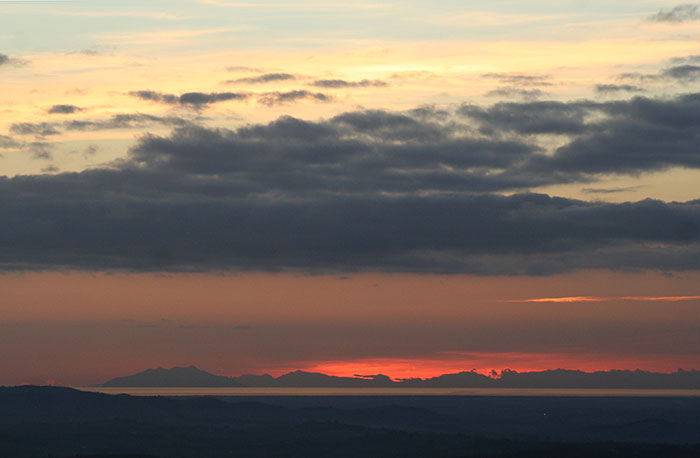
| View at Sunset to the Island Montecristo and the Maremma Coast from the terrace. Podere Santa Pia is a serene, strikingly beautiful and wholly sustainable oasis, situated in the midst of Tuscan Maremma's sublime unspoiled countryside. The ideal location for a memorable countryside Tuscan vacation. |
||||
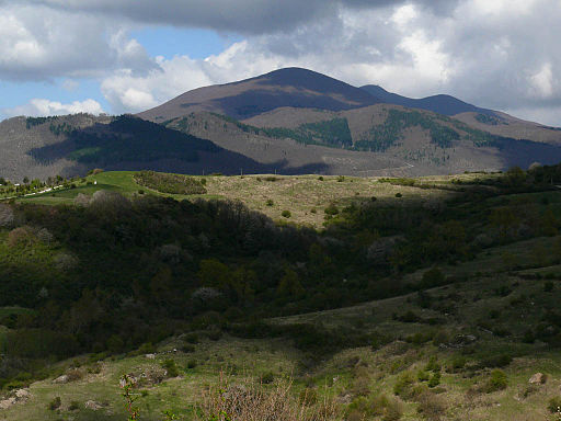
Trekking and hiking on Mount Amiata | Trails to discover the beauty of Mount Amiata (Eng)
|
||||
|
||||
Trekking sul Monte Amiata | Sentieri per scoprire le meraviglie del Monte Amiata (It)
|
||||
Dal Vivo d'Orcia all'Eremo e all'Ermicciolo fino alle sorgenti del Vivo [LUNGHEZZA: 10 Km circa. DURATA: 3 ore circa]
|
||||
|
||||