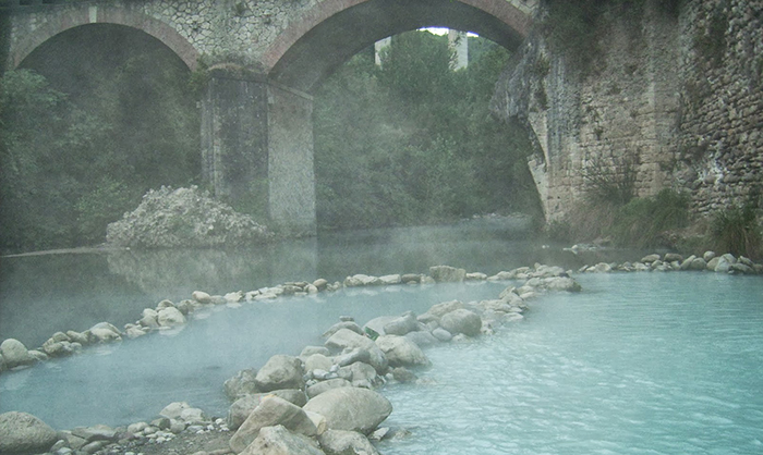
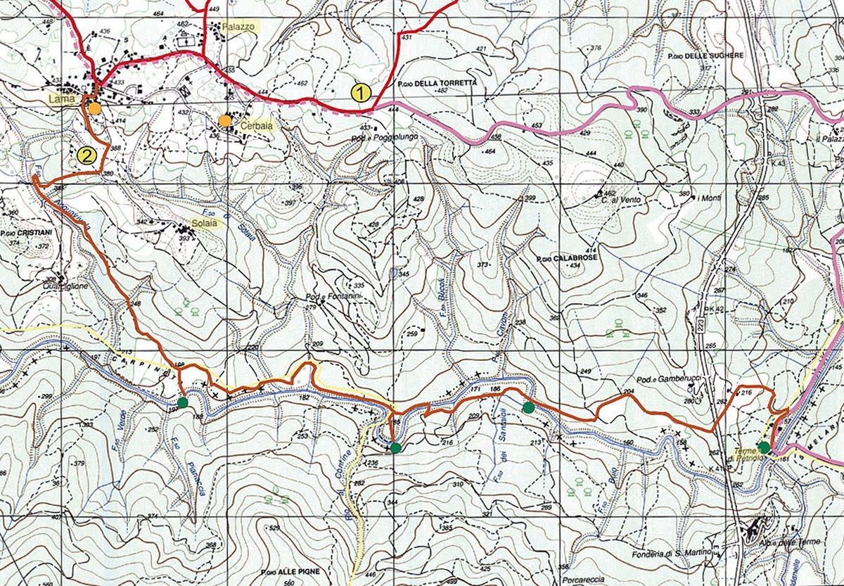
Number of the map: 2 - Length: 4 km. - Journey time: 2 h - Difficulty: medium-easy - Sign posting: scarce - Feasibility: by foot, by bike, by horse - Places off interest: river Farma, Petriolo springs.Petriolo
Notes: A good itinerary indicated by the CAI signs. Good for everyone and without particular difficulties. Quite shady, above all on the river Farma stretch. Particularly interesting are the Petriolo springs where a thermal spring forms hot water pools. Possible on mountain bike or horseback.
Lama is one of the four hamlets that make Iesa (the others are Palazzo, Solaia and Cerbaia ), marvellous and secluded village in the Farma Valley.
Leaving the hamlet of Lama in Iesa, we take the asphalted road in the Solaia direction. After descending for 500 m. we leave the main road for a gravely road on the left. The junction is indicated by the CAI sign (red and white), and by a series of “Parco Farma Merse” signs. The gravely road continues to descend for about 1 km. A hairpin bend near the F.sso Acquaiolo precedes by a few metres the Quarciglione junction. We follow the road in a SSE direction leaning the junction on your left. After about 1 km, we meet the plane of Carpineta and henceforth, the Farma river. The footpath hugs the plane. At this point the Farma forms a magnificent pound where it is possible to swim. The right bank of the river homes the most beautiful geological formations of the Farma, a marine deposit of the Carboniferous time (300 million years ago). The footpath goes beside, henceforth, the clearing and enters the forest on the Farma’s left bank. The flat footpath becomes steep and arrives at a small clearing with a crossroad. We take the left hand footpath you must pay particular attention to see the CAI signs although they are visible. We carry on along the footpath, which tends to go nearer to the river. The footpath meets the river and we continue uphill (after crossing a small ditch) and we meet a fenced clearing with a gate. We open gate (and closed afterward) and we carry on beside the clearing on the left. At the end of the clearing a second gate opens on a track. We take the road going downhill; that is, going right. The road meets the river Farma and continues beside it. After about 500 m a junction on the right, lead us to a creek, which is well worth a stop. Continuing along the road after around 200 m we cross the Farma and continue in the forest along a track. We leave slightly the river to maintain this parallel. After about 300 m the road again meets the Farma. We cross the river and follow a long ascent a shale road. After about 1 km the road meets a pillar of the highway 223 (Siena - Grosseto). We pass under the bridge (Petriolo bridge) and continue on the shale road to the Petriolo hot springs.
|