 |
|
Monticiano
|
|
Monticiano |
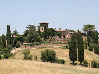
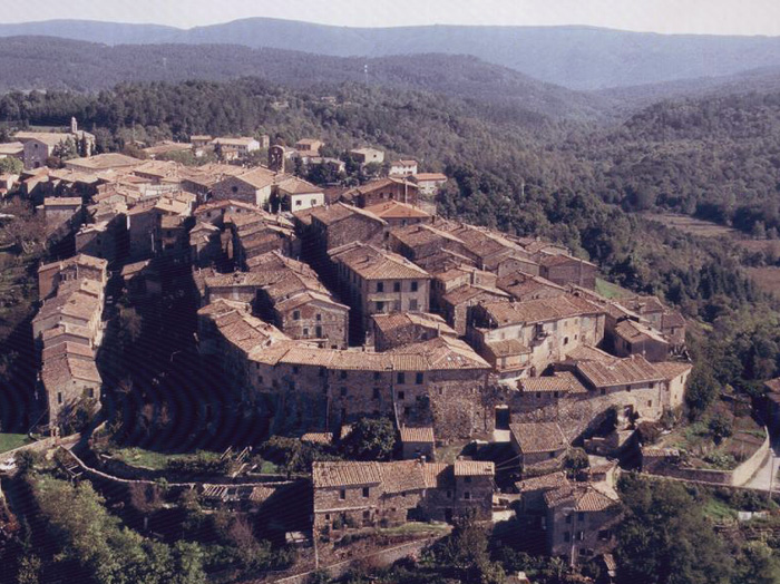
| Monticiano is a very old village which dates back to the 12th century. Originally a castle property of the Bishop of Volterra, it later came under the domination of Siena. The remains of the castle are still visible and the little streets of the village are very picturesque.
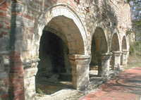
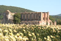
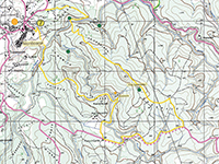
Monticiano is located in a beautiful area, in the heart of a valley between the river Merse and the river Farma. The oldest part of the village is located on a hilltop, within the remains of the ancient walls. From the top of the hill the view over the valley of the river Merse is breathtaking. The origins of the village are celebrated every year in October, when the Palio dei Ciuchi, a donkey race in medieval costumes, brings the past back to life. The village has two churches. The Romanesque Chiesa di Sant'Agostino of the late 13th century, with the chapter room of the former monastery frescoed by Bartolo di Fredi, Guidoriccio Cozzarelli and Giovanni di Bartolo di Fredi, Guidoriccio Cozzarelli e Giovanni di Paolo. In Gothic style it is one of the Augustinian order's oldest hermitages. The older parish Pieve dei Santi Giusto e Clemente, of the 12th century, has a neat stone façade. Monticiano is only 5km away from the Abbey of San Galgano and the legendary sword in the stone. There is a hiking trail through the woods which leads from Monticiano to the Abbey of San Galgano, one of the most beautiful monuments in Tuscany. The village of Bagni di Petriolo with the thermal spas Terme di Petriolo also belongs to the municipality of Monticiano. Worth seeing are the locality of San Lorenzo a Merse with the ancient castle and the Romanesque church, the hamlet of Castello di Tocchi, the ruins of the Castellaccio, Monte Quoio and Renna. Other sights and attractions are the Castle of Belagaio and the Palazzo Calliani. Early in June, in Monticiano, takes place the Palio dei Rioni horse race. Weekly Market in Monticiano is on Friday (Piazza S. Agostino 8:00-13:00).
I Bagni di Petriolo
Castello di Tocchi is an 11th century medieval fortified village on a hilltop about a mile from Tocchi. Its medieval circular stone walls and the magnificent arched entrance have remained intact.
|
||||
|
|
||||
 |
 |
 |
||
San Lorenzo a Merse
|
San Lorenzo a Merse, veduta | San Lorenzo a Merse, panorama | ||
 |
 |
 |
||
San Lorenzo a Merse, campanili
|
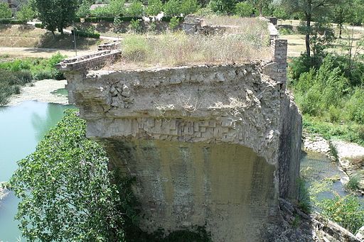
Ponte a Macereto | Ponte a Macereto | ||
 |
 |
 |
||
Pieve di San Lorenzo a Merse
|
Pieve di San Lorenzo a Merse, facciata
|
Pieve di San Lorenzo a Merse | ||
Bagni di Petriolo
|
||||
 |
 |
 |
||
Le terme medievali e la soprastante chiesetta, entrambe di origine medievale
|
Bagni di Petriolo, Monticiano |
Rovine delle mura cittadine di Bagni di Petriolo, Monticiano | ||
| Riserve Naturali Senesi | Nature Reserves | Map |
||||
| Riserva Naturale La Pietra | La Pietra Nature Reserve Situated in Upper Val di Farma, some kilometers in the south-east of the town of Monticiano, La Pietra Nature Reserve protects a territory almost entirely covered with woodlands, between the stream Farma and the last stretch of the stream Farmulla, one of its left tributaries. La Riserva Naturale Alto Merse | Upper Merse Nature Reserve In the valley there are numerous historical traces of the Middle Ages, such as the mills and the iron mines where iron was worked, powered by the energy provided by the water. The river Farma became an industrial centre for the working of iron. The most important ironworks used to be known as the Ruota (‘wheel’) and is now called the Ferriera. The whole building can still be seen, as well as a dam for the collection of water a few hundred metres upstream. The Hermitage of Montespecchio |
 I Canaloni |
|||
| The Hermitage of Montespecchio was built by monks of St. Augustine’s Order in 1192 near the famous serpentinite caves of Vallerano. The convent was built in two colours: pink and black marble, both valuable and expensive building materials. The church was part of one of the largest Augustinian convent complexes of its time from which only a few foundation stones remain today. |
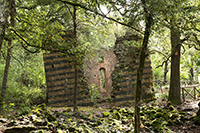 The Hermitage of Montespecchio |
|||
| The Farma Nature Reserve (it) Sentieri Farma Merse | Monticiano-Camerata Belagaio Castle - Torniella | 13 km, 4 hours Torniella - Sassoforte - Roccatederighi | 20 km, 5 hours Walking in Tuscany and the Val di Merse | From San Galgano to Monticiano Walking in Tuscany| From Monticiano to Camerata and the Hermitage of Camerata |
|
|||
I sentieri e le escursioni del Farma-Merse | Sentieri e Percorsi
|
||||
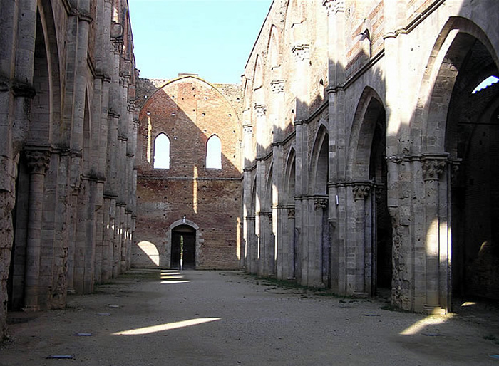 |
The ruins of the Abbey of San Galgano, where Tarkovsky shot the final scene of Nostalghia
|
The Abbey of Saint Galgano was a Cistercian Monastery found in the valley of the river Merse. The abbey was the location where parts of Andrei Tarkovsky's 1983 film Nostalghia were shot. Films set in Tuscany | Nostalghia (1983)
|
Monticiano borders Chiusdino, Civitella Paganico, Murlo, Roccastrada, Sovicille. To the municipality of Monticiano also belong the localities of Castello di Tocchi, Cerbai, Iesa, Lama, Palazzo, San Lorenzo a Merse, Solaia and Tocchi. |
Chiusdino | Istituto Osho Miasto Osho Miasto, the biggest Osho center in Italy, is located in a very quiet position, in the strong, wild and beautiful nature of Montagnola Senese, in Tuscany, close to Siena. All the activities are focused on Osho's work focusing on inner silence, awareness and celebration.
Holiday homes in the Tuscan Maremma | Holiday home Podere Santa Pia
|

