 |
|
Orvieto |
|
|
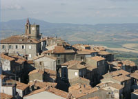
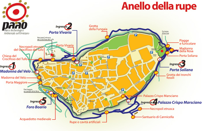
| The site of Orvieto is among the most dramatic in Europe, rising above the almost-vertical faces of tuff cliffs that are completed by defensive walls built of the same stone. Located on a plateau of volcanic tuff, the impressive city of Orvieto is surrounded by a stupendous landscape of fields and vineyards; the unbreachable walls appear to encircle the city rather than elevate it, as though it were a fortress rising on the flat valley floor of the river Paglia. Orvieto is surrounded by a pedestrian-only route that links several interesting sites belonging to the so-called PAAO (Archaeological and Environmental Park of the Orvieto area) along a loop-shaped path. |
Anello della Rupe is a path that goes around the entire rock of Orvieto, in a succession of hills that define the perimeter of the massive tufa rock on which the city rests. There are several entrances to the path around town, the most popular is in Piazza Cahen, called "Le Piagge". Walk down the street near the fortezza dell’Albornoz and cross the beautiful porta Rocca. Along the path there are several maps indicating your spot and interesting facts about the scenery. Look for small wooden signs reading “percorso”, to follow the correct path around the entire rock. |
||
 |
||
|
||
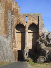
Porta Maggiore is the oldest monumental access to the city, since the Etruscan period, leading to the Bolsena lake. Madonna del Velo |
||
Etruscan Necropolis at Crocifisso del Tufo Sector of the Velzna (Volsinii) annular necropolis (6th-4th ent. B.C.) Porta Soliana |
||
| Eastern city gate known also as Porta Postierla or Porta Rocca, and medieval entrance to the city. The Grotta dei tronchi fossili (Cave of the Fossil Tree Trunks), located along the loop of the cliff near the access to the Archaeological and Environmental Park (PAAO) near Piazza Cahen, is a very interesting artificial cave, hosting paleobotanical remains dating back to 350 thousand years ago, belonging to the ecosystem that existed well before human presence, and preceded the formation of the tufa rock cliff on which Orvieto rises. Sanctuary of Cannicella One of the distinguishing features of the Cannicella necropolis is the presence of a temple (6th century BC) at its centre, which Riccardo Mancini discovered in 1884. The sanctuary, which seems to have been dedicated to Vei (see below), the goddess of death and fertility, was excavated in 1900 and 1936 and then from 1971. The most important find from the site was the so-called “Venus” of Cannicella, which Riccardo Mancini discovered (along with the temple itself) in 1884. In fact, this naked marble figure (ca. 530 BC) probably represents Vei. The portrayal of a naked female such as this is extremely unusual in this period: she seems originally to have worn gold necklaces and earrings. Excavations carried out in 1990 unearthed part of the figure's right arm, which was subsequently re-attached. |
||
| The Duomo di Orvieto |
||
| A visit to Orvieto can start right from the Cathedral. The Duomo di Orvieto is the cathedral of the Diocese of Orvieto-Todi and a masterpiece of Gothic architecture in Central Italy. The Gothic façade of the Orvieto Cathedral is one of the great masterpieces of the Late Middle Ages. The three-gable design is attributed to Maitani, who had clearly undergone some influence by the design scheme for the façade in Tuscan Gothic style of the Siena Cathedral by Giovanni Pisano (1287–1297) and the plan for façade of the Florence Cathedral by Arnolfo di Cambio (1294–1302). Inside, the Cappella del Corporale was built between 1350 and 1356 to house the stained corporal of the miracle of Bolsena. It is from this chapel that the reliquary with the corporal is carried in religious processions through the town on the Feast of Corpus Christi. The Chapel of the Madonna di San Brizio was a fifteenth-century addition to the cathedral. It is almost identical in structure to the Chapel of the Corporal. The construction of this chapel (also known as the Cappella Nuova and Signorelli chapel) was started in 1408 and completed in 1444. Fra Angelico and Benozzo Gozzoli began the decoration of the vault of the chapel in 1447. They painted only two sections: Christ in Judgment and Angels and prophets as they were summoned in the same year to the Vatican by Pope Nicholas V to paint the Niccoline Chapel. After being abandoned for about 50 years, the decoration of the rest of the vault was awarded to Luca Signorelli on 5 April 1499. He added the scenes with the Choir of the Apostles, of the Doctors, of the Martyrs, Virgins and Patriarchs. His work pleased the board and they assigned him to paint frescoes in the large lunettes of the walls of the chapel. Work began in 1500 and was completed in 1503. (There was a break in 1502 because funds were lacking.) These frescoes in the chapel are considered the most complex and impressive work by Signorelli. He and his school spent two years creating a series of frescoes concerning the Apocalypse and the Last Judgment, starting with the Preaching of the Antichrist, continuing with tumultuous episodes of the End of the World, finding a counterpart in the Resurrection of the Flesh. The fourth scene is a frightening depiction of the Damned taken to Hell and received by Demons. On the wall behind the altar, Signorelli depicts on the left side the Elect being led to Paradise and on the right side the Reprobates driven to Hell. He added to these expressive scenes some striking details. On the same square as the Cathedral you can also see the Faina and Soliano Palaces, both now holding prestigious museums. To the right of the cathedral there is a small square, part of the papal and Episcopal palace complex and known as the Papal Palace, home to the National Archaeological Museum. Duomo | Orari dal 1°Novembre al 28 Febbraio : 7.30 – 12.45 14.30 – 17.15 da Marzo ad Ottobre 7.30 – 12.45 14.30 – 18.15 dal 1° Aprile al 30 Settembre 7.30 – 12.45 14.30 – 19.15 Museo dell'Opera del Duomo di Orvieto Piazza del Duomo, 26, 05018 Orvieto Terni 0763 342477 Orario di apertura: martedì e giovedì: 10.00 – 12.00 sabato: 11.00 – 13.00 e 15.00 – 18.00 domenica: 10.00 – 13.00 e 15.00 – 18.00 www.opsm.it Tourist Information | APT Office, Orvieto, Piazza del Duomo 24 The National Archaeological Museum and Museo Claudio Faina Located on the ground floor of the Papal Palace, the National Archaeological Museum hosts materials of great interest coming from the necropolis of Crocifisso del Tufo, Cannicella, Fontana del Leone, Settecamini, Porano. |
||
 |
||
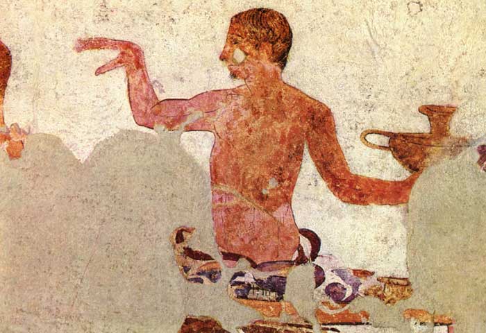
Preparation for the feast (detail), ca. 340—280 B.C. Orvieto, Golini tomb |
||
| Fondazione Museo Claudio Faina | Archaeological Museum The Museo Faina contains one of Italy’s finest archaeological collections, brought together by two aristocrats, Mauro and Eugenio Faina, who from 1864 went personally on digs and acquired items on the open market. Located in Palazzo Faina, the Museo Claudio Faina is directly opposite the Duomo and extends on two floors of the building. Archaeological Museum Museo Claudio Faina e Museo civico |
||
Walking in Tuscany | Walking in the surroundings of Orvieto |
||
| From Orvieto to Civita di Bagnoregio |
||
| From Piazza Cahen, looking at the funicular station, take the downhill road to your right, that borders the walls of the Albornoz Rock. There is public transport to go back to Orvieto, and you can take the COTRAL public bus from the terminus in Bagnoregio's Piazzale Battaglini. Transport | www.cotralspa.it Walking in Tuscany | From Orvieto to Civita di Bagnoregio |
 Civita di Bagnoregio |
|
Orvieto frazioni are Bagni di Orvieto, Bardano, Baschi Scalo, Benano, Biagio, Botto di Orvieto, Canale di Orvieto, Canonica, Capretta, Ciconia, Colonnetta di Prodo, Corbara, Fossatello, Morrano, Orvieto Scalo, Osteria Nuova, Padella, Prodo, Rocca Ripesena, San Faustino, Sferracavallo, Stazione di Castiglione, Sugano, Titignano, Tordimonte and Torre San Severo.
|
||
Enlarge map |
||
Comuni in the Province de Terni, in southern Umbria | Acquasparta · Allerona · Alviano · Amelia · Arrone · Attigliano · Avigliano Umbro · Baschi · Calvi dell'Umbria · Castel Giorgio · Castel Viscardo · Fabro · Ferentillo · Ficulle · Giove · Guardea · Lugnano in Teverina · Montecastrilli · Montecchio · Montefranco · Montegabbione · Monteleone d'Orvieto · Narni · Orvieto · Otricoli · Parrano · Penna in Teverina · Polino · Porano · San Gemini · San Venanzo · Stroncone · Terni |
||
Google Maps | Wikiloc - percorso Giro della Rupe di Orvieto - Orvieto, Umbria (Italia) Orvieto | Orvieto Restaurants |
||
|
||||
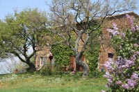
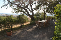
Podere Santa Pia |
Podere Santa Pia |
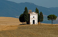
Madonna di Vitaleta Chapel, San Quirico d'Orcia |
||
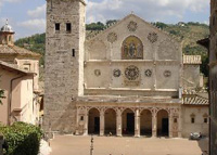
Spoleto, duomo |
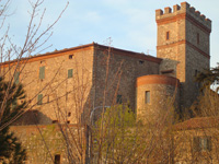
Castiglioncello Bandini |
San Qurico d'Orcia |
||
 |
||||
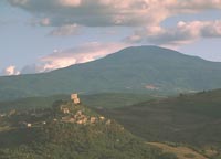
Rocca di Tentennano |
Castell'Azarra |
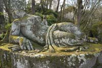
Il parco dei Mostri in Bomarzo |
||
 |
||||
Podere Santa Pia, situated in a particularly scenic valley, which overlooks on the hills around Cinigiano,
up to the Maremma seashore and Monte Christo |
||||

