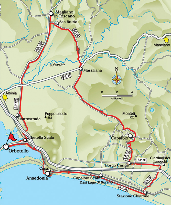
The Lower Albegna Plain
Orbetello - Strada di Camerette - Ansedonia (Cosa ) - Oasi WWF Lago di Burano - Chiarone Scalo - Garavicchio (Giardino dei Tarocchi) - Borgo Carige - Capalbio - Marsiliana - Magliano in Toscana - Quattrostrade - Orbetello Scalo - Orbetello
33. The Lower Albegna Plain - 89 km
Orbetello - km 0 - Strada di Camerette - km 4 - Ansedonia (Cosa) - km 10.9 - Oasi Lago di Burano - km 19.2 - Chiarone Sc alo - km 26.2 - Garavicc hio - km 31.4 (Giardino dei Tarocchi) - Borgo Carige - km 36 - Capalbio - km 41 - Marsiliana - km 55 -Magliano in Toscana - km 65.6 - Quattrostrade - km 82.4 - Orbetello Scalo - km 85 - Orbetello - km 89
Starting point and arrival: Orbetello
Distance in kilometres: 89 km
Difference in altitude: 550 m
Type of road: tarred road (con un tratto di 1.4 km on dirt track)
Bicycle: roadster and all-terrain
Difficulty: average
NOTES: A smoothly flowing itinerary without any particular difference in altitude but with a long distance in kilometres. Expert and well trained cyclists can choose this itinerary to improve on the distance and to pedal with fluidity. From the touristic point of view one cycles by very interesting areas like the Orbetello Lagoon, the archaeological ruins of Cosa (Ansedonia), the WWF Sanctuary of Burano, the Tarot Garden and the towns of Capalbio and Magliano in Toscana.
|
From Orbetello one takes the cycle lane leading to Orbetello Scalo. Near the hospital one cycles on as far as a large roundabout where one takes the Vecchia Aurelia (one way) up to a nearby crossing where one turns right taking the Strada di Camerette. The tarred path winds parallel to the railway and after about 2 kilometres meets a shut gate.
|
 |
Riserva naturale Laguna di Orbetello di Ponente [4]
|
From this point the path is allowed only to cyclists and pedestrians. Skirting the Orbetello Lagoon one reaches the end of this path (another gate) near a crossing (8 kilometres): one continues on the right (on the left the railway bridge) and, immediately after, one follows the road signs to Ansedonia and the archaeological ruins of the town of Cosa. One cycles mainly uphill to reach the summit of the headland (10.9) and past the possible deviation on the left to Cosa, one cycles downhill for 1.1 kilometres as far as a large crossing (12) cycling then straight on towards Capalbio Scalo (on the right it leads to Ansedonia Mare and on the left to the Aurelia) on the provincial road S.P. 68. After further 2.4 kilometres one reaches the entrance of the WWF Sanctuary of Burano (19.2), an ideal stop for nature lovers and birdwatchers.
Nature Reserve Laguna di Orbetello di Ponente
The WWF Oasis of Orbetello is the most important lagoon of the Tiyrrhenian sea.
Due to its geographical location the WWF Oasis of Orbetello sees the concentration of thousands of birds, especially in winter. A wetland of international importance (Ramsar Convention) the Oasis of Orbetello protects 300 hectares of salty lagoon where at times small silt islands covered with swamp vegetation emerge.
See also www.wwf.it/oasi
Museo Archeologico Nazionale di Cosa
Via delle Ginestre, 35, 58015 Ansedonia, Orbetello GR
L'Oasi WWF del Lago di Burano
The Burano Lake protected area is the first WWF Oasis. It includes coastal sand dunes, Mediterranean maquis and a salty lake dominated by a tower.
Entrance Oasi
Strada Prov. del Chiarone 35
58010 Capalbio Scalo (Gr)
Aperta da settembre al primo maggio, visite solo guidate, la domenica alle ore 10.00 e alle 14.30 (ora legale 15.00).
 Mappa Oasi Lago di Burano Mappa Oasi Lago di Burano
|
 |
|
 |
|
 |
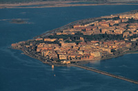
| Orbetello |
|
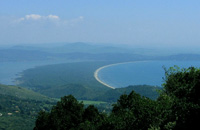
Tombolo Feniglia, vista da Monte Argentario
|
|
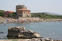
Spiaggia e Torre della Tagliata, detta anche Torre Puccini, poiché il compositore Giacomo Puccini vi soggiornò dal 1919 al 1922. |
| |
|
|
|
|
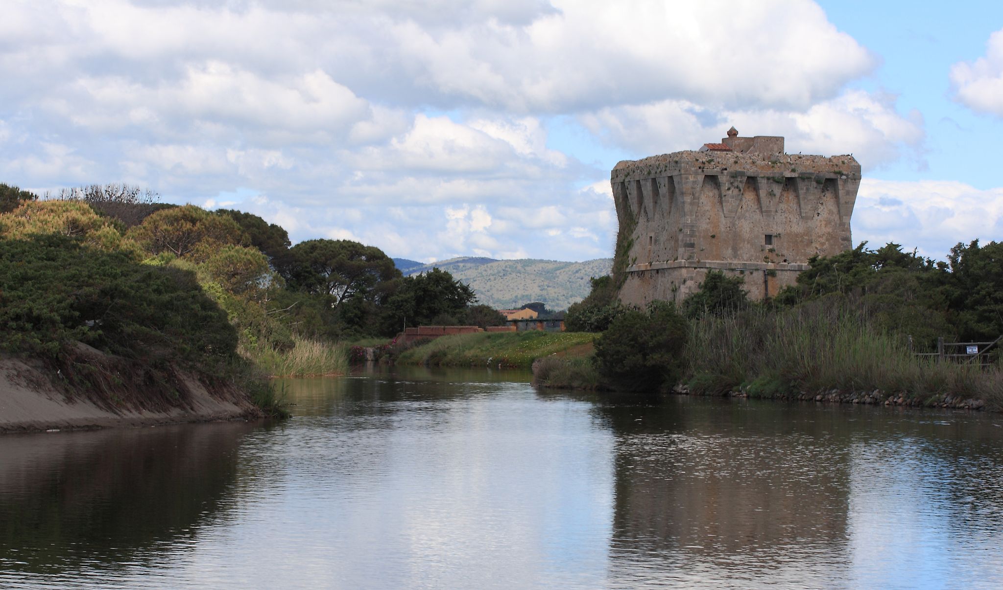 |
Lago di Burano, Torre di Buranaccio [2]
|
The itinerary continues without any great difficulty skirting the lake of Burano to reach a crossing (25.8) where the road continues on its natural flow to the left towards Chiarone and the national road S.S. 1 Aurelia passing under the railway. Past the railway underpass one keeps to the left in the direction of Aurelia and Pescia Fiorentina reaching Chiarone Scalo. Past the small urban centre with its station, near two tall stone pines (26.7) one turns right in the direction of the Aurelia on the S.P. 75. After 3.5 kilometres one cycles under the S.S. 1 Aurelia (4 lanes) continuing in the direction of Pescia Fiorentina. At the next crossroads (31.2) one turns left to take the S.P. 93 “Pedemontana” towards Carige. Precisely nearby the crossing, at the beginning of the Pedemontana one can see the Tarot Garden on the right, undoubtedly deserving a visit. The Pedemontana stretches wavily and it is fringed with fine cork oaks crossing the typical Maremma countryside with its olive groves, wheat fields and farmhouses. Reaching Borgo Carige at the end of the urban area (35.9) one leaves the Pedemontana to take the S.P. 63 towards Capalbio on the right. After about 2 kilometres the road leaves the countryside to enter a thick holm oak grove where the good to cycle on climb to Capalbio (41) begins.
|
 |
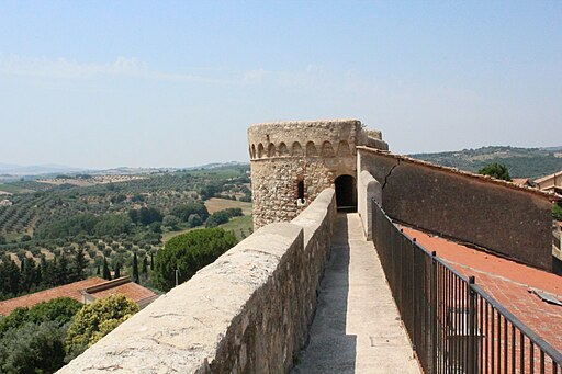
Capalbio
|
Past a possible detour into town the itinerary continues downhill on the S.P. 63 turning left towards Marsiliana, Albinia, Magliano in Toscana. After a first stretch steeply downhill one continues on ups and downs and then on a level stretch as far as Borgo Marsiliana (55). From here one cycles on in the direction of Manciano on the regional road S.R. 74 for about 400 metres as far as the crossroads on the left to Magliano in Toscana. One takes the S.P. 94 “Sant’Andrea” passing shortly afterwards the river Albegna. One continues on the S.P. 94 on a gentle climb along the Fosso Patrignone. After about 7 kilometres one can make a short detour to visit the ruins of the San Bruzio Church and a couple kilometres further on one reaches a T-crossing on the S.P. 160 where one turns right to Magliano in Toscana about 1 kilometre away (65.6). Crossed the old town centre one returns onto the S.P. 160 in the direction of Albinia. The road stretches mainly downhill as far as the bridge over the river Albegna (78) and shortly after one crosses the S.R. 74 following the road signs to La Parrina on the S.P. 128 constantly on a flat course. One continues as far as the Quattrostrade hamlet (82.4). About 50 metres before meeting the S.S. 1 Aurelia one turns left onto a bypath “Via Vicinale dei Poggi” following the indication to the manège. After 500 metres one turns right at the T-crossing once more onto the “Via Vicinale dei Poggi”. One negotiates a stretch of 1.4 kilometres on a dirt track and then on a tarred road always keeping to the main road until meeting the S.S. Aurelia (85.5) where one turns left (direction Rome). The next 500 metres on the freeway claim the utmost attention as far as the detour to Orbetello. At Orbetello Scalo one follows the road signs to the hospital to find (near a roundabout) the access to the cycling lane leading to Orbetello (89). [1]
|
| |