Abbadia San Salvatore

Abbey of Sant'Antimo

Albarese

Acquapendente


anghiari

Archipelago Toscano


Arcidosso


Arezzo


Asciano


Badia di Coltibuono


Bagni San Filippo

Bagno Vignoni

Barberino Val d'Elsa

Beaches

Bolsena Lake


Bomarzo

Brunello di Montalcino

Buenconvento

Campagnatico


Capalbio


Castel del Piano


Castelfiorentino

Castell'Azzara

Castellina in Chianti


Castelmuzio


Castelnuovo Bererdenga


Castiglioncello Bandini


Castiglione della Pescaia


Castiglione d'Orcia


Castiglion Fiorentino


Celleno


Certaldo


Chinaciano Terme


Chianti


Chiusi


Cinigiano


Città di Castello

CivitÀ di Bagnoregio


Colle Val d'Elsa


Cortona


Crete Senesi


Diaccia Botrona

Isola d'Elba

Firenze


Follonica


Gaiole in Chianti


Gavorrano

Gerfalco


Greve in Chianti


Grosseto


Lago Trasimeno


La Foce


Manciano


Maremma


Massa Marittima


Montagnola Senese


Montalcino


Monte Amiata


Monte Argentario

montecalvello

Montefalco


Montemassi


Montemerano


Monte Oliveto Maggiore


Montepulciano


Monteriggioni


Monticchiello


Monticiano


Orbetello


Orvieto


Paganico


Parco Naturale della Maremma


Perugia


Piancastagnaio


Pienza


Pisa


Pitigliano

Prato

Radda in Chianti


Roccalbegna


Roccastrada


San Bruzio


San Casciano dei Bagni


San Galgano


San Gimignano


San Giovanni d'Asso


San Quirico d'Orcia


Sansepolcro


Santa Fiora


Sant'Antimo


Sarteano


Saturnia


Scansano


Scarlino


Seggiano


Siena


Sinalunga


Sorano


Sovana


Sovicille

Talamone

Tarquinia


Tavernelle Val di Pesa


Torrita di Siena


Trequanda


Tuscania


Umbria


Val d'Elsa


Val di Merse


Val d'Orcia


Valle d'Ombrone


Vetulonia


Viterbo

Volterra


Walking in Tuscany


The Upper Fiora Valley


album Surroundings


Cycling in the Tuscan Maremma | The Upper Fiora Valley


The Upper Fiora Valley
Santa Fiora - Torrente Scabbia - Torrente Rigo Secco - Selva - Santa Fiora


25. The Upper Fiora Valley


Santa Fiora - km 0 - Torrente Scabbia - km 4.8 - Torrente Rigo Secco - km 7.8 - Selva - km 12.4 - Santa Fiora - km 34.3

Starting point and arrival: Santa Fiora
Distance in kilometres: 34.3 km
Difference in altitude: 750 m
Type of road: 19.6 km tarred road + 14.7 km dirt track
Bicycle: MTB and all-terrain
Difficulty: average - demanding

NOTES: An itinerary of great landscape interest on roads having scant motorized traffic. The most demanding stretches are the final part of
the dirt track leading to the provincial road S.P. 4 before Selva, the S.P. 123 which climbs skirting the Fiora in the first part (1.5 kilometres) and
the last uphill slope towards Santa Fiora.


One leaves the square in Santa Fiora and clearing the bridge past the supermarket one turns right downhill in the direction of Selvena and Sorano on a road (S.P. 4) marked by wide hairpin bends. After about 2.9 kilometres, by a cold meats plant (on the right), one leaves the tarred road to take the dirt track on the left that reaches without any asperity the ford in the torrent Scabbia 2 kilometres away (4.8). From this point the road continues continuously and gently uphill and after 1.6 kilometres one leaves the main track to take the dirt track on the left.

The gradient diminishes getting to the next ford in the torrent Rigo Secco (7.8). But the climb gets more demanding and reaches, after 2.2. kilometres, with a series of hairpin bends the S.P. 4 where one turns right to reach Selva (12.4). Cycling through the hamlet one continues downhill in the direction of Santa Fiora for 2.7 kilometres as far as a well-defined hairpin bend on the right. Here one leaves the S.P. 4 to take the S.P. 123 on the left following the road sign “Convento”. After a short time one reaches the convent and the road starts downhill for about 1.6 kilometres as far as a fountain (on the left) and a hairpin bend on the right. Before reaching the fountain one takes the dirt track “Via del Prato” on the left that slopes uphill and after about 1 kilometre becomes gentler to continue with a flat stretch and then a steep descent as far as T-crossing where one keeps to the right. Shortly afterwards another T-crossing on a tarred road and again to the right on the S.P. 119; before the bridge one turns right again and shortly afterwards a stretch (1.5 kilometres) of steep slope uphill on a tarred road begins.

The slope becomes gentler to continue with a flat stretch (3.4 kilometres) until it takes a small dirt path on the left which after 1.9 kilometres returns to the S.P. 4 where one turns left downhill. In a short time one reaches again the cold meats plant, met before, and one returns to Santa Fiora uphill on the already covered road (34.3).


Santa fiora, veduta 01

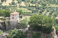
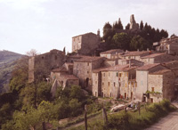
Santa Fiora, view[2]


La Riserva Naturale Bosco della S.S.Trinità


La Riserva Naturale Bosco della S.S.Trinità si trova nel comune di Santa Fiora e si estende per 37 ettari lungo l’Alta Valle del Fiora. L’area è caratterizzata dalla presenza di un nucleo relitto di Abete bianco, entità endemica dell’Appennino. L’altitudine oscilla fra i 600 e 720 metri e interessa il versante ovest del Monte Calvo. All’interno dell’Area Protetta si trova il Convento Francescano della S.S. Trinità, di notevole importanza storica. Secondo una leggenda popolare il Convento fu costruito per ricordare il Conte Guido Sforza del 1400 che avrebbe ucciso un drago che terrorizzava gli abitanti; una metà della testa del drago, tagliata verticalmente, fu mandata al Papa mentre l'altra sarebbe quella che si può vedere nel Convento.

The Bosco della SS Trinità Nature Reserve is located in the commune of Santa Fiora. The area boasts a variety of white firs, a native species of the Apennine area. Altitude in the area varies from 600 to 720 meters and is located on the western slopes of the Monte Calvo. The important SS Trinità Franciscan convent is located inside the nature reserve.

Vegetation

The white fir in the southern most area is accompanied by various other tree species, including lime, maple, chestnut, oak, helm and nut. The presence of white firs at a relatively low altitude has been documented since antiquity; the massive evergreens found in the reserve are in truly excellent condition.

Fauna

Both the reserve and the surrounding area offer the opportunity to observe a diversified ornithological community that include numerous birds of prey like the short-toed eagle, honey buzzard, sparrow hawk and more. The richness and integrity of the ecosystems within the reserve allows for the presence of forest birds of prey and other native species. There is a small lake where trout may be introduced for reproduction purposes to aid in the repopulation of the Fiora River.

The SS Trinità Convent

The important SS Trinità Franciscan convent is located inside the nature reserve. According to popular legend, the SS Trinità convent was built in memory of Count Guido Sforza who, in the year 1400, killed a dragon that had been terrorizing the locals. He sliced the dragon’s head in two vertical parts and sent one half to the pope while the other half stayed at the convent. The religiousness of the people and the convent is well known thanks to the fact that the sanctuary is renowned as far as the Maremma area in southern Tuscany. Pilgrims and nobles would come from miles around during the Middle Ages to ensure the salvation of their souls. The area boasts a fountain nicknamed the “Pope’s Fountain”.


Roccalbegna, cassero  
 
Roccalbegna, cassero  
Santa Fiora
  Eremo di David Lazzaretti or Torre Giurisdavidica, Riserva Naturale Monte Labbro


Traveling in Tuscany| Holiday homes in southern Tuscany | Podere Santa Pia


Podere Santa Pia  

Albegna


  Rocchette di Fazio

Walking and trekking in Tuscany

Da Roccalbegna a Rocchette di Fazio | Percorso a piedi, a cavallo e in bicicletta - 10 km

Trekking in Toscana | Da Roccalbegna alla Riserva Naturale del Pescinello

Trekking in Toscana | Parco Faunistico del Monte Amiata : Il Sentiero Natura

Trekking in Toacana | Nell' Oasi WWF del Bosco Rocconi


Valley of the Albegna River (Valle dell’Albegna) between Roccalbegna and Rocchette di Fazi
Valley of the Albegna River (Valle dell’Albegna) between Roccalbegna and Rocchette di Fazio, Province of Grosseto, Tuscany, Italy. Seen from South to North, in the background Roccalbegna [3]


Cycling in Tuscany | Cycling tours in Southern Tuscany


Veduta di Santa Fiora

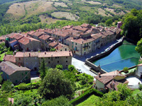
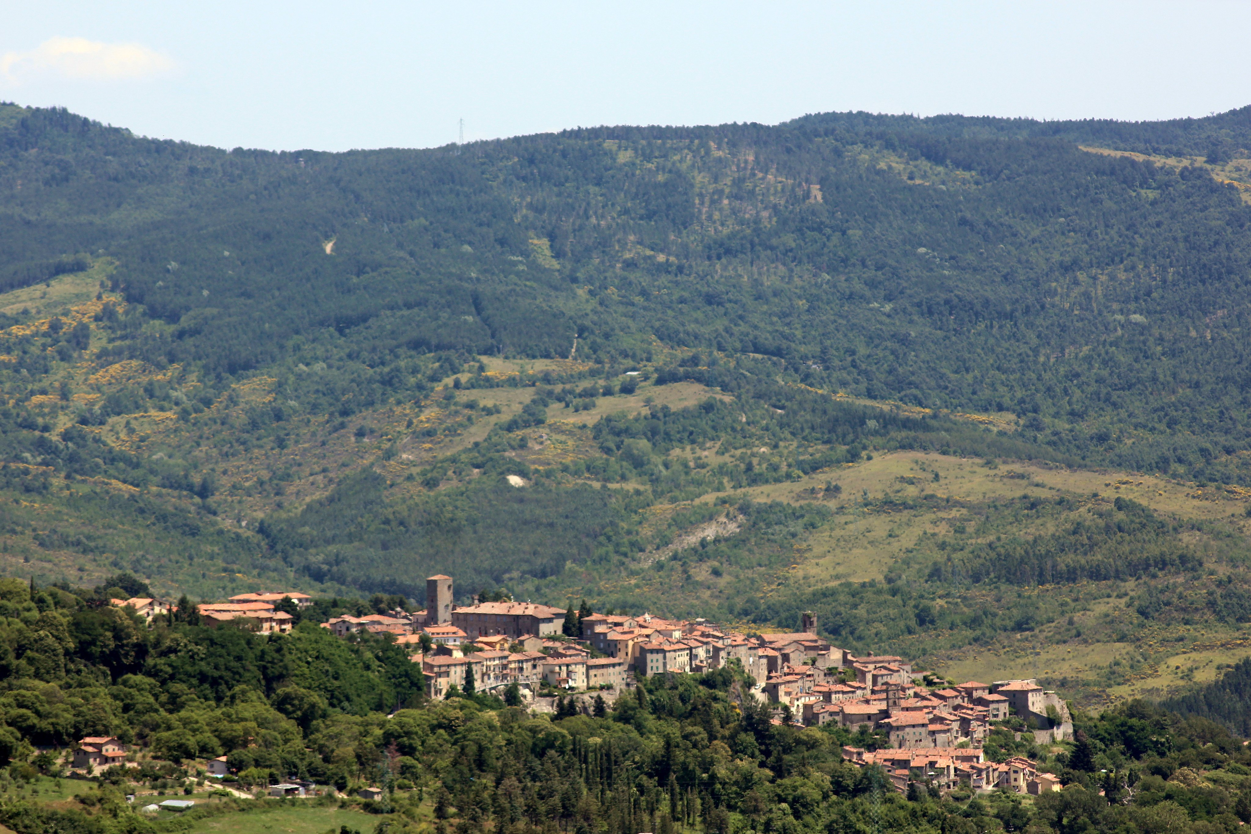
Panorama Santa Fiora [3]


[1] Source: Cicloturismo Toscana | www. maremmabike.it
[2] Foto Alienautic, licenziato in base ai termini della licenza Creative Commons Attribution-Share Alike 3.0 Unported.
[3] Foto LigaDue, licenziato in base ai termini della licenza Creative Commons Attribuzione-Condividi allo stesso modo 4.0 Internazionale