| |
|
CICLOPISTA DEL SOLE
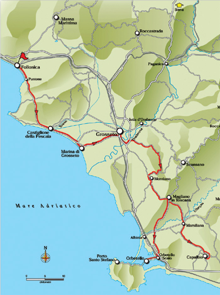
Follonica - Castiglione della Pescaia - Marina di Grosseto - Grosseto - Strada Comunale della Grancia - Montiano - Magliano in Toscana
Variante Capalbio: Marsiliana - Capalbio
Variante Capalbio: s.r. 74 - Quattrostrade - Orbetello Scalo - Orbetello)
34. Ciclopista del Sole - 94.3 km (Capalbio) / 93.5 km (Orbetello)
Follonica - km 0 - Castiglionedella Pescaia - km 17.7 - Marina di Grosseto - km 28.8 - Grosseto - km 41.7 - Strada Comunale - km 46.5 - della Grafica Montiano - km 49.6 - Magliano in Toscana - km 69.7 -
Variante Capalbio: Marsiliana - km 79.3 - Capalbio - km 94.3 -
Variante Argentario: S.R. 74 - km 81.5 - Quattrostrade - km 86.5 - Orbetello Sc alo - km 89.5 - Orbetello - km 93.5
Starting point: Follonica
Arrival point: Orbetello
Distance in kilometres: 94.3 km (Capalbio)
93.5 km (Orbetello)
Difference in altitude: da 500 a 1000 m
Type of road: tarred road
Bicycle: roadster and all-terrain
Difficulty: average - easy
NOTES: In line route stretching from the coast to the Maremma inland. It belongs to the great Italian directrix linking the Brenner to Naples.
It is a good to cycle on route including also the possibility of an integrated transport by rail, line (Roma-Genova) halting at several stations like
Follonica, Grosseto, Orbetello and Capalbio.
From Follonica one takes the provincial road S.P. 158 following the coast as far as the locality Puntone (4.8) and continuing towards the inland reaching Castiglione della Pescaia (17.7). From here, past the bridge over the river Bruna, one cycles towards the coastal pine wood of the Tombolo where the cycling lane begins, leading to Marina di Grosseto (28.8).
|
 |
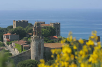
Porto Punta Ala, Castiglione della Pescaia[3]
|
From here one returns inland as far as the crossing with the S.P. 158 (30.2) to take the bike lane leading to the centre of Grosseto (41.7). From here the road stretches southward parallel to the railway following the road signs to Siena and Scansano. Arriving at a roundabout (42.9) one follows the railway underpass in the direction of Rome and taking Via Aurelia Sud. One leaves the inhabited area taking the S.P. 154 “Spadino” (43.2), reaching the bridge over the Ombrone (45.3). Immediately past the bridge one turns right following the road signs to Istia d’Ombrone and Pratini. At the roundabout one continues towards Scansano and Istia d’Ombrone passing under the S.P. 54. At the next crossing one turns right to Scansano, Pratini and Strada Vicinale Montiano. One cycles under the four lanes of the S.S. 1 Aurelia (46.4) following the indication “Pratini A”. Here begins the Strada Comunale della Grancia that at first gently uphill and then downhill winds across a significant stretch of countryside with farmhouses. One keeps to the main route avoiding every detour. After 3.2 kilometres the Strada Comunale della Grancia joins the S.P. 16 to Montiano (49.6) at a T-crossing. From here one cycles uphill across the fair hills of the inland skirting the town of Montiano (59.6) and on ups and downs across vineyards one reaches Magliano in Toscana (69.7). At this point the Ciclopista del Sole offers two possibilities: to cycle in the direction of Capalbio or in that of Monte Argentario.
|
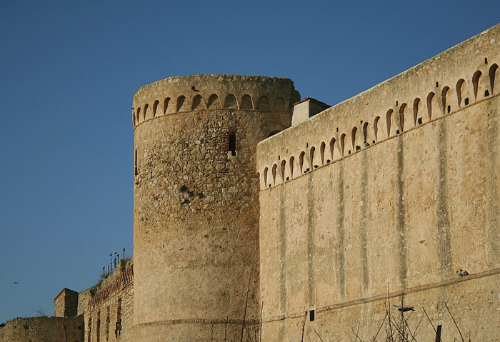 |
Magliano in Toscana
|
CAPALBIO OPTION: From Magliano in Toscana one takes the S.P. 94 “Sant’Andrea” stretching continuously and pleasantly downhill past the bridge over the river Albegna to join the S.R. 74. At the crossing one turns right and after 400 metres one rapidly reaches the urban area of Marsiliana (79.3) where one leaves the S.R. 74 to take the S.P. 63 “Capalbio”. During the first 3 kilometres the road stretches on with ups and downs and then further on evenly across vineyards, tilled fields and maquis. Yet a stretch with ups and downs and after 12 kilometres the climb towards Capalbio begins. One cycles uphill for about 2 kilometres as far as a T-crossing where one turns right towards the middle of the town (94.3)
|
 |
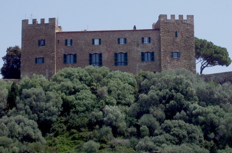
The Maremma Coast, taken from the Old Town of Castiglione della Pescaia [5]
|
ARGENTARIO OPTION: From Magliano in Toscana one takes the S.P. 160 in the direction of Albinia. The road stretches mainly downhill as far as the bridge over the Albegna and shortly afterwards it crosses the S.R. 74 (81.5) following the road signs to the locality La Parrina on the S.P. 128 on flat land. Past the fork in the road one cycles on as far as the Quattrostrade hamlet (86.5). About 50 metres before meeting the S.S. 1 Aurelia one turns left onto a bypath “Via Vicinale dei Poggi” following the indication to a manège. After 500 metres one turns right at the T-crossing once more onto the “Via Vicinale dei Poggi”. One negotiates a stretch of 1.4 kilometres on dirt track and then on a tarred road one keeps always to the main road until meeting the S.S. Aurelia 1 (89.6) where one turns left (direction Rome). The next 500 metres on the freeway claim the utmost attention as far as the detour to Orbetello. At Orbetello Scalo one follows the road signs to the hospital to find (near a roundabout) the access to the cycling lane leading to Orbetello (93.5)
TO THE MAREMMA REGIONAL PARK (avoiding the S.S. Aurelia 1) Reference point is the S.P. 16 Montiano. Arriving from Montiano or from Grosseto (Strada Comunale della Grancia) one cycles on the S.P. 16 and, a little before reaching the fork Rome/Grosseto - in short the ramps to the S.S. 1 “Aurelia” - one reaches a crossroads where one takes the dirt track on the left: after 500 metres the bypath passes by a pull-in on the S.S. 1 “Aurelia”. Here one turns left onto the Strada di Valle Maggiore. After about 500 metres the road starts gradually uphill surrounded by the maquis, clearing a hill after about 2.8 kilometres, bypassing the Poggio del Lupo to start downhill. After 2.2 kilometres (6) at a T-crossing one turns right. One cycles for 1.5 kilometres as far as a farm holiday facility on the left. After further 50 metres one reaches a crossing (7.1) where one turns right (cycling straight on one reaches the S.S. 1 Aurelia). After a short while the road turns to dirt track and one cycles across olive groves as far as a T-crossing at the locality Enaoli (9) where one turns left in the direction of Alberese and, passing under the S.S. 1 “Aurelia”, one reaches Rispescia (10). [1]
|
|
|
|
