| |
|
| |
|
|
|
|
|
|
| |
 |
|
 |
 |
| |
|
|
|
| |
|
Cycling in Tuscan Maremma | Tuffaceous towns
|
|
|
|
| |
|
Tuffaceous towns
Sorano - San Quirico - Madonna delle Grazie - Pitigliano - Sorano
27- Tuffaceous towns
Sorano - km 0 - San Quirico - km 5 - Madonna delle Grazie - km 12.5 - Pitigliano - km 14.5 - Sorano - km 28
Starting point and arrival: Sorano
Distance in kilometres: 28 km (33 km with the Sovana deviation)
Difference in altitude: 390 m
Type of road: tarred road
Bicycle: roadster and all-terrain
Difficulty: average - easy
NOTES: itinerary of great interest, from the point of view of the landscape, requiring the whole day to visit the areas one is cycling through.
The most exacting stretches are the short climb towards Sorano and about 3 kilometres uphill from Pitigliano (plain of the river Lente) as far
as the S.P. 22 to Sorano.
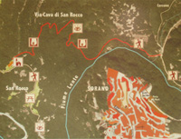
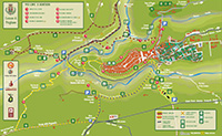
From Sorano one follows the road signs to San Quirico about 5 kilometres away and to be reached on the provincial road S.P. 12. From the town middle one can easily reach the cave dwellings of Vitozza following the road signs. The itinerary continues on the S.P. 12 in the direction of Pitigliano. After 1.8 kilometres one reaches a large crossing and one cycles straight on (crossing the regional road S.R. 74) in the direction of Manciano avoiding to turn right to Sovana and Pitigliano. One cycles therefore on the S.P. 127 “Pantano” without any difficulty through tilled fields for about 10 kilometres as far as a crossing where one turns right onto the S.R. 74 to Pitigliano. At the site Madonna delle Grazie one enjoys an extraordinary view of Pitigliano about 2 kilometres away: 1.2 kilometres downhill and 800 metres uphill. Having visited the centre of Pitigliano one cycles back onto the same road towards the Lente lowland. Leaving the town one turns right in the direction of Sovana on the S.P. 46 ignoring the large hairpin bend on the left. The road bypasses the tuff rise on which Pitigliano stands and reaches a T-crossing after having cycled mainly uphill for 4.8 kilometres (20.8): turning left one cycles easily as far as Sovana 2 kilometres downhill, while the itinerary continues on the right on the pleasant road S.P. 22 in the direction of Sorano. After 4 kilometres the road descends between tall tuff walls, passes by Via Cava of San Rocco until it reaches the bridge over the river Lente where it starts climbing for about 1 kilometre to Sorano (28).
|
| |
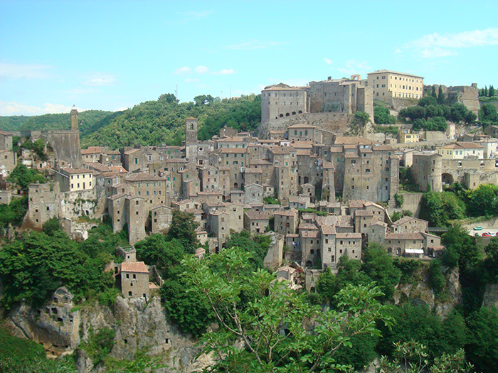
Panorama di Sorano visto da San Rocco
|
|
|
|
| |
|

|
|
|
|
|
 |
|

|
|
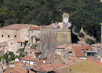 |
| Sorano, Porta di Sopra |
|
Sorano, veduta
|
|
Il Masso Leopoldino
|

|
|
 |
|
 |
| Fortezza Orsini |
|
Rupestre di Vitozza, La Chiesaccia
|
|
Vie Cave San Rocco |
| |
|
|
|
Sulla strada che da Sovana conduce a Sorano, la Via Cava di San Rocco (e parcheggio) si trova sulla sinistra, due chilometri prima di entrare Sorano
|

|
|
|
|
|
 |
|
 |
|
 |
|
|
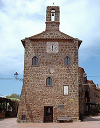
Chiesa di Santa Maria Maggiore |
|
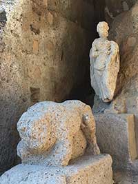
Rocca Aldobrandesca |
 |
|
 |
|
 |
Palazzetto dell'Archivio
|
|
|
|
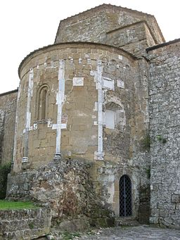
Sovana, Duomo, abside
|
|
Sovana, Chiesa di Santa Maria Maggiore, ciborio preromanico e affresco Madonna col bambino e santi (1508) #poderesantapia
|

|
|
|
 |
|
 |
|
 |
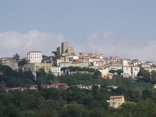
Manciano
|
|
Fattoria fortificata La Campigliola a Manciano
|
|
Manciano, Rocca |

|
|
|
 |
|
 |
|
 |
Panorama Scansano
|
|
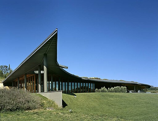
Tenuta dell'Ammiraglia dei Marchesi de' Frescobaldi, Magliano |
|
Particolare del giro delle mura
|
 |
|
 |
|
 |
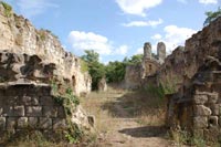
| Vitozza La Chiesaccia |
|
Vitozza, vie cave |
|
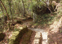
Vie Cave tra Pitigliano e Sovana
|
| |
|
|
|
|
| |
|
|
|
|
Il santuario della Madonna delle Grazie
|

|
Santuario della Madonna delle Grazie dal centro di Pitigliano [2]
|
Fuori dal paese di Pitigliano, sulla strada che porta a Saturnia, si trova il santuario della Madonna delle Grazie, edificato in un punto panoramico da cui si può ammirare il suggestivo paesaggio circostante.
In origine si trovava in questo luogo una cappella dedicata al culto della Vergine, costruita agli inizi del Quattrocento. Successivamente l’edificio fu trasformato in un convento francescano che rimase in uso fino al 1793, quando fu soppresso dai Lorena.
La chiesa è stata completamente restaurata nel 1962. È composta da una sola navata e conserva alcuni elementi decorativi barocchi e tardo rinascimentali.
All’interno si trovano sei altari, sopra i quali sono stati collocati dipinti di artisti locali, in sostituzione delle tele originarie, andate perdute.
Coordinate: 42°37'49"N 11°39'45"E
|
 |
Duomo di Sovana [4]
|
|
|
| |
|


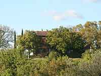
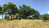
Podere Santa Pia is a beautiful stone farmhouse only 2 km away from Castiglioncello Bandini. The main house is spacious, comfortable and well furnished and offers its guests a breathtaking view over the Maremma hills. This holiday house It is situated in a very panoramic and tranquil position, reached along a 2,7 ams private road.
Numerous other towns and villages offer a treasure trove of history and art waiting to be discovered. The central location of the holiday home allows you to visit the nearby beautiful villages Montalcino, Sant'Antimo, Pienza, S. Quirico d'Orcia and in the south Saturnia and Sorano - known for its beautiful Sasso Leopoldo. And the sea is 38km away in Marina di Grosseto.
Holiday homes in the Tuscan Maremma | Podere Santa Pia
|
| |
|
|
|
|
|
|
|
Podere Santa Pia |
|
Podere Santa Pia |
|
 Follow us on Instagram Follow us on Instagram
|
|
| |
|
|
|
 Follow us on Facebook Follow us on Facebook
|

Cycling in Tuscany | Cycling tours in Southern Tuscany
Intorno a Pitigliano, si sviluppano varie Vie Cave, tra cui quelle della Madonna delle Grazie, che si sviluppano a sud-ovest dell'abitato attorno al santuario della Madonna delle Grazie.
Itinerari | Escursione per le vie cave degli Etruschi
From Pitigliano to Sovana, along the vie caveand the Necropolis of Poggio Felceto | Download pdf
From Sovana to Via cava di San Sebastiano and the Tomba della Sirena (Siren Tomb) | Download pdf
From San Martino sul Fiora to Sovana
From Sorano to Vitozza, along the vie cave and the Necropolis of Poggio Felceto (download pdf)
Parco Archeologico | Sorano - La regione dei Tufi | www.leviecave.it
All'interno del Parco Archeologico Città del Tufo, le Vie Cave di Sorano e Sovana conducono il visitatore alla scoperta delle necropoli etrusche.
|
Trekking in Tuscany | I sentieri delle Città del tufo | Walking along the Etruscan pathways, the vie cave
Sovana
Sovana - Sorano, along the Etruscan vie cave | 13,37 km | 2 h 40 min | gpx
Escursione per le vie cave degli Etruschi, da Sovana a San Rocco e Sorano | 15,89 km | 3 h 10 min | gpx
Sorano
Itinerary from Sorano, to the ancient city of Vitozza and San Quirico | 9 km | 2 hours | gpx
|
|

The Via Cava |
| |

[1] Fonte: Cicloturismo Toscana | www. maremmabike.it
[2] Foto da Vinattieri Matteo, pubblicato nel pubblico dominio.
[3] Fonte www.parcodeglietruschi.it
[4] Fonte foto:Sailko, llicenziato in base ai termini della licenza Creative Commons Attribuzione-Condividi allo stesso modo 3.0 Unported
|
Questo articolo è basato sull'articolo Parco archeologico Città del Tufo dell' enciclopedia Wikipedia ed è rilasciato sotto i termini della GNU Free Documentation License.
Wikimedia Commons contiene file multimediali su Parco archeologico del Tufo.
|
|
|
| |
|
|
|
| |
|
|
|
| |
|
|
|
| |
|
|
|
| |
|
|
|
| |
|
|
|


