| |
|
| |
|
|
|
|
|
|
| |
 |
 |
Cicloturismo in Maremma - La bassa valle dell’ Ombrone
|
« L'antico sangue e l'opere leggiadre
d'i miei maggior mi fer sì arrogante,
che, non pensando a la comune madre,
ogn'uomo ebbi in despetto tanto avante
ch'io ne morì, come i Sanesi sanno
e sallo in Campagnatico ogni fante
Io sono Omberto ... »
(Dante Alighieri, Divina Commedia, Purgatorio, Canto XI, 66)
|
|
 |
 |
| |
|
|
|
| |
|
Cicling tours in the Tuscan Maremma | The lower Ombrone Valley
|
|
|
|
| |
|
The lower Ombrone Valley
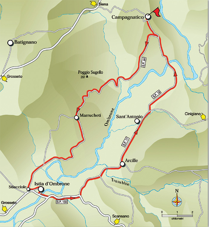
Campagnatico - Marrucheti - Istia d’Ombrone - Arcille - Sant’Antonio - Campagnatico
11. The lower Ombrone Valley- 42.3 km
Campagnatico - km Marrucheti - km 11.8 Istia d’Ombrone- km 21 Arcille - km 28.8 Sant’Antonio - km 32 Campagnatico - km 42.3
Starting point and arrival: Campagnatico
Distance in kilometres: 42.3 km
Difference in altitude: 340 m
Type of road: tarred road
Bicycle: roadster and all-terrain
Difficulty: average
NOTES: The itinerary runs in a complete ring around the Ombrone plain in its last part between the Amiata slopes and the town of Grosseto. The roads do not have any heavy traffic and one is confronted with some heavier traffic only for 3 kilometres on the Via Scansanese (S.P. 159).
The difference in altitude in the first part of the route is “playful” but does not present any particular difficulty. It is advisable to husband one’s vigour keeping in mind that the final stretch requires energy to cope with the last 4.5 kilometres uphill without problems. In addition to Campagnatico, refreshment stands are to be found in Marrucheti, Istia d’Ombrone, Arcille and Sant’Antonio.
The itinerary starts in front of the Town-Hall Palace in Campagnatico. Immediately cycling decidedly downhill in the direction of Grosseto and Scansano (do not follow the road sign to the 4 lanes freeway Si-Gr). Almost at once one reaches a T-crossing where one turns left further downhill following the road signs to Grosseto, Scansano and Granaione.
After about 1 kilometre (1.4) one takes the road on the right S.P. 44 “Conce” in the direction of Marrucheti and Istia d’Ombrone riding on downhill across olive groves and vineyards. The descent ends after about 2 kilometres and one cycles easily on still surrounded by farms, olive groves and vineyards. The road then follows the wavy profile of the hills forming the boundary of the plain where the river Ombrone flows.
|
 |
Veduta di Marrucheti[4]
|
At 6.5 kilometres from the start one reaches the river plain, starting to cycle uphill for about 2.5 kilometres until one clears the hill (9 kilometres).
One cycles downhill for about 1 kilometre and then continues with ups and downs following the profile of the hills as far as the hamlet of Marrucheti (11.8), where a refreshment stand is to be found. From here one cycles downhill for a pair of kilometres and then carries on with ups and downs always downhill reaching the plain (17) starting to skirt the orographic right side of the Ombrone. Shortly afterwards one reaches the Stiacciole hamlet (19.7) where, near a T-crossing, one turns left and takes the S.P. 159 in the direction of Scansano. After 300 metres a further turning to the left to enter the mediaeval village of Istia d’Ombrone (21). Having crossed the village one returns onto the S.P. 159 “Scansanese” where at a left turning one cycles across the bridge (22) over the river Ombrone. After 2.5 kilometres one cycles by a petrol station with a refreshment stand and immediately afterwards (24.8) one leaves the Scansanese turning left in the direction of Arcille and takes the S.P. 17 “Voltina”.
Past the bridge over the stream Trasubbie (27.6) one cycles to the nearby Arcille (28.8) where at a roundabout one turns left in the direction of Campagnatico and Cinigiano and remaining on the S.P. 17 one cycles by the Sant’Antonio hamlet (32). The S.P. 17 continues straight and fluently on, it is not very wide and has no heavy traffic, but it is advisable to keep to the right and to pay attention to cars that might drive by at a high speed. After Sant’Antonio one cycles for 1.5 kilometres up to a crossroads (33.5) where one turns left in the direction of Campagnatico taking the S.P. 18.
Little short of 3 kilometres and one reach the raised spot overlooking the Ombrone lowland and the bridge over the river (37.5). The last stretch of the itinerary is uphill to reach Campagnatico: one climbs for 4.4 kilometres as far as the crossroads and then on the right as far as the centre of the Town (42.3). [1]
|
|
|
|
| |
|
|
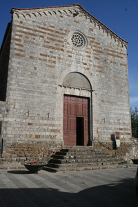
Campagnatico, Chiesa di Santa Maria della Misericordia[2]
|
|
|
| |
|
 |
|
 |
|
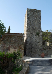 |
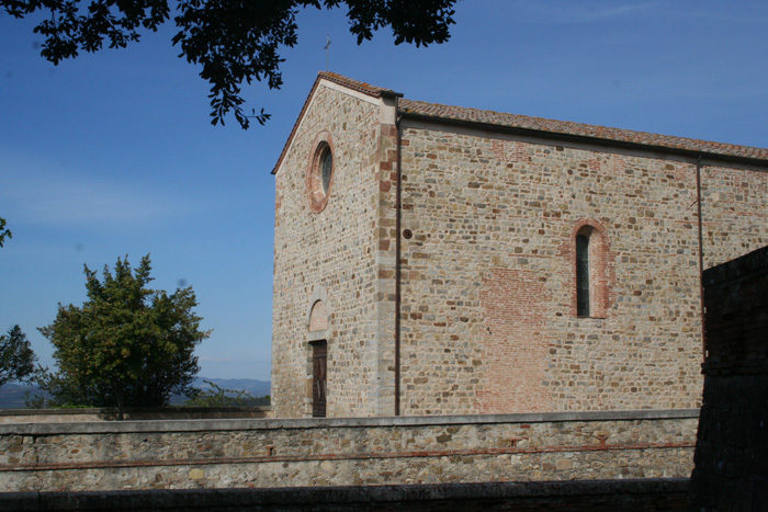
La Chiesa di Santa Maria Ausiliatrice a Marrucheti[5]
|
|
Campagnatico, Pieve di San Giovanni Battista
|
|
Campagnatico, Rocca aldobrandesca di Campagnatico |
| |
|
|
|
|
 |
|
 |
|
 |
| Chiesa di San Salvatore a Istia d'Ombrone[2] |
|
Palazzo di Giustiziaand the Gate[2] |
|
Defensive walls of i Istia d'Ombrone[2] |
| |
|
|
|
|

Holidays in Tuscany | Case vacanza in Toscana | Podere Santa Pia
|
| |
|
|
|
|
|
|
|
Podere Santa Pia |
|
Podere Santa Pia |
|
Campagnatico
|
| |
|
|
|
|
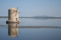
The discovery of the Orbetello Lagoon and the Spanish Mill, a unique landscaped area. Orbetello is located in the middle of the lagoon and is joined to Monte Argentario by an artificial dam (built in 1841 by King Leopold II of Lorraine) that has divided the lagoon into two bodies of water: Eastern Lagoon and Laguna di Ponente.
The Molino Spagnolo or Spanish Mill was built by the Sienese and later restored by the Spanish. Only one left in the series of the nine windmill that once rose from the lagoon. The mill emerges suggestively from the lagoon waters and is one of the symbols of Orbetello; it is circular in shape with conical roof and rear propeller wind and, with the others, was used to grind grain that was brought with punts (boats typical from Orbetello) to the inhabitants of the city.[3] |
|
|
| |
|
|
|
One of the symbols of Orbetello is il Mulino Spagnolo
|
| |
|
|
|
|

Cycling in Tuscany | Cycling tours in Southern Tuscany
Riserva Naturale La Pietra (Map).
La Pietra Nature Reserve protects a territory almost entirely covered with woodlands between the stream Farma and the last stretch of the stream Farmulla.
|

[1] Fonte: Cicloturismo Toscana | www. maremmabike.it
[2] Foto Rein Ergo, licenziato in base ai termini della licenza Creative Commons Attribuzione-Condividi allo stesso modo 4.0 Internazionale
[3]
[4] Photo by Giovanni Casalini, licenziato in base ai termini della licenza Creative Commons Attribuzione-Condividi allo stesso modo 4.0 Internazionale
[5] Photo by Matteo Vinattieri, licenziato in base ai termini della licenza Creative Commons Attribuzione 3.0 Unported
|
|
|
| |
|
|
|
| |
|
|
|
| |
|
|
|
| |
|
|
|
| |
|
|
|
| |
|
|
|


